File:1933 Paris-Nice.png
Jump to navigation
Jump to search
Size of this preview: 599 × 599 pixels. Other resolutions: 240 × 240 pixels | 480 × 480 pixels | 768 × 768 pixels | 1,023 × 1,024 pixels | 1,796 × 1,797 pixels.
Original file (1,796 × 1,797 pixels, file size: 592 KB, MIME type: image/png)
Captions
Captions
Add a one-line explanation of what this file represents
| Description |
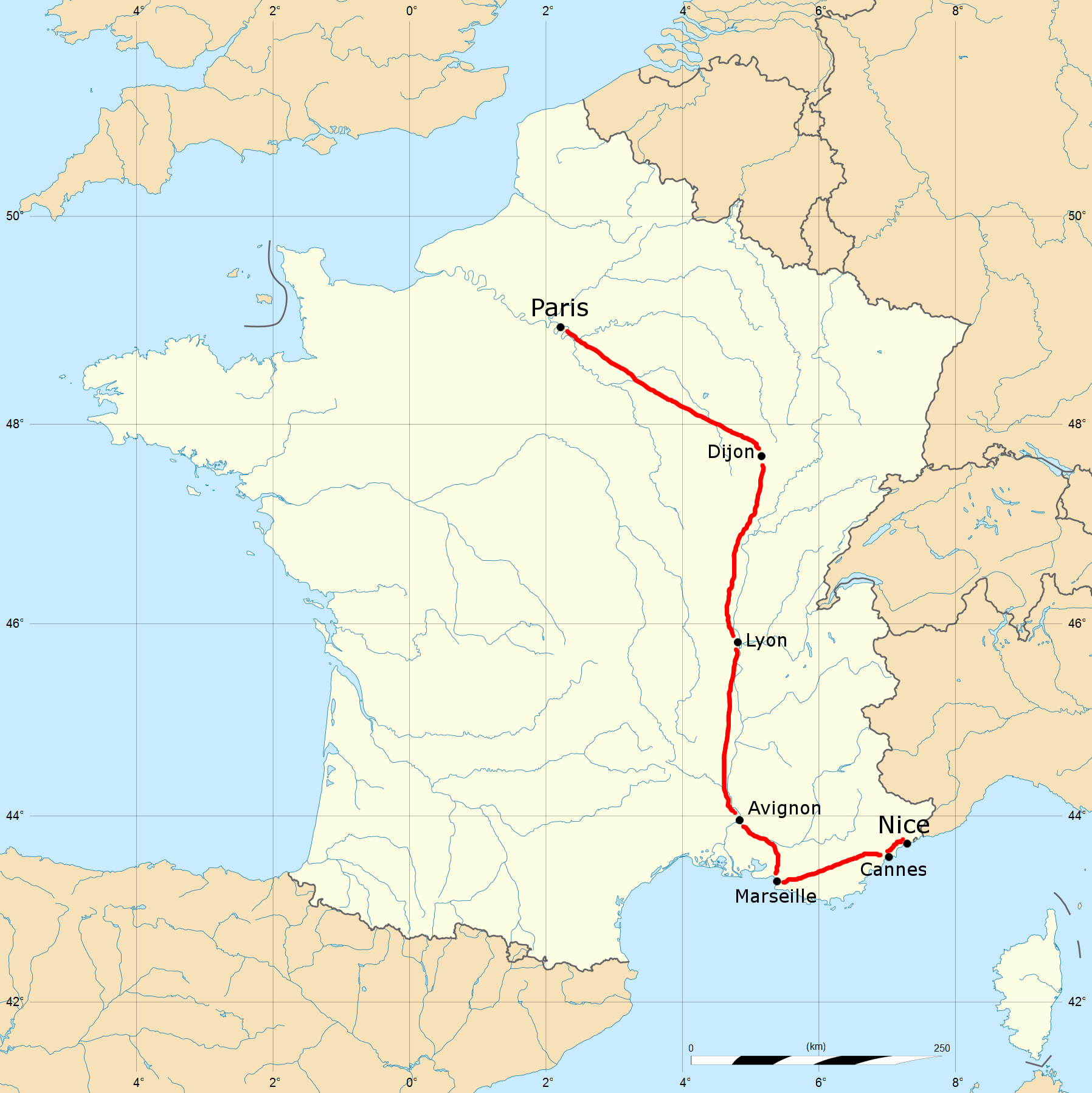
English: The 1933 Paris-Nice route. |
| Date | (UTC) |
| Source | |
| Author |
|
| This is a retouched picture, which means that it has been digitally altered from its original version. Modifications: Route added for the 1933 Paris-Nice. The original can be viewed here: France blank.svg:
|
I, the copyright holder of this work, hereby publish it under the following license:
This file is licensed under the Creative Commons Attribution-Share Alike 2.5 Generic license.
- You are free:
- to share – to copy, distribute and transmit the work
- to remix – to adapt the work
- Under the following conditions:
- attribution – You must give appropriate credit, provide a link to the license, and indicate if changes were made. You may do so in any reasonable manner, but not in any way that suggests the licensor endorses you or your use.
- share alike – If you remix, transform, or build upon the material, you must distribute your contributions under the same or compatible license as the original.
Original upload log
[edit]
This image is a derivative work of the following images:
- File:France_blank.svg licensed with Cc-by-sa-2.5
- 2008-11-07T13:50:25Z Sting 1796x1797 (572016 Bytes) + boundary for the Channel Islands ; - canals
- 2008-09-25T02:46:38Z Sting 1796x1797 (577116 Bytes) Completely new version using NGDC WDBII data and with known projection
- 2006-09-21T16:34:27Z Sting 1796x1796 (996002 Bytes) Colours
- 2006-09-20T00:34:58Z Sting 1796x1796 (996902 Bytes) {{Information |Description=SVG map of France |Source=Own work |Date=September 2006 |Author=Eric Gaba ([[User:Sting|Sting]]) |Permission=CC-BY-SA-2.5 |other_versions= }} ---- {{fr}} * '''Sujet :''' Carte vectorielle de la
Uploaded with derivativeFX
File history
Click on a date/time to view the file as it appeared at that time.
| Date/Time | Thumbnail | Dimensions | User | Comment | |
|---|---|---|---|---|---|
| current | 22:18, 28 June 2011 | | 1,796 × 1,797 (592 KB) | December21st2012Freak (talk | contribs) | Bigger text |
| 04:49, 28 June 2011 |  | 1,796 × 1,797 (587 KB) | December21st2012Freak (talk | contribs) | {{Information |Description={{en|The 1933 Paris-Nice route.}} |Source=*File:France_blank.svg |Date=2011-06-28 04:38 (UTC) |Author=*File:France_blank.svg: Eric Gaba (Sting - fr:Sting) *derivative work: ~~ |
You cannot overwrite this file.
File usage on Commons
There are no pages that use this file.
File usage on other wikis
The following other wikis use this file:
- Usage on en.wikipedia.org
- Usage on es.wikipedia.org
- Usage on fr.wikipedia.org
- Usage on lb.wikipedia.org
- Usage on pt.wikipedia.org
- Usage on ru.wikipedia.org
- Usage on uk.wikipedia.org
- Usage on www.wikidata.org