File:2011-P04-Overijssel-b54.jpg
Jump to navigation
Jump to search
Size of this preview: 665 × 600 pixels. Other resolutions: 266 × 240 pixels | 532 × 480 pixels | 852 × 768 pixels | 1,135 × 1,024 pixels | 1,396 × 1,259 pixels.
Original file (1,396 × 1,259 pixels, file size: 1.08 MB, MIME type: image/jpeg)
Captions
Captions
Add a one-line explanation of what this file represents
Summary
[edit]
| Description |
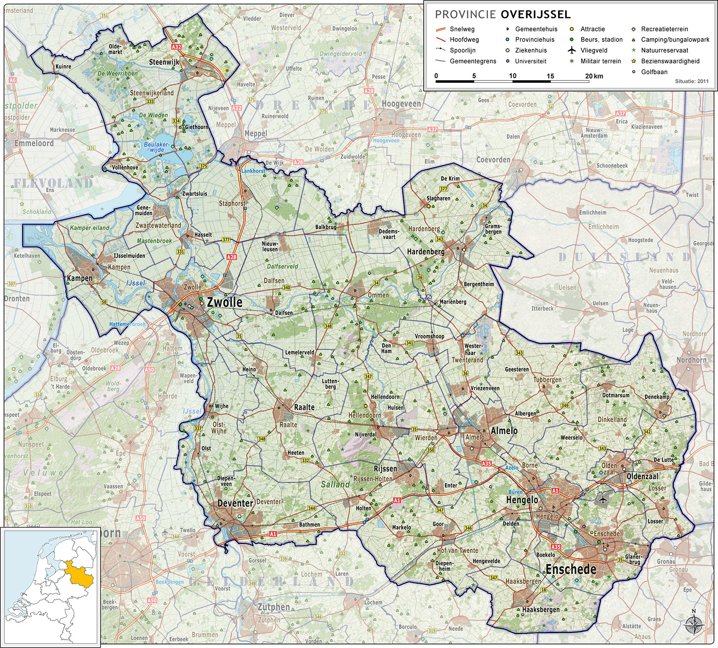
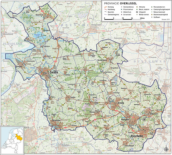
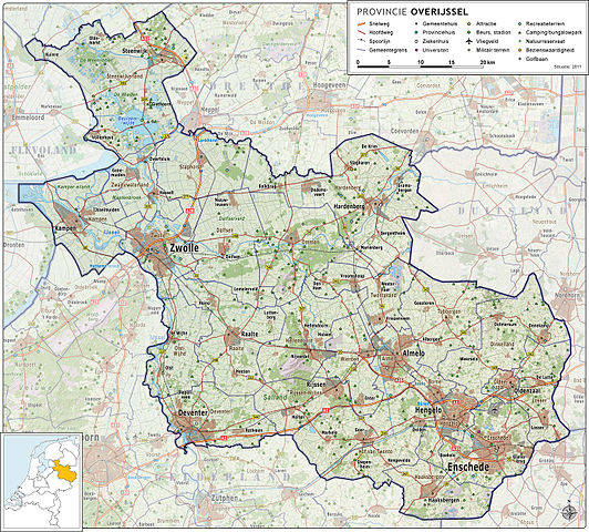
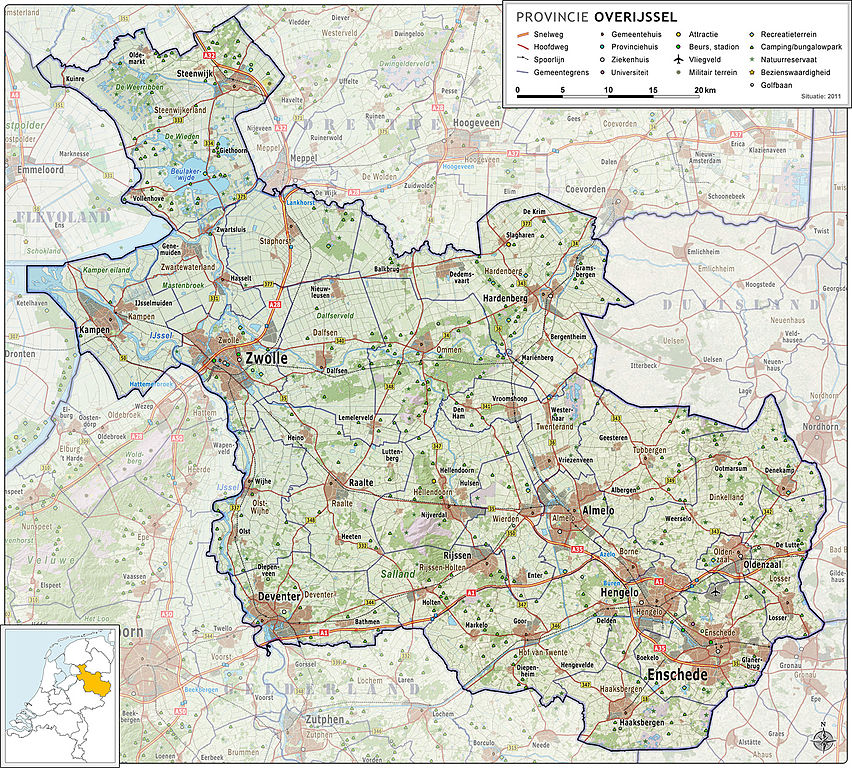
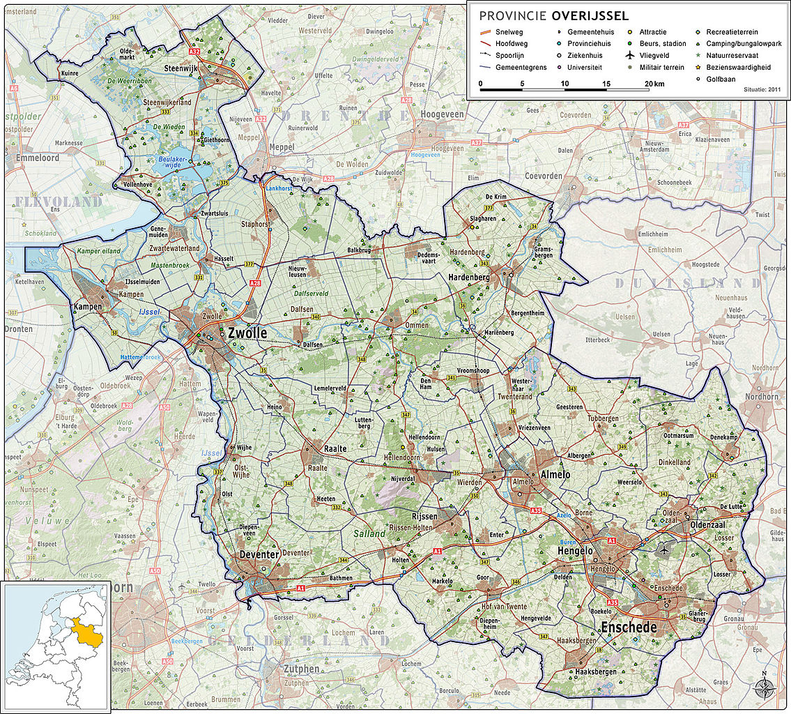
Nederlands: Provincie Overijssel, met indeling van gemeenten (2011) en impressie van het landschap.
Door Jan-Willem van Aalst, samengesteld uit publiek beschikbare geo-data:
|
| Date | |
| Source | Own work |
| Author | Janwillemvanaalst |
| Other versions | 2009-Basisbeeld-Provincie04-Overijssel.jpg; 2010-P04-Overijssel-basisbeeld.jpg |
Licensing
[edit]
I, the copyright holder of this work, hereby publish it under the following license:
This file is licensed under the Creative Commons Attribution-Share Alike 3.0 Unported license.
- You are free:
- to share – to copy, distribute and transmit the work
- to remix – to adapt the work
- Under the following conditions:
- attribution – You must give appropriate credit, provide a link to the license, and indicate if changes were made. You may do so in any reasonable manner, but not in any way that suggests the licensor endorses you or your use.
- share alike – If you remix, transform, or build upon the material, you must distribute your contributions under the same or compatible license as the original.
File history
Click on a date/time to view the file as it appeared at that time.
| Date/Time | Thumbnail | Dimensions | User | Comment | |
|---|---|---|---|---|---|
| current | 06:52, 15 May 2011 | | 1,396 × 1,259 (1.08 MB) | Janwillemvanaalst (talk | contribs) | Revision of coastline; updated infrastructure (local roads, Hanzelijn railroad) and points of interest (removed clinic Kampen) |
| 07:10, 24 April 2011 |  | 1,326 × 1,196 (1,017 KB) | Janwillemvanaalst (talk | contribs) | Updates of names, recreation locations, municipal borders in surrounding countries; removed some polyclinical locations | |
| 16:56, 9 March 2011 |  | 1,326 × 1,196 (990 KB) | Janwillemvanaalst (talk | contribs) | Added public health services; added regional road labels (N-roads) | |
| 19:02, 23 February 2011 |  | 1,326 × 1,196 (983 KB) | Janwillemvanaalst (talk | contribs) | Added cross-border features in Germany; Added local airports; Added Golf courses; Added major city parks. | |
| 08:42, 13 February 2011 |  | 1,326 × 1,196 (954 KB) | Janwillemvanaalst (talk | contribs) | Various map updates and some omissions corrected. Added various tourist locations. | |
| 11:11, 31 December 2010 |  | 1,257 × 1,133 (929 KB) | Janwillemvanaalst (talk | contribs) | {{Information |Description={{nl|1=Provincie Overijssel, met indeling van gemeenten (2011) en impressie van het landschap. Door Jan-Willem van Aalst, samengesteld uit publiek beschikbare geo-data: * Referentie-ondergrond (kustlijn, steden, wegen) gerasterd |
You cannot overwrite this file.
File usage on Commons
The following 24 pages use this file:
- File:P Provinces of the Netherlands - Gelderland.gif
- File:P Provinces of the Netherlands - Groningen.gif
- File:P Provinces of the Netherlands - Limburg.gif
- File:P Provinces of the Netherlands - North Brabant.gif
- File:P Provinces of the Netherlands - North Holland.gif
- File:P Provinces of the Netherlands - Overijssel.gif
- File:P Provinces of the Netherlands - all.gif
- File:Provinces of the Netherlands (LT).svg
- File:Provinces of the Netherlands - Drenthe.svg
- File:Provinces of the Netherlands - Flevoland.gif
- File:Provinces of the Netherlands - Flevoland.svg
- File:Provinces of the Netherlands - Friesland.gif
- File:Provinces of the Netherlands - Friesland.svg
- File:Provinces of the Netherlands - Limburg.svg
- File:Provinces of the Netherlands - Noord-Brabant.svg
- File:Provinces of the Netherlands - Noord-Holland.svg
- File:Provinces of the Netherlands - South Holland.gif
- File:Provinces of the Netherlands - Utrecht.gif
- File:Provinces of the Netherlands - Utrecht.svg
- File:Provinces of the Netherlands - Zeeland.gif
- File:Provinces of the Netherlands - Zeeland.svg
- File:Provinces of the Netherlands - Zuid-Holland.svg
- File:Provinces of the Netherlands - blank.svg
- File:Provinces of the Netherlands - blank (alternative colors).svg
.svg)
.svg)