File:218BCMAPMEDITERRANEAN.jpg
Jump to navigation
Jump to search

Size of this preview: 800 × 474 pixels. Other resolutions: 320 × 189 pixels | 640 × 379 pixels | 1,216 × 720 pixels.
Original file (1,216 × 720 pixels, file size: 89 KB, MIME type: image/jpeg)
Captions
Captions
Add a one-line explanation of what this file represents
Summary
[edit]| Description |
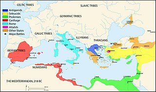
Mediterranean at 218 BC |
|||
| Date | ||||
| Source | Own work | |||
| Author | Megistias | |||
| Other versions |
|
.jpg)


Licensing
[edit]
| I, the copyright holder of this work, release this work into the public domain. This applies worldwide. In some countries this may not be legally possible; if so: I grant anyone the right to use this work for any purpose, without any conditions, unless such conditions are required by law. |
File history
Click on a date/time to view the file as it appeared at that time.
| Date/Time | Thumbnail | Dimensions | User | Comment | |
|---|---|---|---|---|---|
| current | 06:11, 19 May 2020 | | 1,216 × 720 (89 KB) | Barjimoa (talk | contribs) | |
| 06:45, 1 December 2015 |  | 2,052 × 1,215 (1.06 MB) | Chumwa (talk | contribs) | Bosporus → Cimmerian Bosporus | |
| 14:49, 14 February 2010 |  | 2,052 × 1,215 (1.02 MB) | Megistias (talk | contribs) | {{Information |Description=Mediterranean at 218 BC *http://sitemaker.umich.edu/mladjov/files/romanabc218.jpg *Blank map,nasa |Source=Own work by uploader |Date=2010-14-02 |Author=Megistias |Permission= |other_versions= }} == {{int:lice |
You cannot overwrite this file.
File usage on Commons
The following 8 pages use this file:
File usage on other wikis
The following other wikis use this file:
- Usage on bg.wikipedia.org
- Usage on cs.wikipedia.org
- Usage on de.wikipedia.org
- Usage on en.wikipedia.org
- Usage on fa.wikipedia.org
- Usage on fy.wikipedia.org
- Usage on it.wikipedia.org
- Usage on ja.wikipedia.org
- Usage on lb.wikipedia.org
- Usage on ml.wikipedia.org
- Usage on no.wikipedia.org
- Usage on oc.wikipedia.org
- Usage on pt.wikipedia.org
- Usage on uk.wikipedia.org
- Usage on zh.wikipedia.org
Categories:
- Maps of the Second Punic War
- Maps of ancient Thrace
- Attalus I
- Maps showing 3rd-century BC history
- Maps of the Greek colonies
- Maps of Illyria
- Maps of the history of the ancient Balkans
- Maps of the history of the Balkans
- Antigonid dynasty
- Maps of the Seleucid Empire
- Maps of Carthage
- Maps of Ptolemaic Egypt
- Attalid dynasty
- 220s BC
- Maps of the Hellenistic world
- Maps of the Roman Republic 300-200BCE
- Maps of Bosporan Kingdom
- Egypt in the 3rd century BC