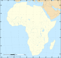
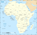
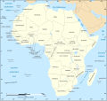
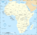
File:African continent-de.svg

Original file (SVG file, nominally 1,525 × 1,440 pixels, file size: 749 KB)
Captions
Captions
Summary
[edit]| DescriptionAfrican continent-de.svg |
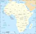
Deutsch: Politische Karte von Afrika als in 07-2011 (deutschsprachig)
English: Political map of the African Continent as in 2011-07 with German caption
Français : Carte politique du continent africain tel qu'en 07/2011 avec légende en allemand
Norsk bokmål: Politisk kart over Afrika på tysk.
Lambert azimutal equal-area projection, WGS84 datum, standard meridian: 15°E, standard parallel: 0° |
| Date | 16 March 2008, updated 2011-07 |
| Source |
African continent-fr.svg
|
| Author | Eric Gaba, Jörg Schwerdtfeger |
| Other versions |
[edit]
|
| SVG development InfoField |
Licensing
[edit]
|
Permission is granted to copy, distribute and/or modify this document under the terms of the GNU Free Documentation License, Version 1.2 or any later version published by the Free Software Foundation; with no Invariant Sections, no Front-Cover Texts, and no Back-Cover Texts. A copy of the license is included in the section entitled GNU Free Documentation License.http://www.gnu.org/copyleft/fdl.htmlGFDLGNU Free Documentation Licensetruetrue |
| This file is licensed under the Creative Commons Attribution-Share Alike 3.0 Unported license. | ||
| ||
| This licensing tag was added to this file as part of the GFDL licensing update.http://creativecommons.org/licenses/by-sa/3.0/CC BY-SA 3.0Creative Commons Attribution-Share Alike 3.0truetrue |
File history
Click on a date/time to view the file as it appeared at that time.
| Date/Time | Thumbnail | Dimensions | User | Comment | |
|---|---|---|---|---|---|
| current | 18:20, 6 December 2020 |  | 1,525 × 1,440 (749 KB) | Sting (talk | contribs) | Swatziland => eSwatini |
| 11:38, 4 October 2012 |  | 1,525 × 1,440 (750 KB) | Svolks (talk | contribs) | SÃO TOMÈ --> SÃO TOMÉ | |
| 20:08, 14 July 2011 |  | 1,525 × 1,440 (750 KB) | Sting (talk | contribs) | Sudan/South Sudan 2011-07 border update | |
| 20:07, 10 January 2009 |  | 1,525 × 1,440 (745 KB) | Sting (talk | contribs) | Correction Sao Tome | |
| 01:51, 27 June 2008 |  | 1,525 × 1,440 (749 KB) | Sting (talk | contribs) | Completely new drawing with known projection ; new colors | |
| 08:10, 16 March 2008 |  | 1,390 × 1,295 (611 KB) | Schwerdtfeger (talk | contribs) | ||
| 07:42, 16 March 2008 |  | 1,390 × 1,295 (602 KB) | Schwerdtfeger (talk | contribs) | {{Information |Description= {{de|Politische Karte von Afrika (deutschsprachig)}} {{en|Political map of the African Continent with German caption}} {{fr|Carte politique du continent africain avec légende en al |
You cannot overwrite this file.
File usage on Commons
The following 31 pages use this file:
- User:Magog the Ogre/Multilingual legend/2020 December 1-10
- Commons:Copyright tags/Africa/de
- Commons:Translation possible/En savoir plus
- File:Africa map blank.svg
- File:Africa map no countries.svg
- File:African continent-br.svg
- File:African continent-ca.svg
- File:African continent-cs.svg
- File:African continent-da.svg
- File:African continent-de.png
- File:African continent-de.svg
- File:African continent-en.svg
- File:African continent-es.svg
- File:African continent-fr.svg
- File:African continent-it.svg
- File:African continent-ka.svg
- File:African continent-ku.svg
- File:African continent-la.svg
- File:African continent-mk.svg
- File:African continent-nb.svg
- File:African continent-pl.png
- File:African continent-pl.svg
- File:African continent-pt.svg
- File:African continent-ru.svg
- File:African continent-uk.svg
- File:African continent-ur2.svg
- File:African continent-繁體中文.png
- File:African continent-繁體中文.svg
- File:African continent sr.svg
- File:Afrik kárttá smn.svg
- Template:Other versions/African continent
File usage on other wikis
The following other wikis use this file:
- Usage on de.wikiversity.org
- Usage on es.wikibooks.org
- Usage on ko.wikipedia.org
- Usage on nl.wiktionary.org
Metadata
This file contains additional information such as Exif metadata which may have been added by the digital camera, scanner, or software program used to create or digitize it. If the file has been modified from its original state, some details such as the timestamp may not fully reflect those of the original file. The timestamp is only as accurate as the clock in the camera, and it may be completely wrong.
| Short title | Politische Karte von Afrika |
|---|---|
| Width | 1524.9999 |
| Height | 1439.9999 |
