File:Algeria provinces numbered2.png
Jump to navigation
Jump to search
No higher resolution available.
Algeria_provinces_numbered2.png (308 × 427 pixels, file size: 71 KB, MIME type: image/png)
Captions
Captions
Add a one-line explanation of what this file represents

|
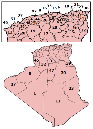
English: This map shows boundaries which are wrong or outdated. Consider using the following updated (as in 2009) map instead : File:Algeria_Wilayas-numbered.svg.
Français : Cette carte montre des frontières erronées ou qui ne sont plus à jour. Veuillez utiliser à la place la carte à jour (telle qu'en 2009) suivante : File:Algeria_Wilayas-numbered.svg.
|
_-_Nmbrs_(geosort)_-_monochrome.svg)
|
| Description | Map of the provinces of Algeria, numbered in Arabic alphabetical order. |
| Date | |
| Source | Self-made, traced from public domain UN or CIA maps. |
| Author | Originaly by User:Golbez, then en:User:Djihed, then User:Escondites |
| Permission (Reusing this file) |
Provide attribution, please. See below. |
I, the copyright holder of this work, hereby publish it under the following licenses:
This file is licensed under the Creative Commons Attribution-Share Alike 2.5 Generic, 2.0 Generic and 1.0 Generic license.
- You are free:
- to share – to copy, distribute and transmit the work
- to remix – to adapt the work
- Under the following conditions:
- attribution – You must give appropriate credit, provide a link to the license, and indicate if changes were made. You may do so in any reasonable manner, but not in any way that suggests the licensor endorses you or your use.
- share alike – If you remix, transform, or build upon the material, you must distribute your contributions under the same or compatible license as the original.

|
Permission is granted to copy, distribute and/or modify this document under the terms of the GNU Free Documentation License, Version 1.2 or any later version published by the Free Software Foundation; with no Invariant Sections, no Front-Cover Texts, and no Back-Cover Texts. A copy of the license is included in the section entitled GNU Free Documentation License. |
| This file is licensed under the Creative Commons Attribution-Share Alike 3.0 Unported license. | ||
| ||
| This licensing tag was added to this file as part of the GFDL licensing update. |
You may select the license of your choice.
File history
Click on a date/time to view the file as it appeared at that time.
| Date/Time | Thumbnail | Dimensions | User | Comment | |
|---|---|---|---|---|---|
| current | 00:07, 8 August 2011 | | 308 × 427 (71 KB) | Omar2788 (talk | contribs) | croping |
| 06:09, 7 January 2007 |  | 308 × 427 (52 KB) | Escondites (talk | contribs) | {{Information |Description=Map of the provinces of Algeria, numbered in Arabic alphabetical order. # Adrar # Ain Defla # Ain Temouchent # [[:Image:Algeria- |
You cannot overwrite this file.
File usage on Commons
There are no pages that use this file.
File usage on other wikis
The following other wikis use this file:
- Usage on ar.wikipedia.org
- Usage on no.wikipedia.org
- Usage on pa.wikipedia.org
- Usage on pt.wikipedia.org
- Usage on su.wikipedia.org
- Usage on tl.wikipedia.org