File:Aysén location map.svg
Jump to navigation
Jump to search

Size of this PNG preview of this SVG file: 300 × 397 pixels. Other resolutions: 181 × 240 pixels | 363 × 480 pixels | 580 × 768 pixels | 774 × 1,024 pixels | 1,547 × 2,048 pixels.
Original file (SVG file, nominally 300 × 397 pixels, file size: 1.07 MB)
Captions
Captions
Add a one-line explanation of what this file represents
Summary
[edit]
| Description |
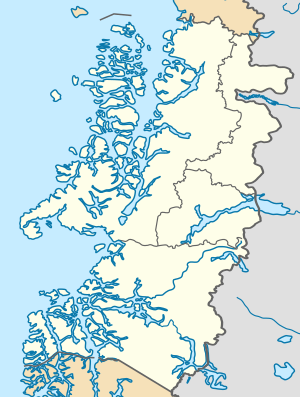
Location map infoː |
| Date | |
| Source |
This file was derived from: Chile location map.svg |
| Author |
|
Licensing
[edit]
This file is licensed under the Creative Commons Attribution-ShareAlike 3.0 Chile license.
- You are free:
- to share – to copy, distribute and transmit the work
- to remix – to adapt the work
- Under the following conditions:
- attribution – You must give appropriate credit, provide a link to the license, and indicate if changes were made. You may do so in any reasonable manner, but not in any way that suggests the licensor endorses you or your use.
- share alike – If you remix, transform, or build upon the material, you must distribute your contributions under the same or compatible license as the original.

File history
Click on a date/time to view the file as it appeared at that time.
| Date/Time | Thumbnail | Dimensions | User | Comment | |
|---|---|---|---|---|---|
| current | 00:15, 16 August 2023 | | 300 × 397 (1.07 MB) | Janitoalevic (talk | contribs) | . |
| 00:07, 16 August 2023 |  | 300 × 397 (1.02 MB) | Janitoalevic (talk | contribs) | Better borders | |
| 23:04, 15 August 2023 |  | 300 × 397 (1.05 MB) | Janitoalevic (talk | contribs) | Fixed border with Magallanes & Chilean Antarctica Region | |
| 22:43, 24 December 2017 |  | 300 × 390 (1.01 MB) | Janitoalevic (talk | contribs) | . | |
| 21:26, 22 October 2017 |  | 300 × 390 (1.01 MB) | Janitoalevic (talk | contribs) | More precise borders. | |
| 00:14, 7 May 2016 |  | 300 × 390 (1.01 MB) | Janitoalevic (talk | contribs) | Added and fixed lakes, islands and borders | |
| 00:44, 6 May 2016 |  | 300 × 390 (1,016 KB) | Janitoalevic (talk | contribs) | Better province borders | |
| 21:56, 5 May 2016 |  | 300 × 390 (1,016 KB) | Janitoalevic (talk | contribs) | User created page with UploadWizard |
You cannot overwrite this file.
File usage on Commons
The following page uses this file:
File usage on other wikis
The following other wikis use this file:
- Usage on ar.wikipedia.org
- Usage on de.wikipedia.org
- Coyhaique
- Puerto Aysén
- Cochrane (Chile)
- Tortel
- Villa O’Higgins
- Lago Buenos Aires/General Carrera
- Nördliches Patagonisches Eisfeld
- Wikipedia:Kartenwerkstatt/Positionskarten/Südamerika
- Aysén (Kommune)
- Messier-Kanal
- Golf von Penas
- Jorge-Montt-Gletscher
- Erdbeben der Región de Aysén 1927
- Lago O’Higgins/San Martín
- Lago Cochrane
- Lago Presidente Ríos
- Vorlage:Positionskarte Chile Aysén
- Moraleda-Kanal
- Melimoyu
- Puerto Aguirre (Chile)
- Usage on en.wikipedia.org
- Usage on eo.wikipedia.org
- Usage on es.wikipedia.org
View more global usage of this file.