File:Berlin Centralmarkthalle Lageplan.jpg
Jump to navigation
Jump to search

Size of this preview: 316 × 599 pixels. Other resolutions: 126 × 240 pixels | 253 × 480 pixels | 405 × 768 pixels | 540 × 1,024 pixels | 1,444 × 2,735 pixels.
Original file (1,444 × 2,735 pixels, file size: 844 KB, MIME type: image/jpeg)
Captions
Captions
Add a one-line explanation of what this file represents
Summary
[edit]
Licensing
[edit]
|
This work is in the public domain in its country of origin and other countries and areas where the copyright term is the author's life plus 70 years or fewer. | |
| This file has been identified as being free of known restrictions under copyright law, including all related and neighboring rights. | |
File history
Click on a date/time to view the file as it appeared at that time.
| Date/Time | Thumbnail | Dimensions | User | Comment | |
|---|---|---|---|---|---|
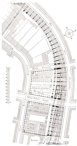
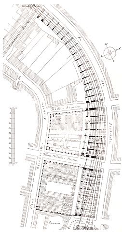
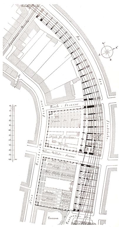
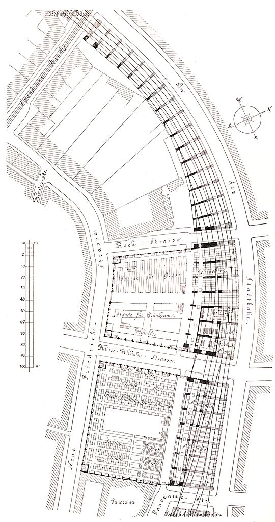
| current | 20:14, 10 June 2006 | | 1,444 × 2,735 (844 KB) | ONAR (talk | contribs) | {{Information| |Description= {{en|Berlin - central market hall, situation plan}} {{de|Berlin - Zentralmarkthalle, Lageplan}} |Source=Berlin und seine Bauten, Verlag Wilhelm Ernst & Sohn 1896 |Date=1896 |Author=unknown |Permission= |other_versions= }} |
You cannot overwrite this file.
File usage on Commons
The following page uses this file:
File usage on other wikis
The following other wikis use this file:
- Usage on de.wikipedia.org