File:Blaeu 1635 - Flandriæ Teutonicæ pars orientalior Ausschnitt1.png
Jump to navigation
Jump to search
Size of this preview: 740 × 599 pixels. Other resolutions: 296 × 240 pixels | 593 × 480 pixels | 968 × 784 pixels.
Original file (968 × 784 pixels, file size: 3.71 MB, MIME type: image/png)
Captions
Captions
Add a one-line explanation of what this file represents
Summary
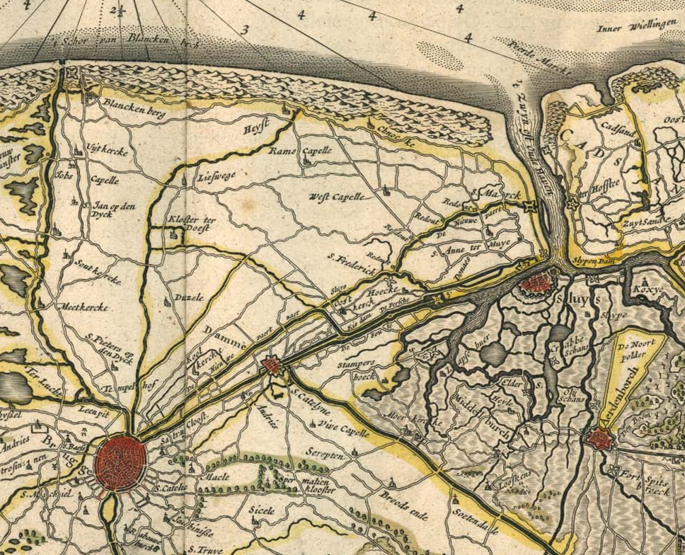
[edit]- Cuting from the map
- Flandriæ Teutonicæ pars orientalior (Eastern part of German Flanders)
from
"Theatrum Orbis Terrarum, sive Atlas Novus in quo Tabulæ et Descriptiones Omnium Regionum, Editæ a Guiljel et Ioanne Blaeu"
(Theater of the World, or a New Atlas of Maps and Representations of All Regions, Edited by Willem and Joan Blaeu), 1645.
- Source
-
 vollständige Karte

Licensing
[edit]
|
This work is in the public domain in its country of origin and other countries and areas where the copyright term is the author's life plus 70 years or fewer. | |
| This file has been identified as being free of known restrictions under copyright law, including all related and neighboring rights. | |
File history
Click on a date/time to view the file as it appeared at that time.
| Date/Time | Thumbnail | Dimensions | User | Comment | |
|---|---|---|---|---|---|
| current | 10:03, 17 July 2006 | | 968 × 784 (3.71 MB) | N3MO (talk | contribs) | == Summary == ; Cuting from the map: '''''Flandriæ Teutonicæ pars orientalior''''' (''Eastern part of German Flanders'')<br>from<br>"Theatrum Orbis Terrarum, sive Atlas Novus in quo Tabulæ et Descriptiones Omnium Regionum, Editæ a Guiljel et Ioanne Bl |
You cannot overwrite this file.
File usage on Commons
The following 2 pages use this file:
.jpg)
File usage on other wikis
The following other wikis use this file:
- Usage on de.wikipedia.org
- Usage on fr.wikipedia.org
- Usage on nl.wikipedia.org
- Usage on vls.wikipedia.org