File:BlankMap-World-v6.png
Jump to navigation
Jump to search

Size of this preview: 800 × 351 pixels. Other resolutions: 320 × 140 pixels | 640 × 281 pixels | 1,425 × 625 pixels.
Original file (1,425 × 625 pixels, file size: 36 KB, MIME type: image/png)
Captions
Captions
Add a one-line explanation of what this file represents

|
File:BlankMap-World6, compact.svg is a vector version of this file. It should be used in place of this PNG file.
File:BlankMap-World-v6.png → File:BlankMap-World6, compact.svg
For more information, see Help:SVG. |
 |
Summary
[edit]
| Description |
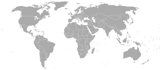
Blank world map, based on Image:BlankMap-World-v4.png, but including all dependencies (i.e. all territories with ISO 3166-1 codes) For sovereign countries which are depicted by a dot, the dot is five pixels wide. For dependencies, the dot is smaller - four pixels wide. |
| Date | 25 July 2006 (original upload date) |
| Source | No machine-readable source provided. Own work assumed (based on copyright claims). |
| Author | No machine-readable author provided. Roke~commonswiki assumed (based on copyright claims). |
derivative works
[edit]
Derivative works of this file:
- Commonwealth of Nations (simple).png
- Commonwealth of Nations prospective members (simple).png
- Countries by most used web browser.png
.png)
.png)
Licensing
[edit]
I, the copyright holder of this work, hereby publish it under the following licenses:

|
Permission is granted to copy, distribute and/or modify this document under the terms of the GNU Free Documentation License, Version 1.2 or any later version published by the Free Software Foundation; with no Invariant Sections, no Front-Cover Texts, and no Back-Cover Texts. A copy of the license is included in the section entitled GNU Free Documentation License. |
| This file is licensed under the Creative Commons Attribution-Share Alike 3.0 Unported license. | ||
| ||
| This licensing tag was added to this file as part of the GFDL licensing update. |
You may select the license of your choice.
File history
Click on a date/time to view the file as it appeared at that time.
| Date/Time | Thumbnail | Dimensions | User | Comment | |
|---|---|---|---|---|---|
| current | 13:20, 16 June 2014 | | 1,425 × 625 (36 KB) | WhyHellWhy (talk | contribs) | Reverted to version as of 04:47, 16 June 2014 |
| 10:30, 16 June 2014 |  | 1,425 × 625 (53 KB) | Denniss (talk | contribs) | Reverted to version as of 23:43, 3 August 2011 | |
| 04:47, 16 June 2014 |  | 1,425 × 625 (36 KB) | WhyHellWhy (talk | contribs) | Crimea | |
| 23:43, 3 August 2011 |  | 1,425 × 625 (53 KB) | Hoshie (talk | contribs) | added South Sudan. | |
| 12:22, 18 April 2010 |  | 1,425 × 625 (47 KB) | Avala (talk | contribs) | ||
| 16:12, 30 March 2009 |  | 1,425 × 625 (47 KB) | Cradel (talk | contribs) | Reverted to version as of 17:12, 8 March 2009 | |
| 22:20, 20 March 2009 |  | 1,425 × 625 (47 KB) | Avala (talk | contribs) | ||
| 17:12, 8 March 2009 |  | 1,425 × 625 (47 KB) | Cradel (talk | contribs) | Reverted to version as of 13:36, 25 October 2008 | |
| 01:01, 20 November 2008 |  | 1,425 × 625 (47 KB) | Tocino (talk | contribs) | Reverted to version as of 22:44, 24 October 2008 | |
| 13:36, 25 October 2008 |  | 1,425 × 625 (47 KB) | Cradel (talk | contribs) | Reverted to version as of 02:33, 1 August 2008 |
You cannot overwrite this file.
File usage on Commons
The following 4 pages use this file:
File usage on other wikis
The following other wikis use this file:
- Usage on de.wikipedia.org
- Usage on en.wikipedia.org
- Wikipedia:Graphics Lab/Map workshop/Archive/Jan 2010
- Wikipedia:Graphics Lab/Map workshop/Archive/Dec 2012
- Wikipedia:Graphics Lab/Map workshop/Archive/Apr 2013
- Wikipedia:Graphics Lab/Map workshop/Archive/Aug 2019
- Wikipedia:Graphics Lab/Map workshop/Archive/Dec 2020
- Wikipedia:Graphics Lab/Map workshop/Archive/Apr 2021
- Wikipedia:Graphics Lab/Map workshop/Archive/May 2021
- Usage on ja.wikipedia.org
- 利用者‐会話:Penn Station/Archive 1
- 利用者・トーク:Penn Station/Archive 2
- 利用者‐会話:Penn Station/Archive 3
- 利用者‐会話:Penn Station/Archive 4
- 利用者‐会話:Penn Station/Archive 5
- 利用者‐会話:Penn Station/Archive 6
- 利用者‐会話:Penn Station/Archive 7
- 利用者‐会話:Penn Station/Archive 8
- 利用者‐会話:Infinite0694
- 利用者‐会話:Penn Station/Archive 9
- 利用者‐会話:Penn Station