File:Bruntál, podchod na náměstí.jpg
From Wikimedia Commons, the free media repository
Jump to navigation
Jump to search
Size of this preview: 450 × 600 pixels. Other resolutions: 180 × 240 pixels | 360 × 480 pixels | 576 × 768 pixels | 768 × 1,024 pixels | 2,350 × 3,133 pixels.
Original file (2,350 × 3,133 pixels, file size: 1.55 MB, MIME type: image/jpeg)
File information
Structured data
Captions
Summary
[edit]DescriptionBruntál, podchod na náměstí.jpg |
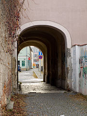
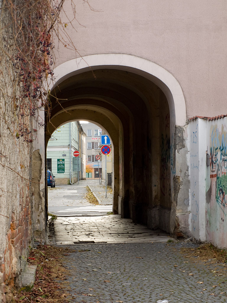
Čeština: Bruntál, Moravskoslezský kraj. Průjezd ul. Farní domem Zámecké nám. 3/9, průhled na náměstí J. Žižky.
English: Underpass, Bruntál, Moravian-Silesian Region |
||
Date | |||
Source |
Own work
|
||
Author | Honza Groh (Jagro) | ||
Permission (Reusing this file) |
I, the copyright holder of this work, hereby publish it under the following license: This file is licensed under the Creative Commons Attribution-Share Alike 3.0 Unported license.
|
Camera location | 49° 59′ 24.3″ N, 17° 27′ 57.34″ E | View this and other nearby images on: OpenStreetMap | 49.990082; 17.465929 |
---|
File history
Click on a date/time to view the file as it appeared at that time.
Date/Time | Thumbnail | Dimensions | User | Comment | |
---|---|---|---|---|---|
current | 23:21, 9 November 2011 | 2,350 × 3,133 (1.55 MB) | Jagro (talk | contribs) |
You cannot overwrite this file.
File usage on Commons
The following page uses this file:
Metadata
This file contains additional information such as Exif metadata which may have been added by the digital camera, scanner, or software program used to create or digitize it. If the file has been modified from its original state, some details such as the timestamp may not fully reflect those of the original file. The timestamp is only as accurate as the clock in the camera, and it may be completely wrong.
Camera manufacturer | OLYMPUS IMAGING CORP. |
---|---|
Camera model | E-420 |
Exposure time | 1/60 sec (0.016666666666667) |
F-number | f/5.6 |
ISO speed rating | 100 |
Date and time of data generation | 14:13, 29 October 2011 |
Lens focal length | 42 mm |
Latitude | 49° 59′ 24.3″ N |
Longitude | 17° 27′ 57.34″ E |
Altitude | 524.068 meters above sea level |
Image title |
|
Horizontal resolution | 240 dpi |
Vertical resolution | 240 dpi |
Software used | Version 1.1 |
File change date and time | 01:46, 2 November 2011 |
Exposure Program | Manual |
Exif version | 2.21 |
Date and time of digitizing | 15:13, 29 October 2011 |
APEX shutter speed | 5.906891 |
APEX aperture | 4.970854 |
APEX exposure bias | 0 |
Maximum land aperture | 3.61328125 APEX (f/3.5) |
Metering mode | Pattern |
Light source | Unknown |
Flash | Flash did not fire, compulsory flash firing |
File source | Digital still camera |
Custom image processing | Normal process |
Exposure mode | Manual exposure |
White balance | Auto white balance |
Digital zoom ratio | 1 |
Scene capture type | Standard |
Scene control | None |
Contrast | Normal |
Saturation | Normal |
Sharpness | Normal |
GPS tag version | 0.0.2.2 |
Lens used | 14.0-42.0 mm f/3.5-5.6 |
Serial number of camera | G21589094 |
Image width | 2,350 px |
Image height | 3,133 px |
Height | 3,133 px |
Width | 2,350 px |
Rating (out of 5) | 0 |
IIM version | 2 |