File:CIA map of Afghanistan in 2007-ar.png
Jump to navigation
Jump to search
No higher resolution available.
CIA_map_of_Afghanistan_in_2007-ar.png (326 × 350 pixels, file size: 337 KB, MIME type: image/png)
Captions
Captions
Add a one-line explanation of what this file represents
Summary
[edit]| Description |
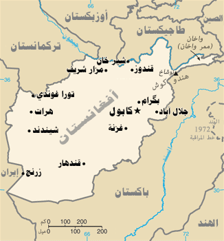
العربية: خارطة وكالة المخابرات المركزية لأفغانستان في 2007
English: CIA map of Afghanistan in 2007 |
|||
| Date | ||||
| Source | Derivative from this file | |||
| Author |
|
|||
| Permission (Reusing this file) |
|
|||
| Other versions |
[]
UNOCHA Versions[edit]
CIA WFB Versions[edit]
Other English Versions[edit] |

_-_AFG_-_UNOCHA.svg)
_-_AFG_-_UNOCHA-bn.svg)
_-_AFG_-_UNOCHA-es.svg)


| This is a retouched picture, which means that it has been digitally altered from its original version. Modifications: Translated to Arabic - عُرِبَت. The original can be viewed here: CIA map of Afghanistan in 2007.gif:
|
File history
Click on a date/time to view the file as it appeared at that time.
| Date/Time | Thumbnail | Dimensions | User | Comment | |
|---|---|---|---|---|---|
| current | 10:51, 21 January 2017 | | 326 × 350 (337 KB) | Moataz1997 (talk | contribs) | User created page with UploadWizard |
You cannot overwrite this file.
File usage on Commons
The following 18 pages use this file:
- User:Sanandros/ogre/secret intelligence/2017 January 21-31
- File:Afghanistan-CIA WFB Map.png
- File:Afghanistan-map-no.png
- File:Afghanistan-map.png
- File:Afghanistan - Location Map (2013) - AFG - UNOCHA-bn.svg
- File:Afghanistan - Location Map (2013) - AFG - UNOCHA-es.svg
- File:Afghanistan - Location Map (2013) - AFG - UNOCHA.svg
- File:Afghanistan map.png
- File:Afghanistan map1.png
- File:Afghanistan map - 2.png
- File:Afghanistan map Hindi.png
- File:Afuhan-ditu-zh-tw.png
- File:Afuhan-ditu-zh.png
- File:CIA map of Afghanistan in 2007-ar.png
- File:CIA map of Afghanistan in 2007.gif
- File:Carte de l'Afghanistan FR.png
- File:Mapa Afghánistánu.PNG
- Template:Other versions/Afghanistan Location Map
File usage on other wikis
The following other wikis use this file:
- Usage on ar.wikipedia.org
- كابل
- قندهار
- غزنة
- أسعد آباد
- قندوز
- مزار شريف
- جلال آباد
- باميان
- بلخ
- بغلان
- بل خمري
- میدانشار
- زرنج
- موسى قلعة
- قلات
- ترين كوت
- فيض آباد
- تالقان
- فراه
- تل حمران
- مرجة
- جيلان (أفغانستان)
- سنجين
- قالب:مدن أفغانستان
- مستخدم:Moataz1997
- شيندند
- مستخدم:Moataz1997/إنشاءات
- ويكيبيديا:ورشة الصور/أرشيف 24
- سربل (مدينة)
- الحدود بين أفغانستان وأوزبكستان
- شغشران
- بل علم
- قلات غلجي
- شرنه
- محمود راقي