File:California 74.svg
Jump to navigation
Jump to search

Size of this PNG preview of this SVG file: 385 × 401 pixels. Other resolutions: 230 × 240 pixels | 461 × 480 pixels | 737 × 768 pixels | 983 × 1,024 pixels | 1,966 × 2,048 pixels.
Original file (SVG file, nominally 385 × 401 pixels, file size: 11 KB)
Captions
Captions
Add a one-line explanation of what this file represents
| Description |
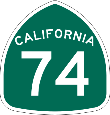
Shield for California State Route 74, located in Southern California.
|
| Date | |
| Source | Made to the specifications of the 1971 Caltrans sign drawing (still in use). Uses the Roadgeek 2005 fonts. (United States law does not permit the copyrighting of typeface designs, and the fonts are meant to be copies of a U.S. Government-produced work anyway.) |
| Author | SPUI |
| Other versions |
This vector image includes elements that have been taken or adapted from this file: |
| SVG development | This logo was created with Adobe Illustrator. |
This file is in the public domain because it comes from the California Manual on Uniform Traffic Control Devices, sign number G28-2 (CA), which states specifically in its introduction, on page 44 that:
|
File history
Click on a date/time to view the file as it appeared at that time.
| Date/Time | Thumbnail | Dimensions | User | Comment | |
|---|---|---|---|---|---|
| current | 16:32, 20 March 2006 | | 385 × 401 (11 KB) | SPUI~commonswiki (talk | contribs) | |
| 13:57, 20 March 2006 |  | 385 × 401 (10 KB) | SPUI~commonswiki (talk | contribs) | ||
| 13:31, 20 March 2006 | 570 × 2,910 (21 KB) | SPUI~commonswiki (talk | contribs) | {{spuiother}} 24 in by 25 in (600 mm by 635 mm) California State Route shield, made to the specifications of the [http://www.dot.ca.gov/hq/traffops/signtech/signdel/specs/G28-2.pdf 1971 Caltrans sign drawing] (still in use). Uses the [http://www.triskele. |
You cannot overwrite this file.
File usage on Commons
The following 4 pages use this file:
File usage on other wikis
The following other wikis use this file:
- Usage on ca.wikipedia.org
- Usage on de.wikipedia.org
- Usage on en.wikipedia.org
- Orange County, California
- Greater Los Angeles
- San Juan Capistrano, California
- Palm Desert, California
- Pacific Crest Trail
- User:Branddobbe/Temporary
- Interstate 215 (California)
- California State Route 111
- California State Route 74
- California State Route 73
- California State Route 243
- Eastern California
- California State Route 75
- California State Route 79
- Wikipedia:WikiProject U.S. Roads/Redirects/California
- California State Route 371
- Interstate 15 in California
- List of highways numbered 74
- Palm Springs, California
- Interstate 5 in California
- San Juan Creek
- List of state highways in California
- Business routes of Interstate 15
- Transportation in the Inland Empire
- California county routes in zone R
- Riverside County, California
- List of mountain passes in California
- User:Ejells2/sandbox
- User:Tv's emory/Sandbox/List of state highways in California
- Template:Pacific Crest Trail
- Usage on en.wikivoyage.org
- Usage on es.wikipedia.org
- Sur de California
- Condado de Riverside
- Área metropolitana de San Diego-Tijuana
- Ruta Estatal de California 75
- Anexo:Carreteras estatales de California
- Ruta Estatal de California 74
- Ruta Estatal de California 79
- Interestatal 215 (California)
- Ruta Estatal de California 73
- Wikiproyecto:Estados Unidos/Carreteras/CA
- Ruta Estatal de California 111
- Ruta Estatal de California 243
View more global usage of this file.