File:Canada British Columbia relief location map.jpg
Jump to navigation
Jump to search
Size of this preview: 740 × 599 pixels. Other resolutions: 296 × 240 pixels | 593 × 480 pixels | 948 × 768 pixels | 1,264 × 1,024 pixels | 2,127 × 1,723 pixels.
Original file (2,127 × 1,723 pixels, file size: 2.04 MB, MIME type: image/jpeg)
Captions
Captions
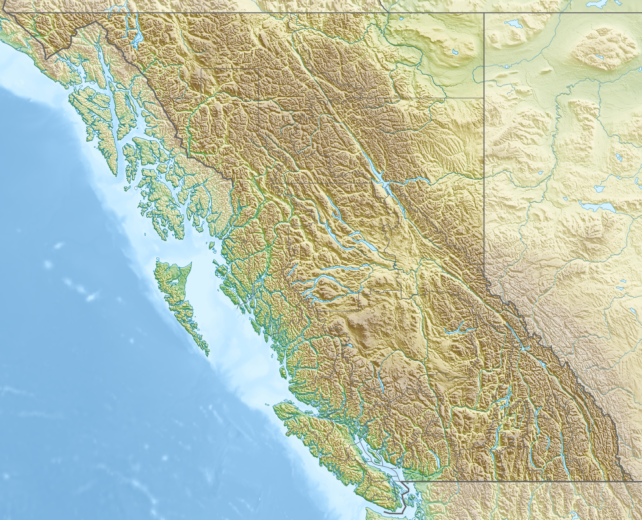
Relief map of The Province of British Columbia, Western Canada
| Description |
Quadratische Plattkarte, N-S-Streckung 170 %. Geographische Begrenzung der Karte:
Equirectangular projection, N/S stretching 170 %. Geographic limits of the map:
|
| Date | |
| Source |
Own work, using
|
| Author | Carport |
| Permission (Reusing this file) |
This file is licensed under the Creative Commons Attribution-Share Alike 3.0 Unported license.
|
| Other versions |
|

File history
Click on a date/time to view the file as it appeared at that time.
| Date/Time | Thumbnail | Dimensions | User | Comment | |
|---|---|---|---|---|---|
| current | 16:38, 30 November 2012 | | 2,127 × 1,723 (2.04 MB) | Carport (talk | contribs) | {{Information |Description= {{de|Physische Positionskarte von British Columbia, Kanada}} Quadratische Plattkarte, N-S-Streckung 170 %. Geographische Begrenzung der Karte: * N: 60.3° N * S: 48.1° N * W: 139.3° ... |
You cannot overwrite this file.
File usage on Commons
The following page uses this file:
File usage on other wikis
The following other wikis use this file:
- Usage on als.wikipedia.org
- Usage on ar.wikipedia.org
- Usage on ast.wikipedia.org
- Usage on ban.wikipedia.org
- Usage on ba.wikipedia.org
- Usage on be-tarask.wikipedia.org
- Usage on be.wikipedia.org
- Usage on bg.wikipedia.org
- Ванкувър
- Лейдисмит (Канада)
- Виктория (Британска Колумбия)
- Чейс (Британска Колумбия)
- Университет на Британска Колумбия
- Съри (Канада)
- Ричмънд (Британска Колумбия)
- Уислър
- Сайпръс (планина)
- Западен Ванкувър
- Бърнаби
- Роджърс Пас (Британска Колумбия)
- Шаблон:ПК Канада Британска Колумбия
- Китсолт
- Колумбийски планини
- Карибу (планина)
- Селкирк (планина)
- Фрейзър (плато)
- Хайда Гуаи
- Usage on bn.wikipedia.org
- Usage on cs.wikipedia.org
View more global usage of this file.