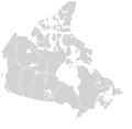
File:Canada blank map.svg

Original file (SVG file, nominally 1,114 × 942 pixels, file size: 205 KB)
Captions
Captions
| DescriptionCanada blank map.svg |
English: Blank SVG map of the territory claimed by Canada
Non-contiguous parts of a states/provinces are "grouped" together with the main area of the state/provinces, so any state/provinces can be coloured in completion with one click anywhere on the state/provinces's area. Also, all states/provinces have a "id" attached to them, making them easy to find. Select "find" and then enter in the state/provinces's ISO 3166-2 code in the "id" field to find it. The codes can be found here. There are 19 lakes shown; each has an ID that matches its official name. The lakes can be easily be found in the XML tree and they can be individually deleted to make room for text or other overlays. |
||||
| Date | 03-07-2007 edited 8-Aug-2007 | ||||
| Source |
|
||||
| Author | Lokal_Profil image cut to remove USA by Paul Robinson | ||||
| Permission (Reusing this file) |
|
||||
| Other versions |
Derivative works of this file:
Canada Labelled map.svg this map with province labels |
||||
| SVG development InfoField |
File history
Click on a date/time to view the file as it appeared at that time.
| Date/Time | Thumbnail | Dimensions | User | Comment | |
|---|---|---|---|---|---|
| current | 23:30, 16 November 2020 |  | 1,114 × 942 (205 KB) | MapGrid (talk | contribs) | Sync with File:Canada_location_map_2_-_lite.svg |
| 11:43, 5 December 2007 |  | 1,304 × 1,263 (113 KB) | Lokal Profil (talk | contribs) | Cleaned up code | |
| 21:25, 9 August 2007 |  | 1,304 × 1,263 (115 KB) | Rfc1394 (talk | contribs) | {{Information |Description={{en|Blank SVG map of Canada}} Non-contiguous parts of a states/provinces are "grouped" together with the main area of the state/provinces, so any state/provinces can be coloured in completion with one click anywhere on the stat |
You cannot overwrite this file.
File usage on Commons
The following 8 pages use this file:
File usage on other wikis
The following other wikis use this file:
- Usage on ca.wikipedia.org
- Usage on ca.wikimedia.org
- Usage on en.wikipedia.org
- Usage on fr.wikipedia.org
- Usage on os.wikipedia.org
- Usage on si.wikipedia.org
- Usage on sl.wikipedia.org
- Usage on uz.wikipedia.org
Metadata
This file contains additional information such as Exif metadata which may have been added by the digital camera, scanner, or software program used to create or digitize it. If the file has been modified from its original state, some details such as the timestamp may not fully reflect those of the original file. The timestamp is only as accurate as the clock in the camera, and it may be completely wrong.
| Short title | Map of Canada |
|---|---|
| Width | 1114 |
| Height | 942 |