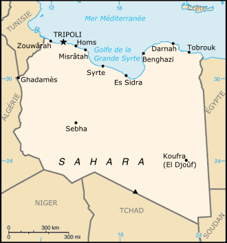
File:Carte Libye.png
Jump to navigation
Jump to search
No higher resolution available.
Carte_Libye.png (330 × 353 pixels, file size: 41 KB, MIME type: image/png)
Captions
Captions
Add a one-line explanation of what this file represents
Summary
[edit]
| Description | |
| Date | |
| Source | File:Ly-map.png |
| Author |
|
| Camera location | | View this and other nearby images on: OpenStreetMap |
|---|
Licensing
[edit]
This image is in the public domain because it contains materials that originally came from the United States Central Intelligence Agency's World Factbook.
|
 |
File history
Click on a date/time to view the file as it appeared at that time.
| Date/Time | Thumbnail | Dimensions | User | Comment | |
|---|---|---|---|---|---|
| current | 15:41, 7 September 2011 | | 330 × 353 (41 KB) | Tm (talk | contribs) | Reverted to version as of 16:30, 3 March 2011 the purpose of this map is to be in French ; if you upload a new version, please keep this language ! |
| 15:35, 7 September 2011 |  | 330 × 353 (96 KB) | ليبي صح (talk | contribs) | (((https://www.cia.gov/library/publications/the-world-factbook/maps/maptemplate_ly.html))) | |
| 15:32, 7 September 2011 |  | 330 × 353 (44 KB) | ليبي صح (talk | contribs) | ((https://www.cia.gov/library/publications/the-world-factbook/maps/maptemplate_ly.html)) | |
| 16:30, 3 March 2011 |  | 330 × 353 (41 KB) | Sémhur (talk | contribs) | Reverted to version as of 14:53, 26 February 2006 : the purpose of this map is to be in French ; if you upload a new version, please keep this language ! | |
| 01:32, 4 September 2010 |  | 328 × 353 (14 KB) | ليبي صح (talk | contribs) | (https://www.cia.gov/library/publications/the-world-factbook/maps/maptemplate_ly.html) | |
| 14:53, 26 February 2006 |  | 330 × 353 (41 KB) | Historicair (talk | contribs) | ||
| 18:45, 25 February 2006 |  | 330 × 353 (41 KB) | Historicair (talk | contribs) | Carte de la Libye {{PD-USGov-CIA-WF}} |
You cannot overwrite this file.
File usage on Commons
There are no pages that use this file.
File usage on other wikis
The following other wikis use this file:
- Usage on az.wikipedia.org
- Usage on fr.wikipedia.org
- Usage on hr.wikipedia.org
- Usage on it.wikipedia.org
- Usage on pt.wikipedia.org
- Usage on ru.wikipedia.org
- Usage on sh.wikipedia.org
- Usage on wo.wikipedia.org