File:Carte de la mer de Norvège-Jan-Mayen-localisation.png
Jump to navigation
Jump to search
Size of this preview: 657 × 600 pixels. Other resolutions: 263 × 240 pixels | 526 × 480 pixels | 1,000 × 913 pixels.
Original file (1,000 × 913 pixels, file size: 259 KB, MIME type: image/png)
Captions
Captions
Add a one-line explanation of what this file represents
| Description |
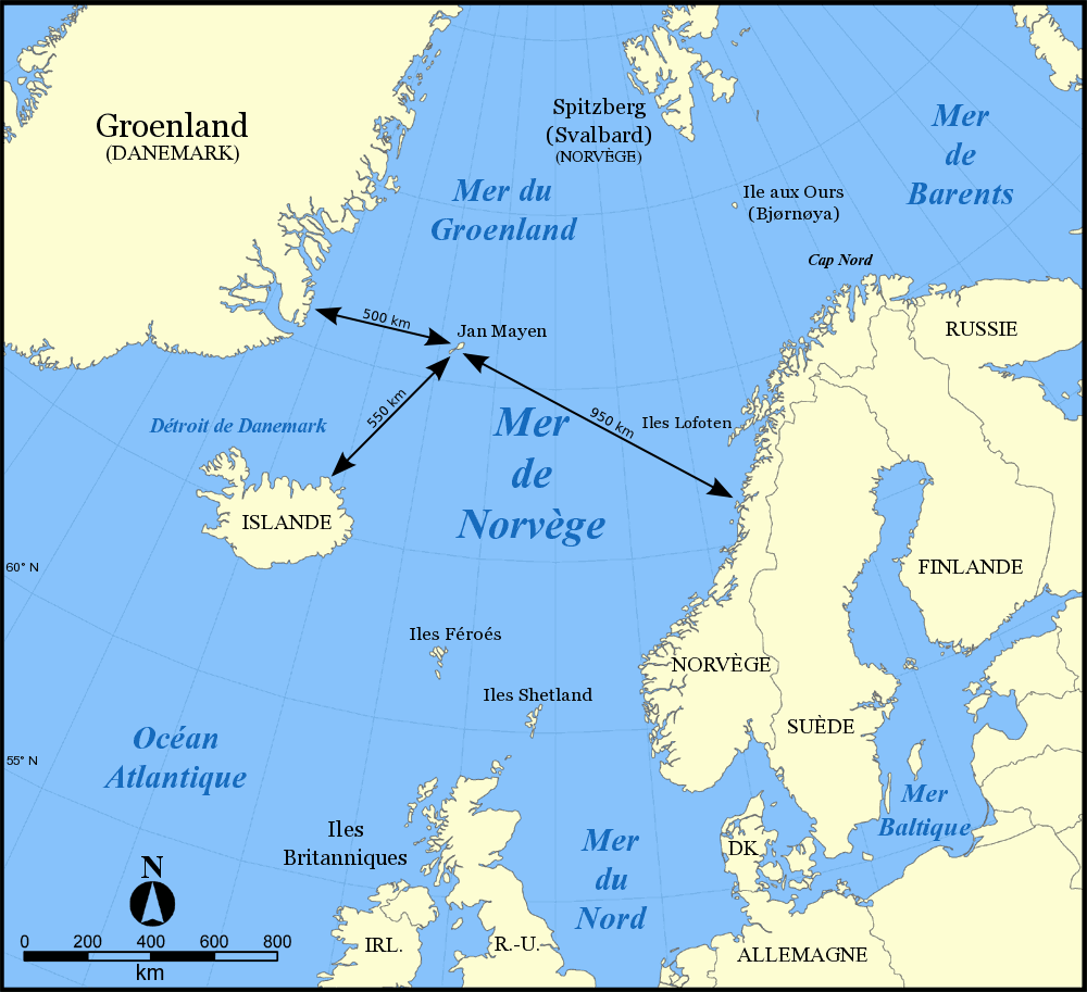
Français : Carte de la mer de Norvège avec les distances entre Jan Mayen et les continents alentour. |
| Date | |
| Source | own work based on Image:Carte de la mer de Norvège.png |
| Author | Emmanuel Boutet |
| Permission (Reusing this file) |
GFDL |
| Other versions |
[]
|


|
Permission is granted to copy, distribute and/or modify this document under the terms of the GNU Free Documentation License, Version 1.2 or any later version published by the Free Software Foundation; with no Invariant Sections, no Front-Cover Texts, and no Back-Cover Texts. A copy of the license is included in the section entitled GNU Free Documentation License. |
| This file is licensed under the Creative Commons Attribution-Share Alike 3.0 Unported license. | ||
| ||
| This licensing tag was added to this file as part of the GFDL licensing update. |
File history
Click on a date/time to view the file as it appeared at that time.
| Date/Time | Thumbnail | Dimensions | User | Comment | |
|---|---|---|---|---|---|
| current | 10:24, 20 April 2007 | | 1,000 × 913 (259 KB) | Emmanuel.boutet (talk | contribs) | |
| 08:55, 19 April 2007 |  | 1,000 × 913 (260 KB) | Emmanuel.boutet (talk | contribs) | {{fr|<br /> *Carte de la mer de Norvège *Créée le 4 novembre 2005 *Fond de carte original (Image:Norwegian Sea blank map.png) de NormanEinstein, annoté par Idarvol }} {{es|Mapa del mar de Noruega (en franc |
You cannot overwrite this file.
File usage on Commons
The following 29 pages use this file:
- File:Bahari ya Barents.png
- File:Barents Sea map.png
- File:Barents Sea map GR.png
- File:Barents Sea map hr.svg
- File:Barents Sea map hu.svg
- File:Barents Sea map ru.svg
- File:Barents sea map blank.png
- File:Barents sea map de.png
- File:Barents sp.png
- File:Carte de la mer de Norvège-Jan-Mayen-localisation.png
- File:Carte de la mer de Norvège.png
- File:Karte Europäisches Nordmeer.png
- File:Norra meri.png
- File:Norveško more.svg
- File:Norvég-tenger térkép 2.png
- File:Norvég tenger térkép.png
- File:Norwegian Sea blank map.png
- File:Norwegian Sea map-da.png
- File:Norwegian Sea map.png
- File:Norwegian Sea map ce.svg
- File:Norwegian Sea map ch.png
- File:Norwegian Sea map cs.png
- File:Norwegian Sea map it.png
- File:Norwegian Sea map mk.svg
- File:Norwegian Sea map no.png
- File:Norwegian Sea map ru.svg
- File:Norwegian Sea map sv.png
- File:Norwegian Sea map uk.svg
- Template:Other versions/Norwegian Sea
File usage on other wikis
The following other wikis use this file:
- Usage on ast.wikipedia.org
- Usage on be-tarask.wikipedia.org
- Usage on es.wikipedia.org
- Usage on fi.wikipedia.org
- Usage on fr.wikipedia.org
- Usage on hu.wikipedia.org
- Usage on it.wikipedia.org
- Usage on ja.wikipedia.org
- Usage on pl.wikipedia.org
- Usage on pl.wikivoyage.org
- Usage on pl.wiktionary.org
- Usage on uk.wikipedia.org