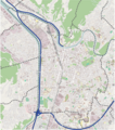
File:Carte géolocalisation Grenoble.png
From Wikimedia Commons, the free media repository
Jump to navigation
Jump to search

Size of this preview: 531 × 600 pixels. Other resolutions: 212 × 240 pixels | 425 × 480 pixels | 703 × 794 pixels.
Original file (703 × 794 pixels, file size: 979 KB, MIME type: image/png)
File information
Structured data
Captions
Captions
Add a one-line explanation of what this file represents

|
This city map image could be re-created using vector graphics as an SVG file. This has several advantages; see Commons:Media for cleanup for more information. If an SVG form of this image is available, please upload it and afterwards replace this template with
{{vector version available|new image name}}.
It is recommended to name the SVG file “Carte géolocalisation Grenoble.svg”—then the template Vector version available (or Vva) does not need the new image name parameter. |
Summary
[edit]| DescriptionCarte géolocalisation Grenoble.png |
Français : Carte de Grenoble, réalisée à partir des données de OpenStreetMap. Couleurs retouchées pour un usage sur wikipedia et suppression du code couleur relatif aux grands axes routiers. Modifications faites par moi-même Pedro38 sous Inkscape |
| Date | |
| Source | http://www.openstreetmap.org/ |
| Author | OpenStreetMap contributors & Myself |
Licensing
[edit]This file is licensed under the Creative Commons Attribution-Share Alike 2.5 Generic license.
- You are free:
- to share – to copy, distribute and transmit the work
- to remix – to adapt the work
- Under the following conditions:
- attribution – You must give appropriate credit, provide a link to the license, and indicate if changes were made. You may do so in any reasonable manner, but not in any way that suggests the licensor endorses you or your use.
- share alike – If you remix, transform, or build upon the material, you must distribute your contributions under the same or compatible license as the original.
File history
Click on a date/time to view the file as it appeared at that time.
| Date/Time | Thumbnail | Dimensions | User | Comment | |
|---|---|---|---|---|---|
| current | 16:30, 29 February 2012 |  | 703 × 794 (979 KB) | Pedro38 (talk | contribs) | Ajout du pont des Martyrs |
| 15:02, 28 February 2012 |  | 703 × 794 (978 KB) | Pedro38 (talk | contribs) |
You cannot overwrite this file.
File usage on Commons
The following 2 pages use this file:
File usage on other wikis
The following other wikis use this file:
- Usage on el.wikipedia.org
- Usage on eo.wikipedia.org
- Usage on fr.wikipedia.org
- Grenoble
- Journée des Tuiles
- European Synchrotron Radiation Facility
- École nationale supérieure de génie industriel
- Institut Laue-Langevin
- La Casamaures
- École polytechnique universitaire de Grenoble-Alpes
- Bastille (Grenoble)
- Magasin-CNAC
- Merlin Gerin
- Centre CEA de Grenoble
- Île-Verte (Grenoble)
- Tour Perret (Grenoble)
- Gare de Grenoble
- Stade des Alpes
- École nationale supérieure d'architecture de Grenoble
- Lycée Stendhal
- École supérieure d'art de Grenoble
- Europole
- Patinoire Polesud
- Chambre de commerce et d'industrie de Grenoble
- Musée dauphinois
- Hyper-centre de Grenoble
- L'Aigle (Grenoble)
- Championnet (Grenoble)
- Notre-Dame (Grenoble)
- Palais des Sports Pierre-Mendès-France
- Musée de Grenoble
- Gare d'Échirolles
- Cité scolaire internationale Europole de Grenoble
- Muséum d'histoire naturelle de Grenoble
- Lycée Champollion
- Chorier-Berriat
- École nationale supérieure de physique, électronique, matériaux
- Musée Hébert (La Tronche)
- Cellatex
- Musée archéologique Saint-Laurent
- Musée de la Résistance et de la Déportation de l'Isère
- Musée de la viscose
- Cabaret frappé
- Collégiale Saint-André de Grenoble
- Presqu'île (Grenoble)
- Grenoble-Institut des neurosciences
- Alpexpo
View more global usage of this file.