File:Caucasus-ethnic-2004.jpg

Original file (1,965 × 2,264 pixels, file size: 1.08 MB, MIME type: image/jpeg)
Captions
Captions

|
This file supersedes the file Caucasus-ethnic-1995.jpg. It is recommended to use this file rather than the other one.
Bahasa Indonesia ∙ davvisámegiella ∙ Deutsch ∙ English ∙ español ∙ français ∙ italiano ∙ magyar ∙ Nederlands ∙ polski ∙ svenska ∙ македонски ∙ മലയാളം ∙ português do Brasil ∙ русский ∙ slovenščina ∙ 日本語 ∙ 中文(简体) ∙ 中文(繁體) ∙ farsi ∙ +/− |

|

|
This file supersedes the file Caucasus-ethnic en.svg. It is recommended to use this file rather than the other one.
Bahasa Indonesia ∙ davvisámegiella ∙ Deutsch ∙ English ∙ español ∙ français ∙ italiano ∙ magyar ∙ Nederlands ∙ polski ∙ svenska ∙ македонски ∙ മലയാളം ∙ português do Brasil ∙ русский ∙ slovenščina ∙ 日本語 ∙ 中文(简体) ∙ 中文(繁體) ∙ farsi ∙ +/− |

|
Summary
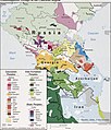
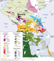
[edit]| DescriptionCaucasus-ethnic-2004.jpg | CIA map on the ethnolinguistic groups in the Caucasus region. National borders are thick black, regional borders within one country in thin black, and disputed borders as dotted lines. |
| Date | |
| Source | TIFF taken from the following source (maximally cropped and then converted to JPG): https://www.loc.gov/item/2005626531/ (permalink: https://lccn.loc.gov/2005626531) |
| Author | U.S. Central Intelligence Agency |
| Other versions |
|
Licensing
[edit]| Public domainPublic domainfalsefalse |
| This image is a work of a Central Intelligence Agency employee, taken or made as part of that person's official duties. As a Work of the United States Government, this image or media is in the public domain in the United States.
čeština ∙ Deutsch ∙ eesti ∙ English ∙ español ∙ français ∙ italiano ∙ português ∙ polski ∙ sicilianu ∙ slovenščina ∙ suomi ∙ Tiếng Việt ∙ български ∙ македонски ∙ русский ∙ українська ∙ বাংলা ∙ മലയാളം ∙ 한국어 ∙ 日本語 ∙ 中文 ∙ 中文(简体) ∙ 中文(繁體) ∙ العربية ∙ پښتو ∙ +/− |

|
File history
Click on a date/time to view the file as it appeared at that time.
| Date/Time | Thumbnail | Dimensions | User | Comment | |
|---|---|---|---|---|---|
| current | 21:27, 29 March 2022 |  | 1,965 × 2,264 (1.08 MB) | Cherkash (talk | contribs) | {{Information | Description = '''CIA map on the ethnolinguistic groups in the Caucasus region.''' National borders are thick black, regional borders within one country in thin black, and disputed borders as dotted lines. | Source = TIFF taken from the following source (maximally cropped and then converted to JPG): https://www.loc.gov/item/2005626531/ (permalink: https://lccn.loc.gov/2005626531) | Date = 2004 | Author = U.S. Central Intelligence Agency | Permission... |
You cannot overwrite this file.
File usage on Commons
The following 4 pages use this file:
File usage on other wikis
The following other wikis use this file:
- Usage on da.wikipedia.org
- Usage on ko.wiktionary.org
- Usage on ku.wikipedia.org
- Usage on pt.wikipedia.org
- Usage on sv.wikipedia.org
- Usage on tr.wikipedia.org

