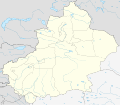
File:China Xinjiang location map.svg

Original file (SVG file, nominally 2,220 × 1,939 pixels, file size: 464 KB)
Captions
Captions
| The image contains one or several undisputed inaccuracies.
It should not be used to illustrate or provide information about the subject, but may be kept in order to provide the basis for a corrected image. If you disagree that it may be useful for this purpose feel free to request deletion. See the talk page for further information. |
This file requires updating because: The China-Tajikistan border has changed, Kunyu, Xinjiang is not included, Aksai Chin & the Trans-Karakoram Tract (the China-India disputed areas administered by China as part of Xinjiang) probably shouldn't be the same color as Tibet (ought to be slashed white & grey lines or something similar), and etc. other problems In doing so, you could add a timestamp to the file.
|
Summary
[edit]| DescriptionChina Xinjiang location map.svg |
Deutsch: Positionskarte von Xinjiang, Volksrepublik China im Jahr 2010
Quadratische Plattkarte, N-S-Streckung 135 %. Geographische Begrenzung der Karte:
English: Location map of Xinjiang, People's Republic of China, in 2010
Equirectangular projection, N/S stretching 135 %. Geographic limits of the map:
|
||
| Date | |||
| Source |
Own work, using
|
||
| Author | NordNordWest | ||
| Permission (Reusing this file) |
This file is licensed under the Creative Commons Attribution-Share Alike 3.0 Germany license.
 This file is licensed under the Creative Commons Attribution-Share Alike 3.0 Germany license.
 |
||
| Other versions |
|
||
| SVG development InfoField | This W3C-invalid map was created with Adobe Illustrator.
|
File history
Click on a date/time to view the file as it appeared at that time.
| Date/Time | Thumbnail | Dimensions | User | Comment | |
|---|---|---|---|---|---|
| current | 07:23, 10 June 2020 |  | 2,220 × 1,939 (464 KB) | NordNordWest (talk | contribs) | corr |
| 22:16, 9 June 2020 |  | 2,220 × 1,939 (470 KB) | Bjh21 (talk | contribs) | Reverted to version as of 13:31, 9 June 2020 (UTC): COM:UPLOADWAR; at least two users are of the opinion that this change is not minor, and I'm coming close to that view myself | |
| 22:09, 9 June 2020 |  | 2,220 × 1,939 (820 KB) | Geographyinitiative (talk | contribs) | Reverted to version as of 01:15, 9 June 2020 (UTC) Incorrect map is incorrect | |
| 13:31, 9 June 2020 |  | 2,220 × 1,939 (470 KB) | NordNordWest (talk | contribs) | Reverted to version as of 15:35, 28 December 2012 (UTC) again: only vector data in this svg please | |
| 01:15, 9 June 2020 |  | 2,220 × 1,939 (820 KB) | Geographyinitiative (talk | contribs) | Reverted to version as of 05:18, 13 April 2020 (UTC) | |
| 20:48, 24 May 2020 |  | 2,220 × 1,939 (470 KB) | Roy17 (talk | contribs) | Reverted to version as of 15:35, 28 December 2012 (UTC) | |
| 05:18, 13 April 2020 |  | 2,220 × 1,939 (820 KB) | Geographyinitiative (talk | contribs) | Reverted to version as of 06:36, 29 January 2019 (UTC) See talk page | |
| 10:41, 29 January 2019 |  | 2,220 × 1,939 (470 KB) | NordNordWest (talk | contribs) | Reverted to version as of 15:35, 28 December 2012 (UTC); only vector data in this svg please | |
| 06:36, 29 January 2019 |  | 2,220 × 1,939 (820 KB) | 复旦大学张超 (talk | contribs) | edit | |
| 15:35, 28 December 2012 |  | 2,220 × 1,939 (470 KB) | NordNordWest (talk | contribs) | upd |
You cannot overwrite this file.
File usage on Commons
The following 3 pages use this file:
File usage on other wikis
The following other wikis use this file:
- Usage on ar.wikipedia.org
- Usage on ba.wikipedia.org
- Usage on bg.wikipedia.org
- Usage on ceb.wikipedia.org
- Usage on ce.wikipedia.org
- Usage on ckb.wikipedia.org
- Usage on cs.wikipedia.org
- Usage on en.wikipedia.org
- Usage on eo.wikipedia.org
- Usage on es.wikipedia.org
- Usage on et.wikipedia.org
- Usage on incubator.wikimedia.org
- Usage on kbd.wikipedia.org
- Usage on kn.wikipedia.org
- Usage on ko.wikipedia.org
- Usage on mk.wikipedia.org
- Usage on or.wikipedia.org
- Usage on pl.wikibooks.org
- Usage on pnb.wikipedia.org
- Usage on ps.wikipedia.org
- Usage on simple.wikipedia.org
- Usage on su.wikipedia.org
- Usage on tr.wikipedia.org
- Usage on vi.wikipedia.org
- Usage on war.wikipedia.org
- Usage on xmf.wikipedia.org
Metadata
This file contains additional information such as Exif metadata which may have been added by the digital camera, scanner, or software program used to create or digitize it. If the file has been modified from its original state, some details such as the timestamp may not fully reflect those of the original file. The timestamp is only as accurate as the clock in the camera, and it may be completely wrong.
| Width | 2220.488px |
|---|---|
| Height | 1938.906px |


