File:D-A-CH beschriftet.svg
Jump to navigation
Jump to search

Size of this PNG preview of this SVG file: 498 × 600 pixels. Other resolutions: 199 × 240 pixels | 398 × 480 pixels | 638 × 768 pixels | 850 × 1,024 pixels | 1,700 × 2,048 pixels | 1,257 × 1,514 pixels.
Original file (SVG file, nominally 1,257 × 1,514 pixels, file size: 715 KB)
Captions
Captions
Add a one-line explanation of what this file represents
This W3C-unspecified vector image was created with Adobe Illustrator.
W3C-validity not checked.
Summary
[edit]| Description |
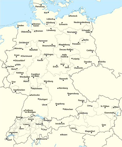
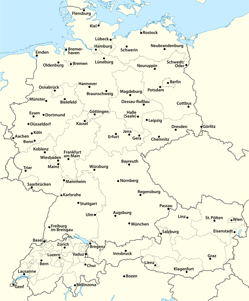
Deutsch: Karte der D-A-CH-Länder mit einigen Städten, Alternativkarte zu D-A-CH location map.svg in der entsprechenden Vorlage:Positionskarte
English: Map of German-speaking Europe (D-A-CH) with some cities, alternative map for D-A-CH location map.svg in a Template:Location map |
||
| Date | 07-06-2009 | ||
| Source | own work, using United States National Imagery and Mapping Agency data | ||
| Author | NordNordWest | ||
| Permission (Reusing this file) |
I, the copyright holder of this work, hereby publish it under the following licenses:
This file is licensed under the Creative Commons Attribution-Share Alike 3.0 Unported license.
You may select the license of your choice. |


|
This map has been made or improved in the German Kartenwerkstatt (Map Lab). You can propose maps to improve as well.
|
File history
Click on a date/time to view the file as it appeared at that time.
| Date/Time | Thumbnail | Dimensions | User | Comment | |
|---|---|---|---|---|---|
| current | 06:35, 18 March 2014 | | 1,257 × 1,514 (715 KB) | Wereldburger758 (talk | contribs) | Valid SVG now |
| 10:24, 7 May 2009 |  | 1,257 × 1,514 (1.46 MB) | NordNordWest (talk | contribs) | {{Information |Description= {{de|Karte der D-A-CH-Länder mit einigen Städten, Alternativkarte zu D-A-CH location map.svg in der entsprechenden Vorlage:Positionskarte}} {{en|Map of [[:en:German-speaking Eu |
You cannot overwrite this file.
File usage on Commons
The following page uses this file:
File usage on other wikis
The following other wikis use this file:
- Usage on de.wikipedia.org