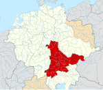
File:Deutschland um das Jahr 1000.svg

Original file (SVG file, nominally 5,247 × 4,115 pixels, file size: 4.92 MB)
Captions
Captions
The factual accuracy of this map or the file name is disputed.
Reason: Outdated; not according to current state of science |  |
Summary
[edit]| DescriptionDeutschland um das Jahr 1000.svg |
English: A map of the German Kingdom/East Francia around 1000 C.E.
The map is a vectorised version of one found in Professor G. Droysens Allgemeiner Historischer Handatlas, which was published in 1886 by R. Andrée Plate, and is now in the public domain. |
| Date | |
| Source |
File: own work Data: Droysens-22-23.jpg |
| Author | Alphathon /'æɫfə.θɒn/ (talk) |
| Other versions |
Licensing
[edit]- You are free:
- to share – to copy, distribute and transmit the work
- to remix – to adapt the work
- Under the following conditions:
- attribution – You must give appropriate credit, provide a link to the license, and indicate if changes were made. You may do so in any reasonable manner, but not in any way that suggests the licensor endorses you or your use.
- share alike – If you remix, transform, or build upon the material, you must distribute your contributions under the same or compatible license as the original.
File history
Click on a date/time to view the file as it appeared at that time.
| Date/Time | Thumbnail | Dimensions | User | Comment | |
|---|---|---|---|---|---|
| current | 16:43, 29 December 2022 |  | 5,247 × 4,115 (4.92 MB) | +JMJ+ (talk | contribs) | Made it so the Jotvingians' name would be visible |
| 14:49, 27 December 2022 |  | 5,247 × 4,115 (4.92 MB) | +JMJ+ (talk | contribs) | Final improvements | |
| 14:39, 27 December 2022 |  | 5,247 × 4,115 (4.92 MB) | +JMJ+ (talk | contribs) | Moved some names so they fit into the view | |
| 14:27, 27 December 2022 |  | 5,247 × 4,115 (4.92 MB) | +JMJ+ (talk | contribs) | Corrections to the easternmost part of the map - mostly following File:Lietuvių giminės senovėje iki XIII amžiaus pradžios.jpg | |
| 04:27, 18 May 2016 |  | 5,247 × 4,115 (4.96 MB) | Alphathon (talk | contribs) | Minor corrections | |
| 00:24, 18 May 2016 |  | 5,247 × 4,115 (4.96 MB) | Alphathon (talk | contribs) | == {{int:filedesc}} == {{Inkscape}} {{Information |Description={{en|A map of the German Kingdom/East Francia around 1000 C.E. The map is a vectorised version of one found in Professor G. Droysens Allg... |
You cannot overwrite this file.
File usage on Commons
The following 22 pages use this file:
- User:Jensga
- User:Magog the Ogre/Multilingual legend/2022 December 21-31
- User:Roy17/Leipzig/2022 December
- File:Angaria locator map (1000).svg
- File:Austria locator map (1000).svg
- File:Bavaria locator map (1000).svg
- File:Billung March locator map (1004).svg
- File:Droysens-22-23.jpg
- File:Duchy of Swabia locator map (1004).svg
- File:March of Carniola locator map (1000).svg
- File:March of Lusatia locator map (1004).svg
- File:March of Meissen locator map (1004).svg
- File:March of Merseburg locator map (1004).svg
- File:March of Zeitz locator map (1004).svg
- File:Mark an der Sann locator map (1000).svg
- File:Nordalbingia locator map (1000).svg
- File:Nordgau locator map (1000).svg
- File:Northern March locator map (1004).svg
- File:Ostfalia locator map (1000).svg
- File:Saxony locator map (1000).svg
- File:Westfalia locator map (1000).svg
- File:Zistanesfeld locator map (1000).svg
File usage on other wikis
The following other wikis use this file:
- Usage on de.wikipedia.org
- Usage on de.wikibooks.org
- Usage on et.wikipedia.org
- Usage on frr.wikipedia.org
- Usage on hu.wikipedia.org
Metadata
This file contains additional information such as Exif metadata which may have been added by the digital camera, scanner, or software program used to create or digitize it. If the file has been modified from its original state, some details such as the timestamp may not fully reflect those of the original file. The timestamp is only as accurate as the clock in the camera, and it may be completely wrong.
| Short title | Deutschland um das Jahr 1000 |
|---|---|
| Image title | A map of the German Kingdom/East Francia around 1000 C.E.
The map is a vectorised version of one found in Professor G. Droysens Allgemeiner Historischer Handatlas, which was published in 1886 by R. Andrée Plate, and is now in the public domain. The source scan can be found at https://commons.wikimedia.org/wiki/File:Droysens-22-23.jpg. Released under CreativeCommons Attribution-ShareAlike 4.0 (CC BY-SA 4.0; https://creativecommons.org/licenses/by-sa/4.0/) by Wikimedia Commons user Alphathon (https://commons.wikimedia.org/wiki/User:Alphathon) |
| Width | 5247.375 |
| Height | 4115 |


