File:Eastern Washington map.svg
Jump to navigation
Jump to search

Size of this PNG preview of this SVG file: 800 × 521 pixels. Other resolutions: 320 × 208 pixels | 640 × 416 pixels | 1,024 × 666 pixels | 1,280 × 833 pixels | 2,560 × 1,666 pixels | 1,781 × 1,159 pixels.
Original file (SVG file, nominally 1,781 × 1,159 pixels, file size: 220 KB)
Captions
Captions
Add a one-line explanation of what this file represents
| Description |
This W3C-unspecified vector image was created with Inkscape .
|
||
| Date | (UTC) | ||
| Source | |||
| Author |
|
||
| Permission (Reusing this file) |
|
||
| Other versions | Derivative works of this file: Flag map of Washington.svg |
Original upload log
[edit]
This image is a derivative work of the following images:
- File:Map_of_Washington_counties,_blank.svg licensed with PD-self
- 2006-02-14T19:06:01Z Dbenbenn 1781x1159 (219804 Bytes) by me, PD. This is a simple modification of [[:Image:Map of Washington highlighting Thurston County.svg]]
Uploaded with derivativeFX
File history
Click on a date/time to view the file as it appeared at that time.
| Date/Time | Thumbnail | Dimensions | User | Comment | |
|---|---|---|---|---|---|
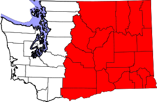
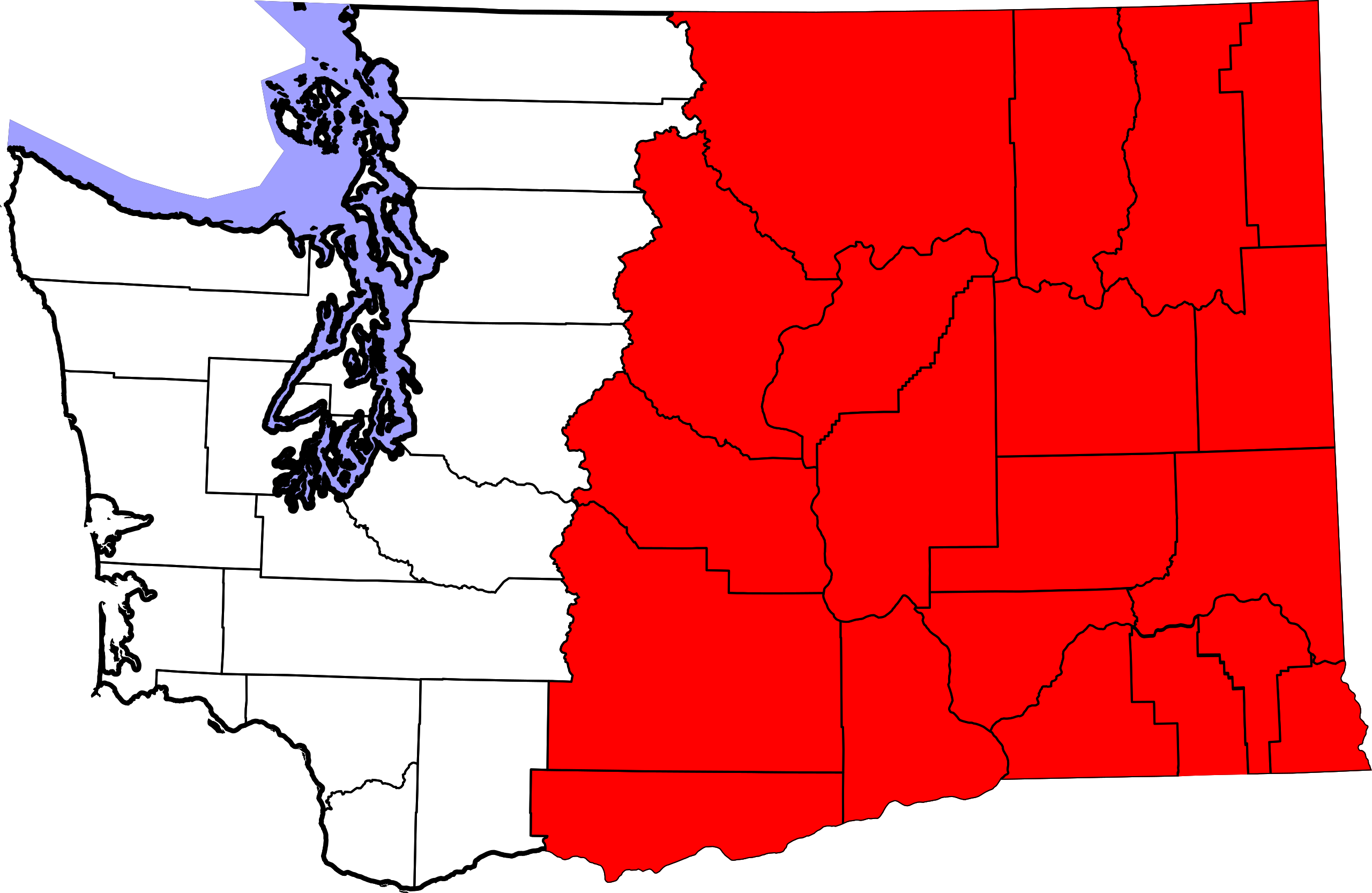
| current | 07:37, 21 January 2011 | | 1,781 × 1,159 (220 KB) | Admrboltz (talk | contribs) | {{Information |Description={{en|A map of w:Washington (U.S. state), highlighting w:Eastern Washington.}} {{Inkscape}} {{RetouchedPicture|Colored in Eastern Washington counties|editor=Admrboltz|orig=Map_of_Washington_counties,_blank.svg}} |Source |
You cannot overwrite this file.
File usage on Commons
The following 2 pages use this file:
File usage on other wikis
The following other wikis use this file:
- Usage on cs.wikipedia.org
- Usage on de.wikipedia.org
- Usage on en.wikipedia.org
- Talk:Columbia River
- Talk:Benton County, Washington
- Talk:Adams County, Washington
- Talk:Asotin County, Washington
- Talk:Chelan County, Washington
- Talk:Columbia County, Washington
- Talk:Douglas County, Washington
- Talk:Ferry County, Washington
- Talk:Franklin County, Washington
- Talk:Garfield County, Washington
- Talk:Grant County, Washington
- Talk:Lincoln County, Washington
- Talk:Spokane County, Washington
- Talk:Stevens County, Washington
- Talk:Walla Walla County, Washington
- Talk:Whitman County, Washington
- Talk:Spokane Valley, Washington
- Talk:Yakima, Washington
- Talk:Washington State University
- Talk:Hanford, Washington
- Talk:Colfax, Washington
- Talk:Mount Adams (Washington)
- Eastern Washington
- Talk:Inland Northwest
- Talk:John Stockton
- Talk:Whitman College
- Talk:Kennewick Man
- Talk:Apple Cup
- Talk:Yakima River
- Talk:Cascadia
- Talk:Chuck Jones
- Talk:Walla Walla, Washington
- Talk:Christine Gregoire
- Talk:Spokane, Washington
- Talk:Sam Kinison
- Talk:Hanford Site
- Talk:Walla Walla University
- Talk:Drew Bledsoe
- Talk:William La Follette
- Talk:Tom Foley
- Talk:Grand Coulee Dam
- Talk:List of state routes in Washington
- Talk:Washington State Route 410
- Talk:Tri-City Dust Devils
- Talk:Tri-Cities, Washington
- Talk:Fairchild Air Force Base
- Talk:Wenatchee, Washington
- Talk:Interstate 82
View more global usage of this file.