File:Europa 1721.svg
From Wikimedia Commons, the free media repository
Jump to navigation
Jump to search

Size of this PNG preview of this SVG file: 600 × 600 pixels. Other resolutions: 240 × 240 pixels | 480 × 480 pixels | 768 × 768 pixels | 1,024 × 1,024 pixels | 2,048 × 2,048 pixels | 1,357 × 1,357 pixels.
Original file (SVG file, nominally 1,357 × 1,357 pixels, file size: 680 KB)
File information
Structured data
Captions
Captions
Add a one-line explanation of what this file represents
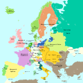
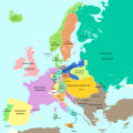
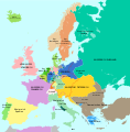
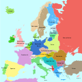
Mapa simplificat d'Europa al final de la Gran Guerra del Nord el 1721.
Summary
[edit]| DescriptionEuropa 1721.svg |
Deutsch: Eine einfache Karte von Europa am Ende des Großen Nordischen Krieges 1721.
English: A simple map showing Europe at the end of the Great Nordic War, 1721
Català: Mapa simplificat d'Europa al final de la Gran Guerra del Nord el 1721 |
||
| Date | |||
| Source |
This file was derived from: Blank map of Europe 1714.svg |
||
| Author |
|
||
| Permission (Reusing this file) |
I, the copyright holder of this work, hereby publish it under the following licenses:
This file is licensed under the Creative Commons Attribution-Share Alike 4.0 International license.
You may select the license of your choice. |
||
| Other versions |
|
||
| SVG development InfoField | This vector image was created with Adobe Illustrator. |
File history
Click on a date/time to view the file as it appeared at that time.
| Date/Time | Thumbnail | Dimensions | User | Comment | |
|---|---|---|---|---|---|
| current | 18:16, 17 September 2023 |  | 1,357 × 1,357 (680 KB) | Lalpino (talk | contribs) | File uploaded using svgtranslate tool (https://svgtranslate.toolforge.org/). Added translation for ca. |
| 11:50, 20 October 2016 |  | 1,357 × 1,357 (667 KB) | Furfur (talk | contribs) | ... erneut | |
| 11:48, 20 October 2016 |  | 1,357 × 1,357 (667 KB) | Furfur (talk | contribs) | rechte Bildgrenze, Grenze in Karelien | |
| 11:03, 20 October 2016 |  | 1,387 × 1,367 (667 KB) | Furfur (talk | contribs) | Details | |
| 22:06, 16 October 2016 |  | 1,387 × 1,367 (666 KB) | Furfur (talk | contribs) | Details (Oldenburg, Toskana) | |
| 19:53, 1 October 2016 |  | 1,387 × 1,367 (666 KB) | Furfur (talk | contribs) | hellere Meeresfarbe | |
| 19:12, 1 October 2016 |  | 1,387 × 1,367 (666 KB) | Furfur (talk | contribs) | nochmal Detail | |
| 19:11, 1 October 2016 |  | 1,387 × 1,367 (666 KB) | Furfur (talk | contribs) | Details | |
| 19:04, 1 October 2016 |  | 1,387 × 1,367 (666 KB) | Furfur (talk | contribs) | == {{int:filedesc}} == {{Information |Description={{User:Medium69/Traduction}} {{de|1=Eine einfache Karte von Europa am Ende des Großen Nordischen Krieges 1721.}} {{en|1=A simple map showing Europe at the end of the Great Nordic War, 1721}} |Source={{... |
You cannot overwrite this file.
File usage on Commons
The following 12 pages use this file:
- User:Magog the Ogre/Multilingual legend/2023 September 16-20
- File:Europa 1701.svg
- File:Europa 1721.svg
- File:Europa 1789.svg
- File:Europa 1812.svg
- File:Europa 1815.svg
- File:Europa 1861.svg
- File:Europa 1867.svg
- File:Europa 1914.svg
- File:Europa 1929.svg
- File:Frieden von Nystad, Stockholm und Fredericksborg.svg
- Template:Other versions/Europa 1721
File usage on other wikis
The following other wikis use this file:
- Usage on af.wikipedia.org
- Usage on bg.wikipedia.org
- Usage on ca.wikipedia.org
- Usage on en.wikipedia.org
- Usage on sh.wikipedia.org
- Usage on zh-yue.wikipedia.org
Metadata
This file contains additional information such as Exif metadata which may have been added by the digital camera, scanner, or software program used to create or digitize it. If the file has been modified from its original state, some details such as the timestamp may not fully reflect those of the original file. The timestamp is only as accurate as the clock in the camera, and it may be completely wrong.
| Width | 1357.391px |
|---|---|
| Height | 1357.3px |


