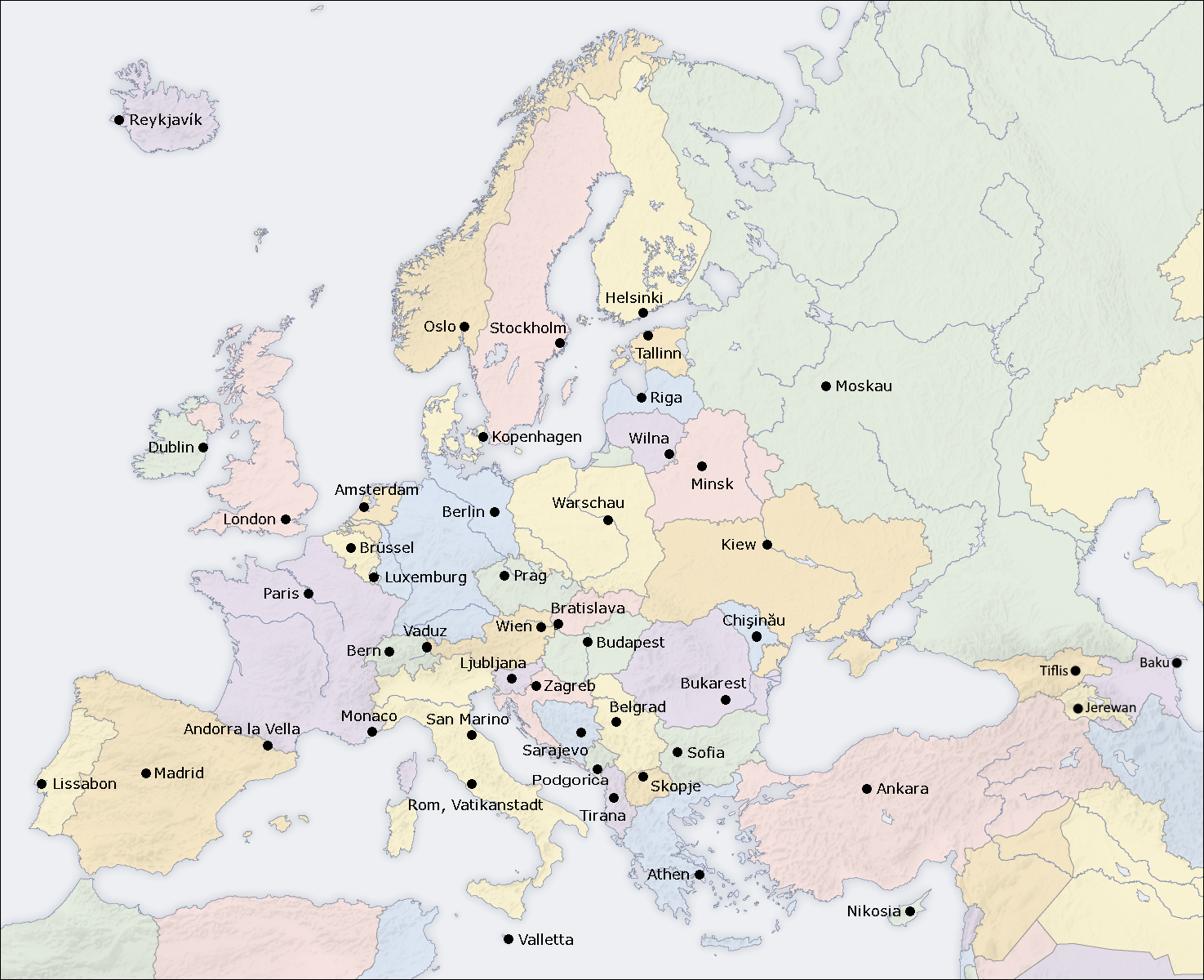
File:Europe capitals map de.png
Jump to navigation
Jump to search
Size of this preview: 737 × 600 pixels. Other resolutions: 295 × 240 pixels | 590 × 480 pixels | 944 × 768 pixels | 1,259 × 1,024 pixels | 1,475 × 1,200 pixels.
Original file (1,475 × 1,200 pixels, file size: 1.16 MB, MIME type: image/png)
Captions
Captions
Add a one-line explanation of what this file represents
Summary
[edit]
| Description | Capitals in Europe, German map |
| Date | |
| Source | Own map, based on the Image:Europe_countries_map.png by User:San Jose |
| Author | User:Highpriority |
| Other versions | capitals map without text, countries map in English, countries map in German, countries map in French, countries map without text |
Licensing
[edit]
The map has been created with the Generic Mapping Tools: https://www.generic-mapping-tools.org/ using one or more of these public-domain datasets for the relief:
|

|
Permission is granted to copy, distribute and/or modify this document under the terms of the GNU Free Documentation License, Version 1.2 or any later version published by the Free Software Foundation; with no Invariant Sections, no Front-Cover Texts, and no Back-Cover Texts. A copy of the license is included in the section entitled GNU Free Documentation License. |
| This file is licensed under the Creative Commons Attribution-Share Alike 3.0 Unported license. | ||
| ||
| This licensing tag was added to this file as part of the GFDL licensing update. |
File history
Click on a date/time to view the file as it appeared at that time.
| Date/Time | Thumbnail | Dimensions | User | Comment | |
|---|---|---|---|---|---|
| current | 18:24, 15 August 2022 | | 1,475 × 1,200 (1.16 MB) | Рагин1987 (talk | contribs) | Die Länder des Kaukasus hinzugefügt (Zypern liegt geografisch ebenfalls vollständig in Asien, und Russland und die Türkei sind transkontinental) |
| 20:02, 19 July 2006 |  | 1,475 × 1,200 (614 KB) | Stefan040780 (talk | contribs) | updated: 19.07.2006 | |
| 01:35, 19 July 2006 |  | 1,475 × 1,200 (614 KB) | Stefan040780 (talk | contribs) | updated, 19th of July | |
| 11:27, 15 April 2006 |  | 1,475 × 1,200 (595 KB) | Highpriority (talk | contribs) | ===English=== * Description: capitals in Europe, German map * Source: own map, based on the https://commons.wikimedia.org/wiki/Image:Europe_countries_map_en.png * Author: http://de.wikipedia.org/wiki/Benutzer:Highpriority * Date of creation: 2006-04-15 * O |
You cannot overwrite this file.
File usage on Commons
The following page uses this file:
File usage on other wikis
The following other wikis use this file:
- Usage on de.wikipedia.org
- Usage on de.wikiversity.org
- Usage on lij.wikipedia.org
- Usage on pdc.wikipedia.org
- Usage on rm.wikipedia.org