File:Europe countries map eo.png
Jump to navigation
Jump to search

Size of this preview: 737 × 600 pixels. Other resolutions: 295 × 240 pixels | 590 × 480 pixels | 944 × 768 pixels | 1,259 × 1,024 pixels | 1,475 × 1,200 pixels.
Original file (1,475 × 1,200 pixels, file size: 963 KB, MIME type: image/png)
Captions
Captions
Add a one-line explanation of what this file represents
| Description |
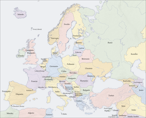
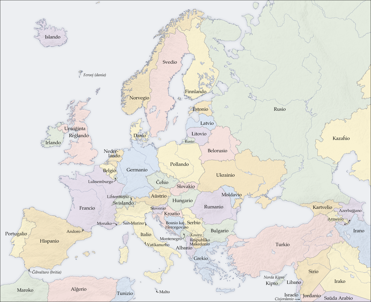
English: Map of countries in Europe |
| Date | (UTC) |
| Source | |
| Author |
|
| Other versions |
[]
|


| This is a retouched picture, which means that it has been digitally altered from its original version. Modifications: aldonis la nomojn de la eŭropaj landoj kaj teritorioj. The original can be viewed here: Europe countries map.png:
|
I, the copyright holder of this work, hereby publish it under the following license:
The map has been created with the Generic Mapping Tools: https://www.generic-mapping-tools.org/ using one or more of these public-domain datasets for the relief:
|

|
Permission is granted to copy, distribute and/or modify this document under the terms of the GNU Free Documentation License, Version 1.2 or any later version published by the Free Software Foundation; with no Invariant Sections, no Front-Cover Texts, and no Back-Cover Texts. A copy of the license is included in the section entitled GNU Free Documentation License. |
| This file is licensed under the Creative Commons Attribution-Share Alike 3.0 Unported license. | ||
| ||
| This licensing tag was added to this file as part of the GFDL licensing update. |
Original upload log
[edit]
This image is a derivative work of the following images:
- File:Europe_countries_map.png licensed with GFDL-GMT
Uploaded with derivativeFX
File history
Click on a date/time to view the file as it appeared at that time.
| Date/Time | Thumbnail | Dimensions | User | Comment | |
|---|---|---|---|---|---|
| current | 18:56, 12 March 2009 | | 1,475 × 1,200 (963 KB) | Rainmonger (talk | contribs) | {{Information |Description={{en|Map of countries in Europe}} |Source=*File:Europe_countries_map.png |Date=2009-03-12 18:54 (UTC) |Author=*File:Europe_countries_map.png: San Jose (map), Patrol110 (translatio |
You cannot overwrite this file.
File usage on Commons
The following 55 pages use this file:
- User:Blahma/Esperanto en Vikimedia Komunejo
- File:Europan.png
- File:Europe countries map-zh-classical.png
- File:Europe countries map.png
- File:Europe countries map 2.png
- File:Europe countries map 2 hr.svg
- File:Europe countries map af.png
- File:Europe countries map ar 2.png
- File:Europe countries map bg.png
- File:Europe countries map bs.png
- File:Europe countries map ce.svg
- File:Europe countries map cs.png
- File:Europe countries map cs2.svg
- File:Europe countries map de.png
- File:Europe countries map de 2.png
- File:Europe countries map dsb.PNG
- File:Europe countries map en.png
- File:Europe countries map en 2.png
- File:Europe countries map eo.png
- File:Europe countries map es.png
- File:Europe countries map et.png
- File:Europe countries map fo.png
- File:Europe countries map fr.png
- File:Europe countries map fr 2.png
- File:Europe countries map gd.png
- File:Europe countries map got.png
- File:Europe countries map hsb.PNG
- File:Europe countries map hu.png
- File:Europe countries map it.png
- File:Europe countries map it 2.png
- File:Europe countries map ja.png
- File:Europe countries map ja 2.png
- File:Europe countries map km.png
- File:Europe countries map km 2.png
- File:Europe countries map la.png
- File:Europe countries map local lang.png
- File:Europe countries map local lang 2.png
- File:Europe countries map lt.png
- File:Europe countries map lv.png
- File:Europe countries map mn.png
- File:Europe countries map nah.png
- File:Europe countries map pl.png
- File:Europe countries map ru.png
- File:Europe countries map ru edited-1.png
- File:Europe countries map sk.png
- File:Europe countries map sl.png
- File:Europe countries map sq.png
- File:Europe countries map sr.png
- File:Europe countries map szl.png
- File:Europe countries map szl 2.png
- File:Europe countries map tg.png
- File:Europe countries map tr.png
- File:Europe countries map uk.png
- File:Europe countries map wo.PNG
- Template:Other versions/Europe countries map
File usage on other wikis
The following other wikis use this file:
- Usage on eo.wiktionary.org
- Usage on nl.wikibooks.org
- Usage on pl.wikibooks.org