File:Falkland Islands relief location map.jpg
Jump to navigation
Jump to search
Size of this preview: 736 × 599 pixels. Other resolutions: 295 × 240 pixels | 589 × 480 pixels | 943 × 768 pixels | 1,257 × 1,024 pixels | 2,533 × 2,063 pixels.
Original file (2,533 × 2,063 pixels, file size: 747 KB, MIME type: image/jpeg)
Captions
Captions
Add a one-line explanation of what this file represents
Summary
[edit]
| Description |
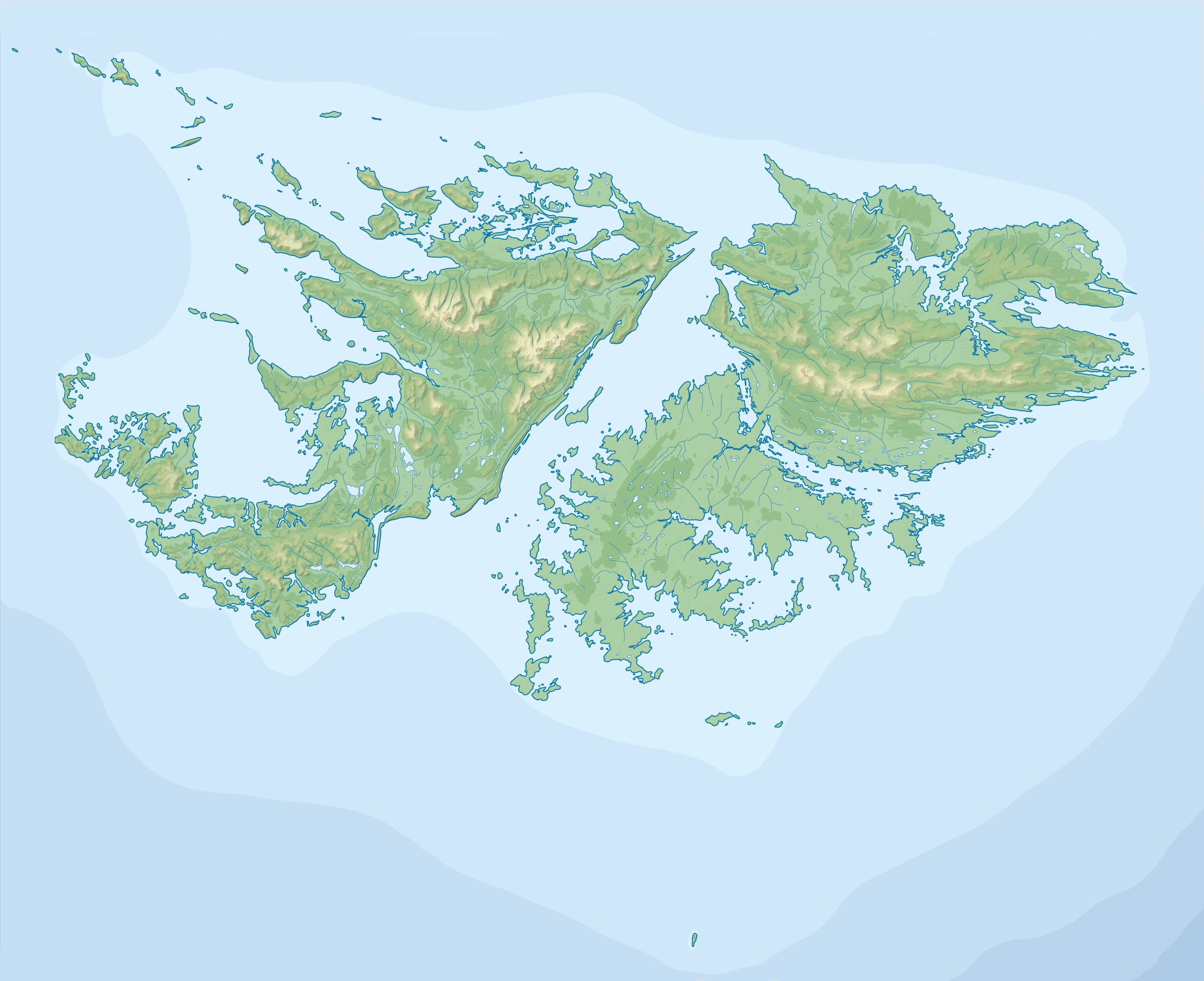
Deutsch: Positionskarte der Falklandinseln
Quadratische Plattkarte, N-S-Streckung 155 %. Geographische Begrenzung der Karte:
English: Location map of the Falkland Islands
Equirectangular projection, N/S stretching 155 %. Geographic limits of the map:
|
| Date | |
| Source |
This file was derived from: |
| Author |
Licensing
[edit]
I, the copyright holder of this work, hereby publish it under the following license:
This file is licensed under the Creative Commons Attribution-Share Alike 4.0 International license.
- You are free:
- to share – to copy, distribute and transmit the work
- to remix – to adapt the work
- Under the following conditions:
- attribution – You must give appropriate credit, provide a link to the license, and indicate if changes were made. You may do so in any reasonable manner, but not in any way that suggests the licensor endorses you or your use.
- share alike – If you remix, transform, or build upon the material, you must distribute your contributions under the same or compatible license as the original.
File history
Click on a date/time to view the file as it appeared at that time.
| Date/Time | Thumbnail | Dimensions | User | Comment | |
|---|---|---|---|---|---|
| current | 22:38, 7 April 2015 | | 2,533 × 2,063 (747 KB) | Milenioscuro (talk | contribs) | User created page with UploadWizard |
You cannot overwrite this file.
File usage on Commons
The following page uses this file:
File usage on other wikis
The following other wikis use this file:
- Usage on da.wikipedia.org
- Usage on de.wikipedia.org
- Mount Usborne
- Falklandsund
- Speedwell Island
- Beauchene Island
- Port Egmont (Bucht)
- Mount Adam (Falklandinseln)
- Barren Island (Falklandinseln)
- George Island
- Port Howard
- Port Pleasant
- Vorlage:Positionskarte Falklandinseln
- Wikipedia:Kartenwerkstatt/Positionskarten/Südamerika
- Carcass Island
- Bleaker Island
- Bird Island (Falklandinseln)
- Eddystone Rock (Falklandinseln)
- Great Island (Falklandinseln)
- Sealion Island
- Keppel Island (Falklandinseln)
- Goose Green
- New Island (Falklandinseln)
- Staats Island
- West Point Island
- Darwin (Falklandinseln)
- Ruggles Island
- San Carlos Water
- Berkeley Sound
- Sedge Island (Falklandinseln)
- Fox Bay
- Usage on eo.wikipedia.org
- Usage on es.wikipedia.org
View more global usage of this file.