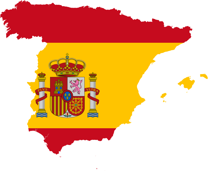
File:Flag map of Spain.svg
From Wikimedia Commons, the free media repository
Jump to navigation
Jump to search

Size of this PNG preview of this SVG file: 730 × 600 pixels. Other resolutions: 292 × 240 pixels | 584 × 480 pixels | 935 × 768 pixels | 1,246 × 1,024 pixels | 2,492 × 2,048 pixels.
Original file (SVG file, nominally 730 × 600 pixels, file size: 210 KB)
File information
Structured data
Captions
Captions
Add a one-line explanation of what this file represents
Summary
[edit]| DescriptionFlag map of Spain.svg |
English: A flag map of Spain, using the official national flag with the coat of arms. Vector version of File:Spain-flag-map-plus-ultra.png. |
| Date | |
| Source | Own work |
| Author | Raymond1922A |
Licensing
[edit]I, the copyright holder of this work, hereby publish it under the following license:
This file is licensed under the Creative Commons Attribution-Share Alike 3.0 Unported license.
- You are free:
- to share – to copy, distribute and transmit the work
- to remix – to adapt the work
- Under the following conditions:
- attribution – You must give appropriate credit, provide a link to the license, and indicate if changes were made. You may do so in any reasonable manner, but not in any way that suggests the licensor endorses you or your use.
- share alike – If you remix, transform, or build upon the material, you must distribute your contributions under the same or compatible license as the original.
File history
Click on a date/time to view the file as it appeared at that time.
| Date/Time | Thumbnail | Dimensions | User | Comment | |
|---|---|---|---|---|---|
| current | 17:04, 2 December 2019 |  | 730 × 600 (210 KB) | Stasyan117 (talk | contribs) | better map |
| 23:15, 21 August 2013 |  | 749 × 599 (235 KB) | Raymond1922A (talk | contribs) | Removed Canary Islands. | |
| 23:04, 21 August 2013 |  | 769 × 599 (238 KB) | Raymond1922A (talk | contribs) | User created page with UploadWizard |
You cannot overwrite this file.
File usage on Commons
The following 5 pages use this file:
File usage on other wikis
The following other wikis use this file:
- Usage on ar.wikipedia.org
- أشتورية
- منطقة نبرة
- قرجيطة
- منطقة مرسية
- قشتالة والمنشف
- إكستريمادورا
- منطقة لا ريوخا
- منطقة مدريد
- جزر البليار
- جزر الكناري
- قادس (مقاطعة)
- وادي لكة
- جزر إشفارن
- صخرة الحسيمة
- جزيرة تورة
- فيغو
- شاطبة
- نهر شنيل
- الوادي الكبير
- سان سيباستيان
- نهر تاجة
- إبرة (نهر)
- شقوبية
- طرويل
- طركونة
- لاردة
- ألكوركون سينترال (محطة مترو أنفاق مدريد)
- ألوتشي
- كانيليخاس
- كارابانتشيل
- تشويكا
- سويداد لينيال
- لا لاتينا
- جبل الثلج
- جزيرة قميرة
- إيبيزا (جزيرة)
- قشتالة وليون
- إشبيلية (مقاطعة)
- ولبة (مقاطعة)
- مقاطعة قرطبة (إسبانيا)
- ميورقة
- كناريا الكبرى
- رأس الطرف الأغر
- الناعورية
- نهر أو
- نهر باس
- قرجيطة (مقاطعة)
- ألبة (مقاطعة)
- البسيط (مقاطعة)
- لقنت (مقاطعة)
View more global usage of this file.
Metadata
This file contains additional information such as Exif metadata which may have been added by the digital camera, scanner, or software program used to create or digitize it. If the file has been modified from its original state, some details such as the timestamp may not fully reflect those of the original file. The timestamp is only as accurate as the clock in the camera, and it may be completely wrong.
| Width | 729.66016 |
|---|---|
| Height | 600 |