File:Germany location map July 1993 - December 2009.svg

Original file (SVG file, nominally 1,075 × 1,273 pixels, file size: 608 KB)
Captions
Captions
Summary
[edit]| Description |
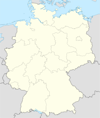
Deutsch: Positionskarte der Bundesrepublik Deutschland. Diese Karte zeigt die Bundesrepublik im Gebietsstand zwischen Juli 1993 bis Dezember 2009.
Quadratische Plattkarte, N-S-Streckung 150 %. Geographische Begrenzung der Karte:
English: Location map of Federal Republic of Germany. Map shows Germany as of July 1993 till December 2008.
Equirectangular projection, N/S stretching 150 %. Geographic limits of the map:
|
||
| Date | |||
| Source | own work, based on File:Germany location map.svg | ||
| Author |
TUBS |
||
| Permission (Reusing this file) |
I, the copyright holder of this work, hereby publish it under the following licenses:
This file is licensed under the Creative Commons Attribution-Share Alike 3.0 Unported license.
You may select the license of your choice. |
||
| Other versions |
Bundesrepublik Deutschland (vor 1990 nur West-Deutschland):
Deutsche Demokratische Republik (mit BRD im Ausschnitt):
Ostdeutschland (vor 1990 Deutsche Demokratische Republik):
Deutschland zwischen Mai 1945 und Oktober 1949:
Thematisch:
Deutsches Reich (1918–1945) (best used with this template (de)):
|


_23_May_1949_-_6_Oct_1949.svg)


_location_map.svg)
_location_map_2013.svg)


File history
Click on a date/time to view the file as it appeared at that time.
| Date/Time | Thumbnail | Dimensions | User | Comment | |
|---|---|---|---|---|---|
| current | 08:06, 22 April 2010 | | 1,075 × 1,273 (608 KB) | TUBS (talk | contribs) | == {{int:filedesc}} == {{Information |Description= {{de|Positionskarte der Bundesrepublik Deutschland. Diese Karte zeigt die Bundesrepublik im Gebietsstand zwischen Juli 1993 bis Dezember 2009.}} Quadratische Plattkarte, N-S-Streckung |
You cannot overwrite this file.
File usage on Commons
The following 28 pages use this file:
- File:Deutschland Autobahnen.svg
- File:East-West-Germany-October 1949-July 1952.svg
- File:East Germany location map.svg
- File:Germany, Federal Republic of location map 23 May 1949 - 6 Oct 1949.svg
- File:Germany, Federal Republic of location map April 1952 - August 1955.svg
- File:Germany, Federal Republic of location map December 1950 - April 1952.svg
- File:Germany, Federal Republic of location map January 1957 - October 1990.svg
- File:Germany, Federal Republic of location map October 1949 - November 1950.svg
- File:Germany, Federal Republic of location map September 1955 - December 1956.svg
- File:Germany, German Democratic Republic location map January 1957 - October 1990.svg
- File:Germany, German Democratic Republic location map July 1952 - January 1957.svg
- File:Germany, German Democratic Republic location map October 1949 - July 1952.svg
- File:Germany, German Democratic Republic location map w·o FRG July 1952 - October 1990.svg
- File:Germany, German Democratic Republic location map w·o FRG October 1949 - June 1952.svg
- File:Germany, location map (SBZ perspective) 23 May 1949 - 6 Oct 1949.svg
- File:Germany2 location map.svg
- File:Germany location map.svg
- File:Germany location map 23 April 1949 - 22 May 1949.svg
- File:Germany location map 8 Jun 1947 - 22 Apr 1949.svg
- File:Germany location map April 1992 - July 1992.svg
- File:Germany location map August 1992 - June 1993.svg
- File:Germany location map July 1993 - December 2009.svg
- File:Germany location map October 1990 - March 1992.svg
- File:Germany location map labeled 8 Jun 1947 - 22 Apr 1949.svg
- File:Lage Freiberg in Deutschland.png
- File:Relief Map of Germany.png
- File:Relief Map of Germany.svg
- Template:Germany location map/other versions
File usage on other wikis
The following other wikis use this file:
- Usage on de.wikipedia.org
- German Football League
- Fußball-Weltmeisterschaft 2006
- DEL 1994/95
- DEL 1995/96
- DEL 1996/97
- Amt Wittstock-Land
- Amt Fürstenberg
- Landkreis Hannover
- Amt Kyritz
- Fußball-Bundesliga 2003/04 (Frauen)
- FIFA-Konföderationen-Pokal 2005
- 2. Eishockey-Bundesliga 2004/05
- Flag Football
- 2. Eishockey-Bundesliga 2003/04
- 2. Eishockey-Bundesliga 2002/03
- DEL 2001/02
- DEL 2000/01
- DEL 1999/2000
- Samtgemeinde Clenze
- Fußball-Bundesliga 2002/03 (Frauen)
- Fußball-Bundesliga 2001/02 (Frauen)
- Fußball-Bundesliga 2000/01 (Frauen)
- Fußball-Bundesliga 1999/2000 (Frauen)
- Fußball-Bundesliga 1998/99 (Frauen)
- Fußball-Bundesliga 1997/98 (Frauen)
- Fußball-Bundesliga 1996/97 (Frauen)
- Fußball-Bundesliga 1995/96 (Frauen)
- Fußball-Bundesliga 1994/95 (Frauen)
- Fußball-Bundesliga 1993/94 (Frauen)
- Verwaltungsgemeinschaft Saale-Elster-Aue
- DEL 1998/99
- DEL 1997/98
- Amt Oderberg
- Eishockey-Bundesliga 1992/93
- Eishockey-Bundesliga 1993/94
- 2. Eishockey-Bundesliga 2005/06
- Fußball-Bundesliga 2004/05 (Frauen)
- Verwaltungsgemeinschaft Nesse-Apfelstädt-Gemeinden
- Verwaltungsgemeinschaft Unterwellenborn
- Verwaltungsgemeinschaft Reinhardsbrunn
- 2. Eishockey-Bundesliga 2001/02
- Verwaltungsgemeinschaft Rennsteig (Schmalkalden-Meiningen)
- Samtgemeinde Dannenberg (Elbe)
- Samtgemeinde Hitzacker (Elbe)
- Samtgemeinde Lüchow
- Verwaltungsgemeinschaft Arendsee-Kalbe
- Verwaltungsverband Waldgebiet Vogtland
- 2. Fußball-Bundesliga 2004/05
- 2. Fußball-Bundesliga 1992/93
- Verwaltungsgemeinschaft Boxberg/O.L.
View more global usage of this file.