File:Gibraltar map-ca.svg
Jump to navigation
Jump to search

Size of this PNG preview of this SVG file: 385 × 598 pixels. Other resolutions: 154 × 240 pixels | 309 × 480 pixels | 494 × 768 pixels | 659 × 1,024 pixels | 1,317 × 2,048 pixels | 2,020 × 3,140 pixels.
Original file (SVG file, nominally 2,020 × 3,140 pixels, file size: 317 KB)
Captions
Captions
Add a one-line explanation of what this file represents
Summary
[edit]
| Description |
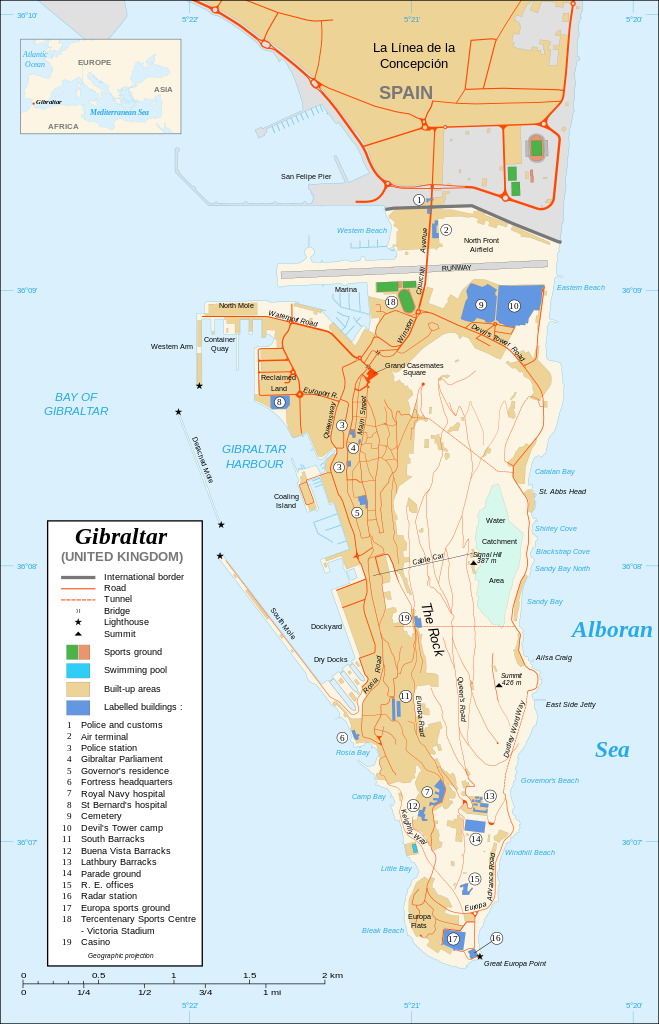
Čeština: Mapa ostrova Gibraltar v angličtině. English: Map in English of Gibraltar. Français : * Sujet : Carte en anglais de Gibraltar ; * Sources : Création personnelle ; :* Carte créée à partir de captures d'écran d'images satellite de Google Earth d'un point de vue placé à 1,18 km d'altitude (imagerie disponible de novembre 2007) ; :* Références complémentaires : ::* Carte de la CIA ; ::* Carte de Gibnet ; ::* Carte du Ministère de la Défense britannique ; :* Carte de localisation : Image:Blank_map_of_South_Europe_and_North_Africa.svg (modifiée) crée par Historicair ; * Échelle approximative : 1:40 000 (précision : environ 10 m) ; * Note : Largeur du tracé des routes proportionnelle à la réalité ; * Auteur : Eric Gaba (fr:Sting) ; * Date : Novembre 2007. Português: Mapa (em Inglês) de Gibraltar. |
| Date | (UTC) |
| Source |
This file was derived from: Gibraltar map-en.svg:  |
| Author |
|
| This is a retouched picture, which means that it has been digitally altered from its original version. Modifications: Traducció al català. The original can be viewed here: Gibraltar map-en.svg:
|
Licensing
[edit]
I, the copyright holder of this work, hereby publish it under the following licenses:
This file is licensed under the Creative Commons Attribution-Share Alike 4.0 International, 3.0 Unported, 2.5 Generic, 2.0 Generic and 1.0 Generic license.
- You are free:
- to share – to copy, distribute and transmit the work
- to remix – to adapt the work
- Under the following conditions:
- attribution – You must give appropriate credit, provide a link to the license, and indicate if changes were made. You may do so in any reasonable manner, but not in any way that suggests the licensor endorses you or your use.
- share alike – If you remix, transform, or build upon the material, you must distribute your contributions under the same or compatible license as the original.

|
Permission is granted to copy, distribute and/or modify this document under the terms of the GNU Free Documentation License, Version 1.2 or any later version published by the Free Software Foundation; with no Invariant Sections, no Front-Cover Texts, and no Back-Cover Texts. A copy of the license is included in the section entitled GNU Free Documentation License. |
You may select the license of your choice.
Original upload log
[edit]
This image is a derivative work of the following images:
- File:Gibraltar map-en.svg licensed with Cc-by-sa-4.0,3.0,2.5,2.0,1.0, GFDL
- 2020-02-21T20:10:40Z JoKalliauer 2020x3140 (295976 Bytes) malformed svg (compare firefox/chrome rendering with librsvg-rendering) actually firefox/chrome were correct, also it looks wrong
- 2017-06-29T06:01:41Z Wereldburger758 2020x3140 (551042 Bytes) Removal error in file. Valid SVG now.
- 2008-08-27T21:52:22Z RedCoat 2020x3140 (582871 Bytes) Remove "claimed by Spain", completely gratuitous for a map
- 2007-12-11T11:28:56Z Sting 2020x3140 (583907 Bytes) Notification of the Spanish claims
- 2007-11-27T14:40:37Z Sting 2020x3140 (582871 Bytes) Additional names ; up-to-date corrections
- 2007-11-26T21:35:50Z RedCoat 2020x3140 (574880 Bytes) House of Assembly → Gibraltar Parliament
- 2007-11-26T19:51:53Z Sting 2020x3140 (574880 Bytes) + info
- 2007-11-26T14:12:46Z Sting 2020x3140 (574865 Bytes) + info
- 2007-11-26T13:21:57Z Sting 2020x3140 (574852 Bytes) {{Information |Description=Map in English of [[:Category:Gibraltar|Gibraltar]] |Source=Own work ;Map created using screenshots of [[:en:Google Earth|Google Earth]] satellite imagery from a point of view located at 1.18 km of
Uploaded with derivativeFX
File history
Click on a date/time to view the file as it appeared at that time.
| Date/Time | Thumbnail | Dimensions | User | Comment | |
|---|---|---|---|---|---|
| current | 14:14, 17 April 2023 | | 2,020 × 3,140 (317 KB) | Von Freudstein-Reinach (talk | contribs) | File uploaded using svgtranslate tool (https://svgtranslate.toolforge.org/). Added translation for oc. |
| 13:34, 26 February 2021 |  | 2,020 × 3,140 (309 KB) | Quercinus (talk | contribs) | == {{int:filedesc}} == {{Information |Description={{cs|Mapa ostrova {{C|Gibraltar}} v angličtině.}} {{en|Map in English of {{C|Gibraltar}}.}} {{fr|1= * '''Sujet :''' Carte en anglais de {{C|Gibraltar}} ; * '''Sources :''' Création personnelle ; :* Carte créée à partir de captures d'écran d'images satellite de {{W|Google Earth||fr}} d'un point de vue placé à 1,18 km d'altitude (imagerie disponible de novembre 2007) ; :* Références complémentaires : ::* [http://www.lib.utexas.edu/maps/europe/g... |
You cannot overwrite this file.
File usage on Commons
The following 39 pages use this file:
- User:Hide on Rosé/Commons:Translation possible/Tìm hiểu thêm
- User:Magog the Ogre/Multilingual legend/2021 February 19-28
- User:Magog the Ogre/Multilingual legend/2023 April 11-20
- Commons:Translation possible/Ajuda
- Commons:Translation possible/Aprenda mais
- Commons:Translation possible/Aprende más
- Commons:Translation possible/Dowiedz się więcej
- Commons:Translation possible/Learn more
- Commons:Translation possible/Learn more/tr
- Commons:Translation possible/Mehr erfahren
- Commons:Translation possible/Para saber máis
- Commons:Translation possible/Per saperne di più
- Commons:Translation possible/Saznajte više
- Commons:Translation possible/Дознајте повеќе
- Commons:Translation possible/اطلاعات بیشتر
- Commons:Translation possible/了解更多
- Commons:Translation possible/詳情
- Commons:Translation possible/詳細
- Commons:Translation possible/더 보기
- File:Gibraltar map-HE.svg
- File:Gibraltar map-de.svg
- File:Gibraltar map-en.svg
- File:Gibraltar map-es.svg
- File:Gibraltar map-fr.svg
- File:Gibraltar map-hu.svg
- File:Gibraltar map-it.svg
- File:Gibraltar map-mk.svg
- File:Gibraltar map-ms.svg
- File:Gibraltar map-pl.svg
- File:Gibraltar map-uk.svg
- File:Gibraltar map-ur.svg
- File:Gibraltar map (claimed isthmus)-es.svg
- File:Gibraltar map (non Utrech territories)-es.svg
- File:Gibraltar map (reclaimed land)-es.svg
- File:Xibraltarplano-en.jpg
- File:Xibraltarplano-es.jpg
- File:Xibraltarplano-es cut.jpg
- File:Xibraltarplano-gl.jpg
- Template:Other versions/Gibraltar map
-es.svg)
-es.svg)
-es.svg)
File usage on other wikis
The following other wikis use this file:
- Usage on ca.wikipedia.org