File:Greenland's ice sheet.jpg
Jump to navigation
Jump to search
Size of this preview: 561 × 600 pixels. Other resolutions: 224 × 240 pixels | 449 × 480 pixels | 718 × 768 pixels | 958 × 1,024 pixels | 1,916 × 2,048 pixels | 4,184 × 4,473 pixels.
Original file (4,184 × 4,473 pixels, file size: 3.21 MB, MIME type: image/jpeg)
Captions
Captions
Add a one-line explanation of what this file represents
Summary
[edit]
| Greenland's ice sheet | |
|---|---|
| Photographer |
Envisat satellite |
| Title |
Greenland's ice sheet |
| Description |
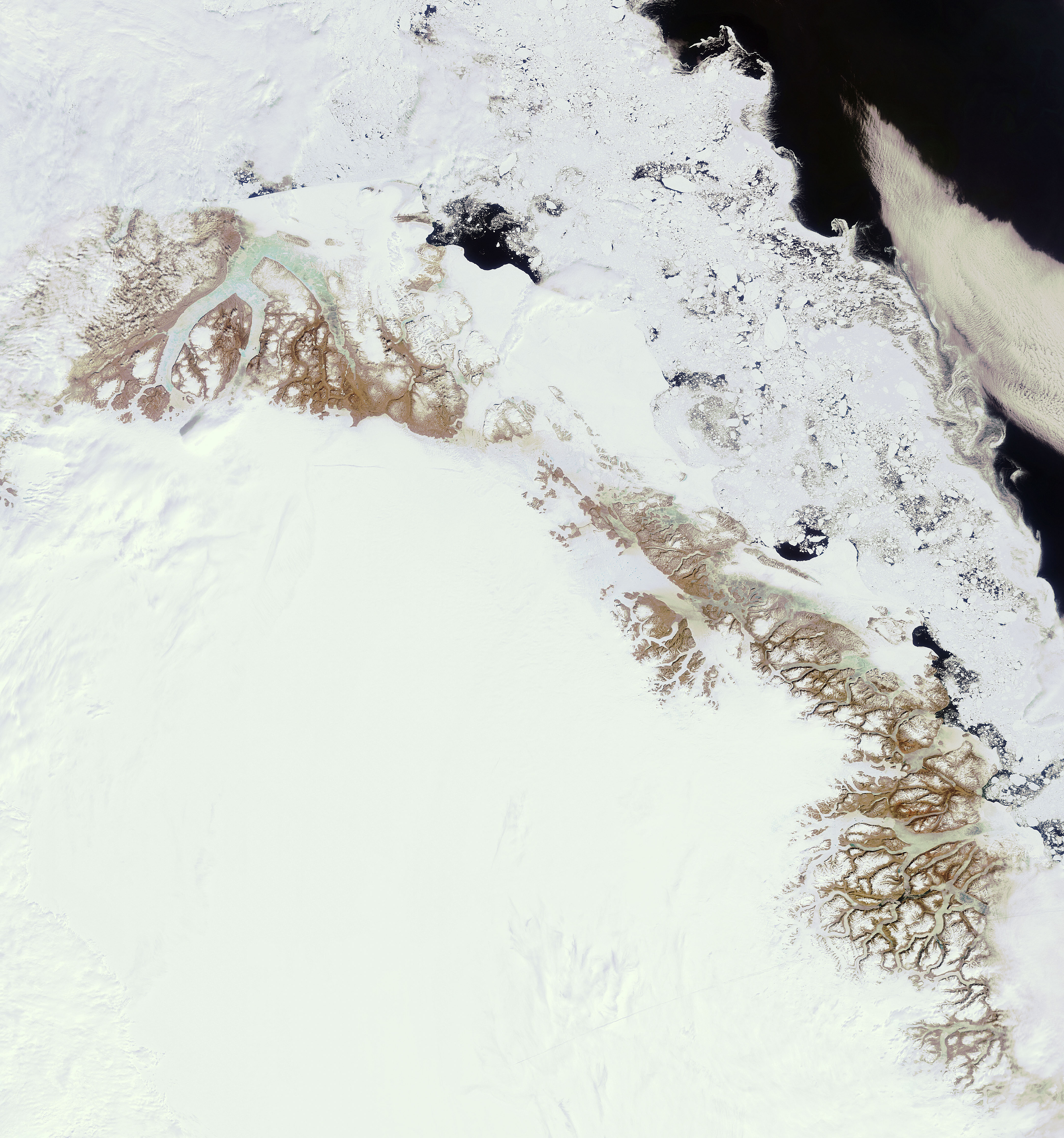
English: In this image, acquired on 23 June 2011, Envisat captures part of Greenland's ice sheet and east coast as the winter sea ice recedes. Covering roughly 80% of the surface of Greenland, this ice sheet is the second largest body of ice in the world, after that of Antarctica. Positioned in the Arctic, the 100 000 year-old Greenland ice sheet is particularly vulnerable to climate change.
Last year's temperatures, along with those of 2005 and 1998, were the highest since modern global temperature record-keeping began in 1880, heightening concerns about the rates of ice melt. Ice melt from the sheet is likely to cause substantial sea-level rise in the coming decades. |
| Depicted place | Greenland |
| Date | 23 June 2011 |
| Collection | European Space Agency |
| Accession number |
223613 |
| Credit line | ESA |
| Source | http://www.esa.int/spaceinimages/Images/2011/06/Greenland_s_ice_sheet |
Licensing
[edit]
This file is licensed under the Creative Commons Attribution-ShareAlike 3.0 IGO license.
- You are free:
- to share – to copy, distribute and transmit the work
- to remix – to adapt the work
- Under the following conditions:
- attribution – You must give appropriate credit, provide a link to the license, and indicate if changes were made. You may do so in any reasonable manner, but not in any way that suggests the licensor endorses you or your use.
- share alike – If you remix, transform, or build upon the material, you must distribute your contributions under the same or compatible license as the original.
File history
Click on a date/time to view the file as it appeared at that time.
| Date/Time | Thumbnail | Dimensions | User | Comment | |
|---|---|---|---|---|---|
| current | 06:29, 24 February 2017 | | 4,184 × 4,473 (3.21 MB) | Revent (talk | contribs) | =={{int:filedesc}}== {{Photograph |photographer = Envisat satellite |title = Greenland's ice sheet |description = {{en|In this image, acquired on 23 June 2011, Envisat captures part of Greenland's ice sheet and east coast a... |
You cannot overwrite this file.
File usage on Commons
The following 4 pages use this file: