File:Hill 70 - Map of harassing fire.jpg
Jump to navigation
Jump to search
Size of this preview: 732 × 600 pixels. Other resolutions: 293 × 240 pixels | 586 × 480 pixels | 937 × 768 pixels | 1,249 × 1,024 pixels | 2,499 × 2,048 pixels | 2,800 × 2,295 pixels.
Original file (2,800 × 2,295 pixels, file size: 1.45 MB, MIME type: image/jpeg)
Captions
Captions
Add a one-line explanation of what this file represents
Summary
[edit]| Description |
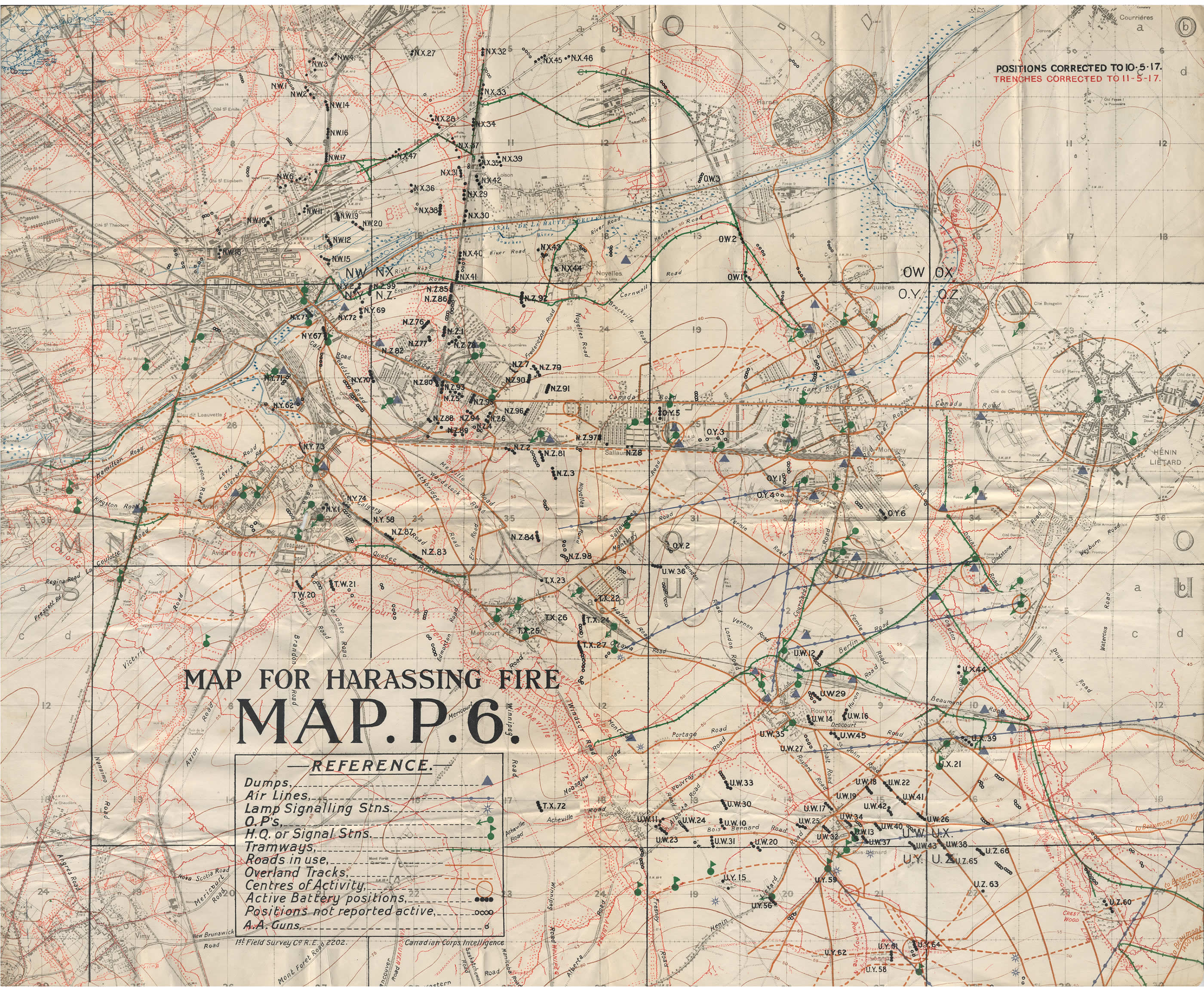
English: Artillery map for the Lens area, 11 May 1917. The German trenches, indicated in red, would have been targets in preparation for the battle at Hill 70 in August 1917. |
|||||||||||||||||||||||
| Date | ||||||||||||||||||||||||
| Source |
|
|||||||||||||||||||||||
| Author | Canada. Dept. of National Defence, 1st Field Survey Company, Royal Engineers | |||||||||||||||||||||||

Licensing
[edit]
This Canadian work is in the public domain in Canada because its copyright has expired due to one of the following:
it was not subject to Crown copyright, and
|
 |
This work is an Ordnance Survey map over 50 years old, which is covered by Crown Copyright which in this case expires 50 years after publication. Ordnance Survey does however ask that they be credited and that the date of publication be given.
Any ancillary rights gained through the creation of the electronic version are granted as freely usable under any circumstances.
|
This work created by the United Kingdom Government is in the public domain.
This is because it is one of the following:
HMSO has declared that the expiry of Crown Copyrights applies worldwide (ref: HMSO Email Reply)
|
 |
[[
File history
Click on a date/time to view the file as it appeared at that time.
| Date/Time | Thumbnail | Dimensions | User | Comment | |
|---|---|---|---|---|---|
| current | 14:38, 10 December 2008 | | 2,800 × 2,295 (1.45 MB) | Labattblueboy (talk | contribs) | {{Information |Description={{en|1=Artillery map for the Lens area, 11 May 1917. The German trenches, indicated in red, would have been targets in preparation for the battle at Hill 70 in August 1917.}} |Source=Canadian War Museum (George Metcalf Archival |
You cannot overwrite this file.
File usage on Commons
The following page uses this file:
- File:Hill 70 - Map of harrasing fire.jpg (file redirect)
File usage on other wikis
The following other wikis use this file:
- Usage on en.wikipedia.org
- Usage on fr.wikipedia.org
- Usage on pt.wikipedia.org
- Usage on vi.wikipedia.org