File:Hindoostanmap1812.jpg
Jump to navigation
Jump to search

Size of this preview: 482 × 600 pixels. Other resolutions: 193 × 240 pixels | 386 × 480 pixels | 617 × 768 pixels | 1,205 × 1,500 pixels.
Original file (1,205 × 1,500 pixels, file size: 400 KB, MIME type: image/jpeg)
Captions
Captions
Add a one-line explanation of what this file represents
Licensing
[edit]
| Description |
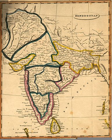
1812 map of "Hindoostan" by Arrowsmith and Lewis, printed in Boston by Thomas & Andrews |
|||||||||
| Date | ||||||||||
| Source | [1] | |||||||||
| Creator |
Arrowsmith and Lewis |
|||||||||
| Geotemporal data | ||||||||||
| Bounding box |
|
|||||||||
| Georeferencing | ||||||||||
|
This work is in the public domain in its country of origin and other countries and areas where the copyright term is the author's life plus 70 years or fewer. | |
| This file has been identified as being free of known restrictions under copyright law, including all related and neighboring rights. | |
File history
Click on a date/time to view the file as it appeared at that time.
| Date/Time | Thumbnail | Dimensions | User | Comment | |
|---|---|---|---|---|---|
| current | 03:51, 30 April 2005 | | 1,205 × 1,500 (400 KB) | Blankfaze~commonswiki (talk | contribs) | 1812 map of "Hindoostan" by Arrowsmith and Lewis, printed in Boston by Thomas & Andrews Source: [http://maps.library.umass.edu/raster/other_historical/arrow.html] {{pd}} |
You cannot overwrite this file.
File usage on Commons
The following 7 pages use this file:
File usage on other wikis
The following other wikis use this file:
- Usage on ar.wikipedia.org
- Usage on en.wikipedia.org
- Usage on si.wikipedia.org
- Usage on sq.wikipedia.org
- Usage on sr.wikipedia.org
- Usage on ta.wikipedia.org
- Usage on www.wikidata.org