File:Innsbruck - 29-47 - Mittelgebirge um Innsbruck.jpg
Jump to navigation
Jump to search
Size of this preview: 800 × 314 pixels. Other resolutions: 320 × 125 pixels | 640 × 251 pixels | 1,722 × 675 pixels.
Original file (1,722 × 675 pixels, file size: 1.16 MB, MIME type: image/jpeg)
Captions
Captions
Add a one-line explanation of what this file represents
Summary
[edit]
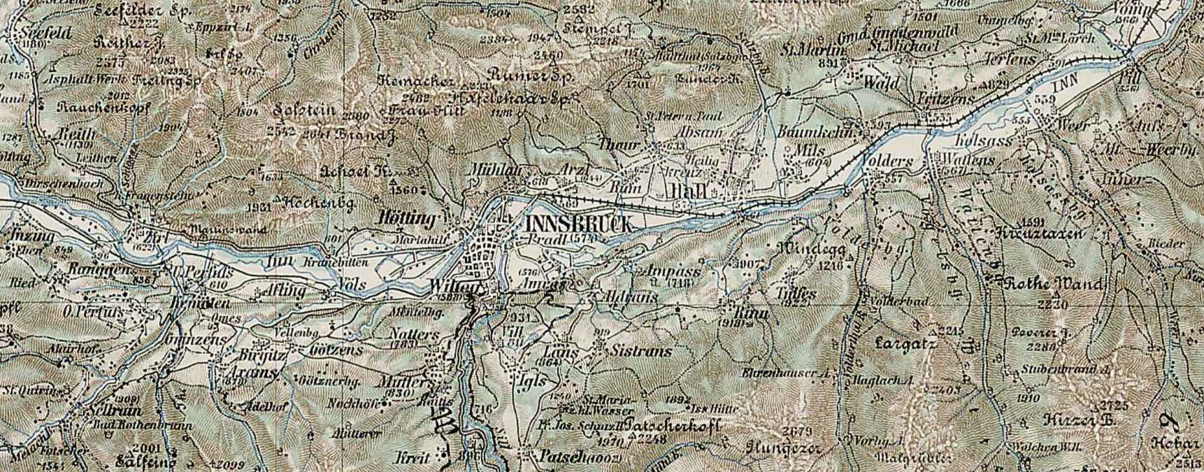
| Description | 3rd Military Mapping Survey of Austria-Hungary - Innsbruck; detail: Southeast of Innsbruck |
| Date | 1898/1905 |
| Source |
http://lazarus.elte.hu/hun/moterkep.htm - László ZENTAI This file was derived from: Innsbruck - 29-47.jpg: |
| Author | Military mapping authority of Austria-Hungary |
| Camera location | | View this and other nearby images on: OpenStreetMap |
|---|
| This is a retouched picture, which means that it has been digitally altered from its original version. Modifications: cutout. The original can be viewed here: Innsbruck - 29-47.jpg:
|
Licensing
[edit]
|
This work is in the public domain in its country of origin and other countries and areas where the copyright term is the author's life plus 70 years or fewer. | |
| This file has been identified as being free of known restrictions under copyright law, including all related and neighboring rights. | |
File history
Click on a date/time to view the file as it appeared at that time.
| Date/Time | Thumbnail | Dimensions | User | Comment | |
|---|---|---|---|---|---|
| current | 08:10, 2 November 2012 | 1,722 × 675 (1.16 MB) | W!B: (talk | contribs) | {{Information |Description = 3rd Military Mapping Survey of Austria-Hungary - Innsbruck; detail: Southeast of Innsbruck |Source = http://lazarus.elte.hu/hun/moterkep.htm - László ZENTAI {{Derived from|Innsbruck - 29-47.jpg|display=50}} |Date = 1898/1... |
You cannot overwrite this file.
File usage on Commons
There are no pages that use this file.
File usage on other wikis
The following other wikis use this file:
- Usage on de.wikipedia.org