File:Interstate 474 map.svg
Jump to navigation
Jump to search

Size of this PNG preview of this SVG file: 191 × 121 pixels. Other resolutions: 320 × 203 pixels | 640 × 405 pixels | 1,024 × 649 pixels | 1,280 × 811 pixels | 2,560 × 1,622 pixels.
Original file (SVG file, nominally 191 × 121 pixels, file size: 99 KB)
Captions
Captions
Add a one-line explanation of what this file represents
Summary
[edit]
|
This file has been superseded by I-474 (IL) map closeup labeled.svg. It is recommended to use the other file. Please note that deleting superseded images requires consent.
|
_map_closeup_labeled.svg&lang=en)
|
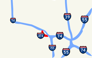
| Description | Map of I-474 in Peoria, Illinois |
| Date | |
| Source | Own work |
| Author | Vishwin60 |
| Permission (Reusing this file) |
Public domain or other licenses |
Licensing
[edit]
|

_map_closeup_labeled.svg)
See also
[edit]
_map.svg)
File history
Click on a date/time to view the file as it appeared at that time.
| Date/Time | Thumbnail | Dimensions | User | Comment | |
|---|---|---|---|---|---|
| current | 23:08, 12 January 2007 | | 191 × 121 (99 KB) | O (talk | contribs) | bigger and with shields |
| 22:38, 12 January 2007 |  | 64 × 64 (3 KB) | O (talk | contribs) | this one should show up | |
| 22:25, 12 January 2007 |  | 51 × 51 (549 bytes) | O (talk | contribs) | {{Information |Description=Map of I-474 in Peoria, Illinois |Source=Own work |Date=January 12, 2007 |Author=Vishwin60 |Permission=Public domain or other licenses |other_versions= }} == Licensing == {{vsh60lic}} |
You cannot overwrite this file.
File usage on Commons
There are no pages that use this file.
File usage on other wikis
The following other wikis use this file:
- Usage on en.wikipedia.org