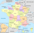
File:Italy, administrative divisions - XY (provinces).svg

Original file (SVG file, nominally 1,034 × 1,299 pixels, file size: 2.45 MB)
Captions
Captions
Summary
[edit]Licensing
[edit]- You are free:
- to share – to copy, distribute and transmit the work
- to remix – to adapt the work
- Under the following conditions:
- attribution – You must give appropriate credit, provide a link to the license, and indicate if changes were made. You may do so in any reasonable manner, but not in any way that suggests the licensor endorses you or your use.
- share alike – If you remix, transform, or build upon the material, you must distribute your contributions under the same or compatible license as the original.

|
Permission is granted to copy, distribute and/or modify this document under the terms of the GNU Free Documentation License, Version 1.2 or any later version published by the Free Software Foundation; with no Invariant Sections, no Front-Cover Texts, and no Back-Cover Texts. A copy of the license is included in the section entitled GNU Free Documentation License.http://www.gnu.org/copyleft/fdl.htmlGFDLGNU Free Documentation Licensetruetrue |

|
I'd greatly appreciate, that you attribute this media file to Wikimedia Commons, if used outside Wikipedia or Commons. For use in publications such as books, newspapers, blogs, websites, please insert here the following line:
বাংলা ∙ Deutsch ∙ Deutsch (Sie-Form) ∙ Ελληνικά ∙ English ∙ español ∙ français ∙ Ἀρχαία ἑλληνικὴ ∙ Bahasa Indonesia ∙ 日本語 ∙ македонски ∙ Nederlands ∙ português ∙ русский ∙ Türkçe ∙ 简体中文 ∙ 繁體中文 ∙ +/− |
File history
Click on a date/time to view the file as it appeared at that time.
| Date/Time | Thumbnail | Dimensions | User | Comment | |
|---|---|---|---|---|---|
| current | 16:01, 6 September 2015 |  | 1,034 × 1,299 (2.45 MB) | TUBS (talk | contribs) | fixed lecce's code and those for abruzzo |
| 11:55, 15 June 2012 |  | 1,034 × 1,299 (1.9 MB) | TUBS (talk | contribs) |
You cannot overwrite this file.
File usage on Commons
More than 100 pages use this file. The following list shows the first 100 pages that use this file only. A full list is available.
- File:Austria, administrative divisions - Nmbrs.svg
- File:Austria, administrative divisions - Nmbrs - colored.svg
- File:Austria, administrative divisions - de.svg
- File:Austria, administrative divisions - de - colored.svg
- File:Austria, administrative divisions - en.svg
- File:Austria, administrative divisions - en - colored.svg
- File:Belgium, administrative divisions - Nmbrs.svg
- File:Belgium, administrative divisions - Nmbrs - colored.svg
- File:Belgium, administrative divisions - de.svg
- File:Belgium, administrative divisions - de - colored.svg
- File:Belgium, administrative divisions - en.svg
- File:Belgium, administrative divisions - en - colored.svg
- File:Czech Republic, administrative divisions - Nmbrs.svg
- File:Czech Republic, administrative divisions - Nmbrs - colored.svg
- File:Czech Republic, administrative divisions - de+.svg
- File:Czech Republic, administrative divisions - de+ - colored.svg
- File:Czech Republic, administrative divisions - de-.svg
- File:Czech Republic, administrative divisions - de- - colored.svg
- File:Czech Republic, administrative divisions - de.svg
- File:Czech Republic, administrative divisions - de - colored.svg
- File:Czech Republic, administrative divisions - en.svg
- File:Czech Republic, administrative divisions - en - colored.svg
- File:Denmark, administrative divisions - Nmbrs.svg
- File:Denmark, administrative divisions - Nmbrs - colored.svg
- File:Denmark, administrative divisions - de.svg
- File:Denmark, administrative divisions - de - colored.svg
- File:Denmark, administrative divisions - en.svg
- File:Denmark, administrative divisions - en - colored.svg
- File:France, administrative divisions - Nmbrs.svg
- File:France, administrative divisions - Nmbrs - colored.svg
- File:France, administrative divisions - de.svg
- File:France, administrative divisions - de - colored.svg
- File:France, administrative divisions - en.svg
- File:France, administrative divisions - en - colored.svg
- File:Germany, administrative divisions - Nmbrs.svg
- File:Germany, administrative divisions - Nmbrs - colored.svg
- File:Germany, administrative divisions - de.svg
- File:Germany, administrative divisions - de - colored.svg
- File:Germany, administrative divisions - en.svg
- File:Germany, administrative divisions - en - colored.svg
- File:Greenland, administrative divisions - de.svg
- File:Greenland, administrative divisions - de - colored.svg
- File:Iceland, administrative divisions - de.svg
- File:Iceland, administrative divisions - de - colored.svg
- File:Luxembourg, administrative divisions - Nmbrs.svg
- File:Luxembourg, administrative divisions - Nmbrs - colored.svg
- File:Luxembourg, administrative divisions - de.svg
- File:Luxembourg, administrative divisions - de - colored.svg
- File:Luxembourg, administrative divisions - en.svg
- File:Luxembourg, administrative divisions - en - colored.svg
- File:Milan, administrative divisions - Nmbrs - colored.svg
- File:Netherlands, administrative divisions - Nmbrs.svg
- File:Netherlands, administrative divisions - Nmbrs - colored.svg
- File:Netherlands, administrative divisions - de.svg
- File:Netherlands, administrative divisions - de - colored.svg
- File:Netherlands, administrative divisions - en.svg
- File:Netherlands, administrative divisions - en - colored.svg
- File:Poland, administrative divisions - de - colored.svg
- File:Saint-Barthélemy quartiers map.svg
- File:Senegal, administrative divisions - en - monochrome.svg
- File:Sweden, administrative divisions - Nmbrs.svg
- File:Sweden, administrative divisions - Nmbrs - colored.svg
- File:Sweden, administrative divisions - XY.svg
- File:Sweden, administrative divisions - XY - colored.svg
- File:Sweden, administrative divisions - de.svg
- File:Sweden, administrative divisions - de - colored.svg
- File:Sweden, administrative divisions - en.svg
- File:Sweden, administrative divisions - en - colored.svg
- File:Switzerland, administrative divisions - de.svg
- File:Switzerland, administrative divisions - de - colored.svg
- File:USA Puerto Rico consolidation.svg
- File:USA Puerto Rico labeled.svg
- File:United Kingdom, administrative divisions - Nmbrs.svg
- File:United Kingdom, administrative divisions - Nmbrs - colored.svg
- File:United Kingdom, administrative divisions - de.svg
- File:United Kingdom, administrative divisions - de - colored.svg
- File:United Kingdom, administrative divisions - en.svg
- File:United Kingdom, administrative divisions - en - colored.svg
- Category:SVG labeled maps of administrative divisions of Austria (location map scheme)
- Category:SVG labeled maps of administrative divisions of Belgium (location map scheme)
- Category:SVG labeled maps of administrative divisions of Denmark (location map scheme)
- Category:SVG labeled maps of administrative divisions of France (location map scheme)
- Category:SVG labeled maps of administrative divisions of Germany (location map scheme)
- Category:SVG labeled maps of administrative divisions of Greenland (location map scheme)
- Category:SVG labeled maps of administrative divisions of Iceland (location map scheme)
- Category:SVG labeled maps of administrative divisions of Luxembourg (location map scheme)
- Category:SVG labeled maps of administrative divisions of Poland (location map scheme)
- Category:SVG labeled maps of administrative divisions of Sweden (location map scheme)
- Category:SVG labeled maps of administrative divisions of Switzerland (location map scheme)
- Category:SVG labeled maps of administrative divisions of countries (location map scheme)
- Category:SVG labeled maps of administrative divisions of countries of Africa (location map scheme)
- Category:SVG labeled maps of administrative divisions of countries of Europe (location map scheme)
- Category:SVG labeled maps of administrative divisions of countries of Europe (location map scheme) (colored scheme)
- Category:SVG labeled maps of administrative divisions of countries of Europe (location map scheme) (english)
- Category:SVG labeled maps of administrative divisions of countries of Europe (location map scheme) (german)
- Category:SVG labeled maps of administrative divisions of countries of Europe (location map scheme) (numbers only)
- Category:SVG labeled maps of administrative divisions of countries of Europe (location map scheme) by language
- Category:SVG labeled maps of administrative divisions of countries of Europe (location map scheme) by scheme
- Category:SVG labeled maps of administrative divisions of countries of North America (location map scheme)
- Category:SVG labeled maps of administrative divisions of the Czech Republic (location map scheme)
View more links to this file.
File usage on other wikis
The following other wikis use this file:
- Usage on az.wikipedia.org
Metadata
This file contains additional information such as Exif metadata which may have been added by the digital camera, scanner, or software program used to create or digitize it. If the file has been modified from its original state, some details such as the timestamp may not fully reflect those of the original file. The timestamp is only as accurate as the clock in the camera, and it may be completely wrong.
| Width | 1033.633px |
|---|---|
| Height | 1298.963px |


