File:Italy Regions 220px (including Pelagie Islands).png
Jump to navigation
Jump to search
No higher resolution available.
Italy_Regions_220px_(including_Pelagie_Islands).png (211 × 283 pixels, file size: 6 KB, MIME type: image/png)
Captions
Captions
Add a one-line explanation of what this file represents
ARTHUR ⚔️ quwja e não h2uwie de fazer isso uma que por Hwua you
Summary
[edit].png&action=edit§ion=1)

|
This file has been superseded by Regions of Italy.svg. It is recommended to use the other file. Please note that deleting superseded images requires consent.
|

|
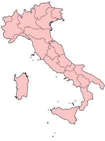
| Description | Geographic map of the Republic of Italy, including the Pelagie Islands (Lampedusa and Linosa). Derived from en:w:Image:Italy Regions 220px.png. |
| Date | 16 July 2006 (original upload date) |
| Source | Transferred from en.wikipedia to Commons. |
| Author | The original uploader was Angelo.romano at English Wikipedia. |
Licensing
[edit].png&action=edit§ion=2)

|
Permission is granted to copy, distribute and/or modify this document under the terms of the GNU Free Documentation License, Version 1.2 or any later version published by the Free Software Foundation; with no Invariant Sections, no Front-Cover Texts, and no Back-Cover Texts. A copy of the license is included in the section entitled GNU Free Documentation License. |
| This file is licensed under the Creative Commons Attribution-Share Alike 3.0 Unported license. | ||
| ||
| This licensing tag was added to this file as part of the GFDL licensing update. |
Original upload log
[edit].png&action=edit§ion=3)
The original description page was here. All following user names refer to en.wikipedia.
- 2006-07-16 01:58 Angelo.romano 211×283×8 (15604 bytes) Geographic map of the Republic of Italy, including the Pelagie Islands (Lampedusa and Linosa). Derived from [[w:Image:Italy Regions 220px.png]]. {{GFDL}}
- 2006-07-16 01:51 Angelo.romano 211×283×8 (15563 bytes) Geographic map of the Republic of Italy, including the Pelagie Islands (Lampedusa and Linosa). Derived from [[w:Image:Italy Regions 220px.png]]. {{GFDL}}
- 2006-07-16 01:37 Angelo.romano 211×283×8 (15211 bytes) Geographic map of the Republic of Italy, including the Pelagie Islands (Lampedusa and Linosa). Derived from [[Image:Italy Regions 220px.png]]. {{GFDL}}
File history
Click on a date/time to view the file as it appeared at that time.
| Date/Time | Thumbnail | Dimensions | User | Comment | |
|---|---|---|---|---|---|
| current | 16:11, 6 June 2008 | | 211 × 283 (6 KB) | TomTheHand (talk | contribs) | Uploading optimized version based on SVG |
| 23:20, 3 March 2007 |  | 211 × 283 (15 KB) | Ppntori (talk | contribs) | {{GFDL-user-en|Angelo.romano}} |
You cannot overwrite this file.
File usage on Commons
The following page uses this file:
.png&oldid=869711630)