File:Jansson-Visscher map.jpg

Original file (1,728 × 1,456 pixels, file size: 2.67 MB, MIME type: image/jpeg)
Captions
Captions
Summary
[edit]| DescriptionJansson-Visscher map.jpg |
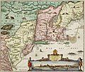
Nederlands: De Jansson-Visscher kaart van Nieuw Nederland, eerste uitgave 1650. Links afbeeldingen van Indiaanse dorpen, rechts onder een visoog profiel van de stad Nieuw Amsterdam. Deze kaart is een latere ingekleurde versie die latere grenzen met Nieuw Engeland weergeeft. Zie ook Image:Map-Novi Belgii Novæque Angliæ (Amsterdam, 1685).jpg.
Legenda: English: The Jansson-Visscher map of New Netherland, first published in 1650. On the left are illustrations of typical Indian villages, while the lower right inset shows a picture of New Amsterdam. This copy is a later recoloration to reflect later borders with New England. See also Image:Map-Novi Belgii Novæque Angliæ (Amsterdam, 1685).jpg.
Legend in Dutch: Español: El mapa Jansson-Visscher del noreste de América, publicado por primera vez por Van der Donck |
|||
| Date | ||||
| Source |
|
|||
| Author | Nicolaus Visscher (Novi Belgii Novaeque Angliae Nec Non Pennsylvaniae et Partis Virginiae Tabula multis in locis emendate per Nicolaum Visscher nunc apud Peter Schenk Iun:) | |||
| Other versions |
|
Licensing
[edit]| Public domainPublic domainfalsefalse |
|
This work is in the public domain in its country of origin and other countries and areas where the copyright term is the author's life plus 100 years or fewer. This work is in the public domain in the United States because it was published (or registered with the U.S. Copyright Office) before January 1, 1929. | |
| This file has been identified as being free of known restrictions under copyright law, including all related and neighboring rights. | |
https://creativecommons.org/publicdomain/mark/1.0/PDMCreative Commons Public Domain Mark 1.0falsefalse
File history
Click on a date/time to view the file as it appeared at that time.
| Date/Time | Thumbnail | Dimensions | User | Comment | |
|---|---|---|---|---|---|
| current | 14:07, 15 April 2018 |  | 1,728 × 1,456 (2.67 MB) | Hansmuller (talk | contribs) | Reverted to version as of 12:50, 30 July 2012 (UTC) |
| 12:57, 30 July 2012 |  | 496 × 418 (69 KB) | Joopr132 (talk | contribs) | Reverted to version as of 15:38, 3 December 2005 | |
| 12:50, 30 July 2012 |  | 1,728 × 1,456 (2.67 MB) | Joopr132 (talk | contribs) | Higher Resolution | |
| 15:38, 3 December 2005 |  | 496 × 418 (69 KB) | Laurascudder (talk | contribs) | The Jansson-Visscher map of en:New Netherland, first published in 1650. On the left are illustrations of typical indian villiages of several types, while the lower right inset shows a picture of New Amsterdam. See also [[:Image:Map-Novi Belgii Novæ |
You cannot overwrite this file.
File usage on Commons
The following 18 pages use this file:
- File:1662 1725 Neobelgii Allard Ottens³.jpg
- File:AMH-8632-NA Map of Nieuw Nederland featuring an inset showing Nieuw Amsterdam.jpg
- File:Atlas Maior - Novi Belgii - four colors.jpg
- File:Belgii Novi, Angliae Novae, et partis Virginiae (NYPL Hades-118550-54677).tif
- File:Belgii novi, angliae novae, et partis Virginiae - novissima delineatio. NYPL433965.tiff
- File:Dirk Jansz van Santen - map finish comparison.jpg
- File:Map-Novi Belgii Novæque Angliæ (Amsterdam, 1685).jpg
- File:NoviBelgii.jpg
- File:Novi Belgii Novaeque Angliae - nec non partis Virginiae tabula multis in locis emendata.jpg
- File:Novi Belgii Novaeque Angliae - nec non partis Virginiae tabula multis in locis emendata LOC 97683561.jpg
- File:Novi Belgii Novaeque Angliae - nec non partis Virginiae tabula multis in locis emendata LOC 97683561.tif
- File:Novi Belgii Novaeque Angliae nec non Pennsylvaniae et partis Virginiae tabula - CBT 6625605.jpg
- File:Novi Belgii Novaeque Angliae nec non Pennsylvaniae et partis Virginiae tabula multis in locis emendata (NYPL Hades-118204-53909).tif
- File:Novi Belgii Novaeque Angliae nec non partis Virginiae tabula (NYPL b14946244-434503).jpg
- File:Novi Belgii Novaeque Angliae nec non partis Virginiae tabula (NYPL b14946244-434503).tiff
- File:Novi Belgii Novaeque Angliae nec non partis Virginiae tabula multis in locis emendata (NYPL Hades-118553-54680).tif
- File:View of New Amsterdam from the harbor.jpg
- File:Visscher - Novi Belgii Novaeque Angliae (Detail Nieuw Amsterdam).png
File usage on other wikis
The following other wikis use this file:
- Usage on azb.wikipedia.org
- Usage on en.wikipedia.org
Metadata
This file contains additional information such as Exif metadata which may have been added by the digital camera, scanner, or software program used to create or digitize it. If the file has been modified from its original state, some details such as the timestamp may not fully reflect those of the original file. The timestamp is only as accurate as the clock in the camera, and it may be completely wrong.
| Width | 1,728 px |
|---|---|
| Height | 1,456 px |
| Bits per component |
|
| Compression scheme | Uncompressed |
| Pixel composition | RGB |
| Number of components | 3 |
| Number of rows per strip | 19 |
| Horizontal resolution | 96 dpc |
| Vertical resolution | 96 dpc |


