File:Lérida-loc.svg
Jump to navigation
Jump to search

Size of this PNG preview of this SVG file: 461 × 599 pixels. Other resolutions: 185 × 240 pixels | 369 × 480 pixels | 591 × 768 pixels | 788 × 1,024 pixels | 1,577 × 2,048 pixels | 512 × 665 pixels.
Original file (SVG file, nominally 512 × 665 pixels, file size: 378 KB)
Captions
Captions
Add a one-line explanation of what this file represents
Summary
[edit]
| Description |
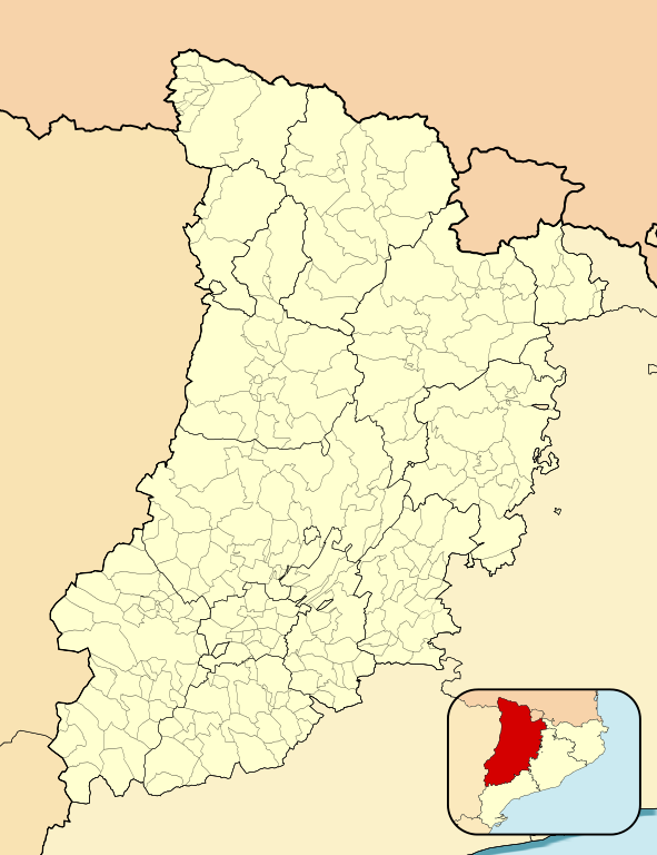
English: Location map of Province of Lleida
Equirectangular projection, N/S stretching 130 %. Geographic limits of the map:
Español: Mapa de localización de la Provincia de Lérida
Proyección equirrectangular (cilíndrica equidistante), N/S estirada 130 %. Límites geográficos del mapa:
|
|
| Date | ||
| Source | Own work based on: EspañaLoc.svg by HansenBCN | |
| Author | Miguillen | |
| SVG development | This locator map was created with Inkscape.
|
Licensing
[edit]
Miguillen, the copyright holder of this work, hereby publishes it under the following license:
This file is licensed under the Creative Commons Attribution-Share Alike 3.0 Unported license.
Attribution: Miguillen
- You are free:
- to share – to copy, distribute and transmit the work
- to remix – to adapt the work
- Under the following conditions:
- attribution – You must give appropriate credit, provide a link to the license, and indicate if changes were made. You may do so in any reasonable manner, but not in any way that suggests the licensor endorses you or your use.
- share alike – If you remix, transform, or build upon the material, you must distribute your contributions under the same or compatible license as the original.
File history
Click on a date/time to view the file as it appeared at that time.
| Date/Time | Thumbnail | Dimensions | User | Comment | |
|---|---|---|---|---|---|
| current | 21:36, 16 January 2011 | | 512 × 665 (378 KB) | Miguillen (talk | contribs) | colores |
| 15:22, 8 December 2010 |  | 512 × 665 (378 KB) | Miguillen (talk | contribs) | diferencio mejor colores | |
| 12:34, 28 November 2010 |  | 512 × 665 (378 KB) | Miguillen (talk | contribs) | trazo mapa de ubicación | |
| 12:09, 28 November 2010 |  | 512 × 665 (378 KB) | Miguillen (talk | contribs) | cambio color tierra de otra CCAA y cambio mapa de ubicación | |
| 15:47, 20 November 2010 |  | 512 × 675 (358 KB) | Miguillen (talk | contribs) | == {{int:filedesc}} == {{Information |Description={{en|Location map of Province of Lleida}} Equirectangular projection, N/S stretching 130 %. Geographic limits of the map: * N: ° N * S: ° N * W: ° E * E: ° E {{es|Mapa |
You cannot overwrite this file.
File usage on Commons
There are no pages that use this file.
File usage on other wikis
The following other wikis use this file:
- Usage on ar.wikipedia.org
- Usage on ba.wikipedia.org
- Usage on ceb.wikipedia.org
- Usage on en.wikipedia.org
- Balaguer
- Tremp
- Tàrrega
- Mollerussa
- Taüll
- Les Borges Blanques
- Arbeca
- Fígols i Alinyà
- Organyà
- Ivars de Noguera
- Vilanova de la Barca
- Montornès de Segarra
- Vinaixa
- Cabó
- Alcarràs
- Civís
- Os de Civís
- Les Valls de Valira
- La Pedrera de Rúbies Formation
- Pedró dels Quatre Batlles
- Guissona
- Gerri de la Sal
- Bellver de Cerdanya
- Lles de Cerdanya
- Os de Balaguer
- La Tallada
- Bellvís
- Benavent de Segrià
- Castell de Mur
- Castellnou de Seana
- Montellà i Martinet
- Rialp
- Riu de Cerdanya
- Isona
- Module:Location map/data/Spain Province of Lleida/doc
- Amorós
- Module:Location map/data/Spain Province of Lleida
- Agulló
- Corçà, Àger
- Ainet de Besan
- Araós
- Àreu
- Besan, Pallars
- Norís
- Àrreu
- Borén
- Isavarre
View more global usage of this file.