File:Location Sweden EU Europe.png
Jump to navigation
Jump to search

Size of this preview: 721 × 600 pixels. Other resolutions: 289 × 240 pixels | 577 × 480 pixels | 923 × 768 pixels | 1,231 × 1,024 pixels | 2,056 × 1,710 pixels.
Original file (2,056 × 1,710 pixels, file size: 336 KB, MIME type: image/png)
Captions
Captions
Add a one-line explanation of what this file represents

|
File:Location Sweden EU Europe.svg is a vector version of this file. It should be used in place of this PNG file.
File:Location Sweden EU Europe.png → File:Location Sweden EU Europe.svg
For more information, see Help:SVG. |
 |
Summary
[edit]
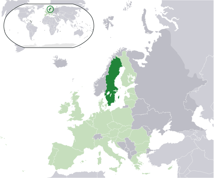
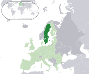
| Description | Location map: Sweden (dark green) / European Union (light green) / Europe (dark grey); inspired by and consistent with general country locator maps by User:Vardion, et al. | |||
| Date | ||||
| Source | Own work | |||
| Author | Quizimodo | |||
| Other versions |
|
Licensing
[edit]
| This work has been released into the public domain by its author, I, Quizimodo. This applies worldwide. In some countries this may not be legally possible; if so: I, Quizimodo grants anyone the right to use this work for any purpose, without any conditions, unless such conditions are required by law. |
File history
Click on a date/time to view the file as it appeared at that time.
| Date/Time | Thumbnail | Dimensions | User | Comment | |
|---|---|---|---|---|---|
| current | 16:15, 4 December 2016 | | 2,056 × 1,710 (336 KB) | Koreanovsky (talk | contribs) | Updated the map |
| 03:16, 5 October 2007 |  | 2,056 × 1,710 (112 KB) | Tene~commonswiki (talk | contribs) | Optimised with PNGOUT (0;r) | |
| 01:04, 18 June 2007 |  | 2,056 × 1,710 (178 KB) | Quizimodo~commonswiki (talk | contribs) | image (updated) | |
| 11:30, 17 June 2007 |  | 2,056 × 1,710 (227 KB) | Quizimodo~commonswiki (talk | contribs) | {{Information |Description=Location map: Sweden (dark green) / European Union (light green) / Europe (dark grey); inspired by and consistent with general country locator maps by User:Vardion, et al |Source=self-made |Date= |Author= [[User:Quizimodo|Quizim |
You cannot overwrite this file.
File usage on Commons
The following page uses this file:
File usage on other wikis
The following other wikis use this file:
- Usage on an.wikipedia.org
- Usage on bcl.wikipedia.org
- Usage on bs.wikipedia.org
- Usage on dz.wikipedia.org
- Usage on es.wikipedia.org
- Usage on incubator.wikimedia.org
- Usage on it.wikibooks.org
- Usage on kn.wikipedia.org
- Usage on kv.wikipedia.org
- Usage on ml.wikipedia.org
- Usage on myv.wikipedia.org
- Usage on new.wikipedia.org
- Usage on pl.wikinews.org
- Usage on pl.wikiquote.org
- Usage on pt.wikipedia.org
- Usage on qu.wikipedia.org
- Usage on ro.wikipedia.org
- Usage on ro.wikibooks.org
- Usage on sv.wikipedia.org
- Usage on sv.wikinews.org
- Usage on tl.wikipedia.org