File:Map-Lusophone World-fr.png
Jump to navigation
Jump to search
Size of this preview: 800 × 370 pixels. Other resolutions: 320 × 148 pixels | 640 × 296 pixels | 1,357 × 628 pixels.
Original file (1,357 × 628 pixels, file size: 37 KB, MIME type: image/png)
Captions
Captions
Add a one-line explanation of what this file represents
Summary
[edit]
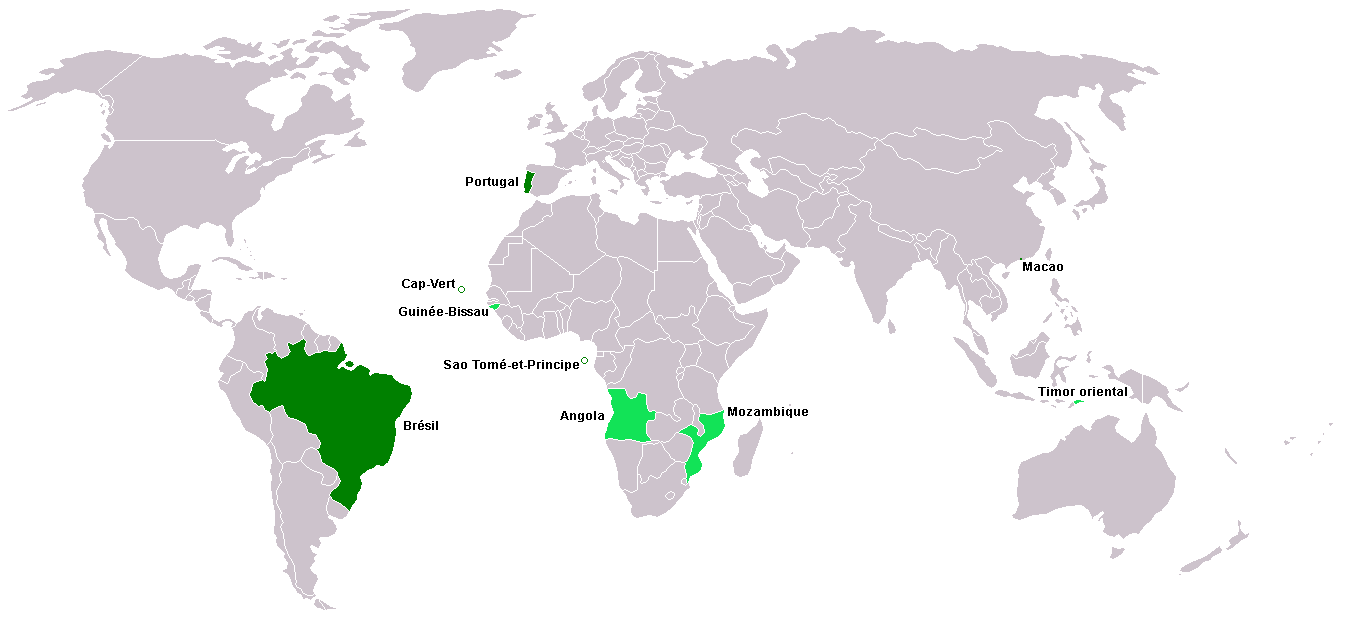
Carte du monde lusophone. (Version française de Image:Map-Lusophone_World-en.png.)
Carte créée à partir de Image:BlankMap-World.png. La carte vierge a été créée par User:Vardion et adaptée par User:E Pluribus Anthony pour Wikipédia.
Cette version colorée a été faite par User:Yug avec indication des pays par User:Sting.
Licensing
[edit]
| I, the copyright holder of this work, release this work into the public domain. This applies worldwide. In some countries this may not be legally possible; if so: I grant anyone the right to use this work for any purpose, without any conditions, unless such conditions are required by law. |
File history
Click on a date/time to view the file as it appeared at that time.
| Date/Time | Thumbnail | Dimensions | User | Comment | |
|---|---|---|---|---|---|
| current | 09:19, 9 March 2018 | | 1,357 × 628 (37 KB) | Maphobbyist (talk | contribs) | Montenegro and South Sudan borders |
| 21:25, 23 January 2006 |  | 1,357 × 628 (38 KB) | Sting (talk | contribs) | French version of Image:Map-Lusophone_World-en.png Carte du monde lusophone. Carte créée à partir de Image:BlankMap-World.png La carte vierge a été créée par User:Vardion et adaptée par [[User:E Pluribus Anthony |
You cannot overwrite this file.
File usage on Commons
The following page uses this file: