File:Map Artemia Germany Uwe Manzke.jpg
Jump to navigation
Jump to search
Size of this preview: 404 × 599 pixels. Other resolutions: 162 × 240 pixels | 324 × 480 pixels | 518 × 768 pixels | 1,200 × 1,779 pixels.
Original file (1,200 × 1,779 pixels, file size: 287 KB, MIME type: image/jpeg)
Captions
Captions
Add a one-line explanation of what this file represents
Summary
[edit]
| Description |
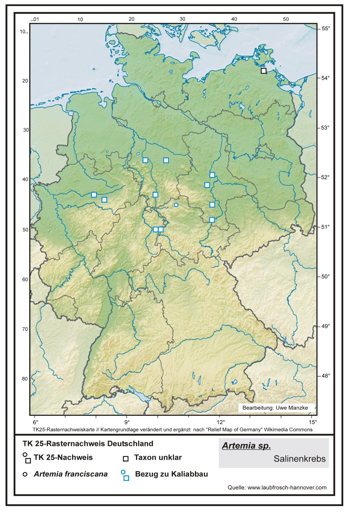
Deutsch: Rasterpunkt-Nachweiskarte zur Verbreitung von Salzkrebschen (Salinenkrebs u. a.), Artemia spp., in Deutschland.
English: Grid point map to the distribution of Artemia in Germany. |
| Date | |
| Source |
This file was derived from: Relief Map of Germany.svg:  |
| Author |
Uwe Manzke (→ www.laubfrosch-hannover.com)
|
| Permission (Reusing this file) |
Licensing
[edit]
This file is licensed under the Creative Commons Attribution-Share Alike 4.0 International license.
Attribution: Uwe Manzke
- You are free:
- to share – to copy, distribute and transmit the work
- to remix – to adapt the work
- Under the following conditions:
- attribution – You must give appropriate credit, provide a link to the license, and indicate if changes were made. You may do so in any reasonable manner, but not in any way that suggests the licensor endorses you or your use.
- share alike – If you remix, transform, or build upon the material, you must distribute your contributions under the same or compatible license as the original.
File history
Click on a date/time to view the file as it appeared at that time.
| Date/Time | Thumbnail | Dimensions | User | Comment | |
|---|---|---|---|---|---|
| current | 09:30, 29 March 2022 | | 1,200 × 1,779 (287 KB) | Fice (talk | contribs) | == {{int:filedesc}} == {{Information |Description= {{de|1=Rasterpunkt-Nachweiskarte zur Verbreitung von '''Salzkrebschen''' (Salinenkrebs u. a.), ''Artemia'' spp., in Deutschland. Datenstand: Dezember 2021.}} {{en|1= Grid point map to the distribution of '''''Artemia''''' in Germany.}} |Source={{Derived from|Relief_Map_of_Germany.svg|display=50}} |Date= 2022-03-25 |Author= '''Uwe Manzke''' (→ www.laubfrosch-hannover.com) *[[:File:Relief_Map_of_Germany.svg... |
You cannot overwrite this file.
File usage on Commons
There are no pages that use this file.
File usage on other wikis
The following other wikis use this file:
- Usage on de.wikipedia.org