File:Map DK Regions2.png
Jump to navigation
Jump to search
No higher resolution available.
Map_DK_Regions2.png (465 × 550 pixels, file size: 46 KB, MIME type: image/png)
Captions
Captions
Add a one-line explanation of what this file represents
Summary
[edit]
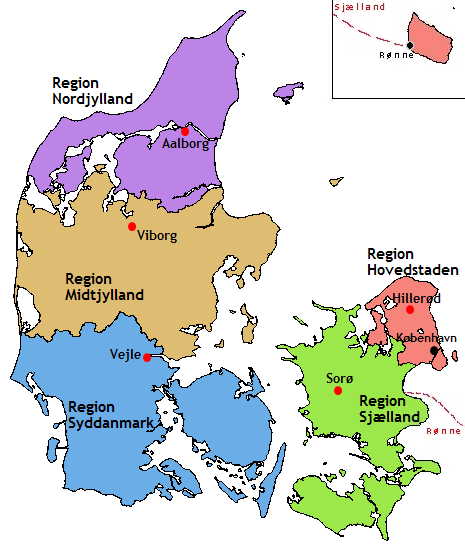
| Description | Location map of the Regions in Denmark. Created by User:Kazubon based on Image:Map DK Regions.png created by User:Valentinian who released the latter image under PD. |
| Date | 20 January 2007 (original upload date) |
| Source | No machine-readable source provided. Own work assumed (based on copyright claims). |
| Author | No machine-readable author provided. Kazubon~commonswiki assumed (based on copyright claims). |
Licensing
[edit]
| I, the copyright holder of this work, release this work into the public domain. This applies worldwide. In some countries this may not be legally possible; if so: I grant anyone the right to use this work for any purpose, without any conditions, unless such conditions are required by law. |

|
File:Denmark regions label.svg is a vector version of this file. It should be used in place of this PNG file.
File:Map DK Regions2.png → File:Denmark regions label.svg
For more information, see Help:SVG. |
 |
File history
Click on a date/time to view the file as it appeared at that time.
| Date/Time | Thumbnail | Dimensions | User | Comment | |
|---|---|---|---|---|---|
| current | 20:17, 10 August 2015 | | 465 × 550 (46 KB) | Kontrollstellekundl (talk | contribs) | corr. |
| 12:34, 20 January 2007 |  | 465 × 550 (15 KB) | Kazubon~commonswiki (talk | contribs) | Location map of the Regions in Denmark. Created by User:Kazubon based on Image:Map DK Regions.png created by User:Valentinian who released the latter image under PD. |
You cannot overwrite this file.
File usage on Commons
There are no pages that use this file.
File usage on other wikis
The following other wikis use this file:
- Usage on da.wikipedia.org
- Usage on de.wikipedia.org
- Usage on de.wiktionary.org
- Usage on en.wikipedia.org
- Usage on fi.wikipedia.org
- Usage on fo.wikipedia.org
- Usage on fr.wikipedia.org
- Usage on hr.wikipedia.org
- Usage on hu.wikipedia.org
- Usage on it.wikipedia.org
- Usage on ko.wikipedia.org
- Usage on nds.wikipedia.org
- Usage on nl.wikipedia.org
- Usage on nn.wikipedia.org
- Usage on no.wikipedia.org
- Usage on pt.wikipedia.org
- Subdivisões da Dinamarca
- Municípios da Dinamarca
- Discussão:Ålborg
- Região da Capital (Dinamarca)
- Jutlândia Central (região)
- Predefinição:Regiões da Dinamarca
- Jutlândia do Norte (região)
- Dinamarca do Sul (região)
- Zelândia (região)
- Wikipedia:Projetos/Cidades do Mundo/Dinamarca/marca
- Discussão:Aabybro
- Discussão:Aalestrup
- Discussão:Aars
- Discussão:Aarslev
- Discussão:Aarup
- Discussão:Aaskov
- Discussão:Aabenraa (município)
- Discussão:Ærøskøbing
- Discussão:Albertslund
- Discussão:Allerød
- Discussão:Arden (Dinamarca)
- Discussão:Assens
- Discussão:Augustemburgo
- Discussão:Aulum-Haderup
- Discussão:Ballerup
- Discussão:Billund
- Discussão:Birkerød
- Discussão:Bjergsted
- Discussão:Bjerringbro
View more global usage of this file.