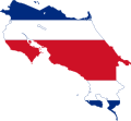
File:Map and flag of Costa Rica.svg
From Wikimedia Commons, the free media repository
Jump to navigation
Jump to search

Size of this PNG preview of this SVG file: 631 × 600 pixels. Other resolutions: 252 × 240 pixels | 505 × 480 pixels | 808 × 768 pixels | 1,077 × 1,024 pixels | 2,154 × 2,048 pixels.
Original file (SVG file, nominally 631 × 600 pixels, file size: 46 KB)
File information
Structured data
Captions
Captions
Add a one-line explanation of what this file represents
Costa Rica
| DescriptionMap and flag of Costa Rica.svg | Map of Costa Rica incorporating its flag. |
| Date | |
| Source | Self made from Image:Mapa CR.svg and Image:Flag of Costa Rica.svg |
| Author | Bryan based on work by Shamhain and SKopp |
| Permission (Reusing this file) |
Image:Mapa CR.svg is GFDL and CC-BY-SA-2.5,2.0,1.0. Image:Flag of Costa Rica.svg is Public domain. Contributions by Bryan are public domain. |
I, the copyright holder of this work, hereby publish it under the following licenses:

|
Permission is granted to copy, distribute and/or modify this document under the terms of the GNU Free Documentation License, Version 1.2 or any later version published by the Free Software Foundation; with no Invariant Sections, no Front-Cover Texts, and no Back-Cover Texts. A copy of the license is included in the section entitled GNU Free Documentation License.http://www.gnu.org/copyleft/fdl.htmlGFDLGNU Free Documentation Licensetruetrue |
This file is licensed under the Creative Commons Attribution-Share Alike 3.0 Unported, 2.5 Generic, 2.0 Generic and 1.0 Generic license.
- You are free:
- to share – to copy, distribute and transmit the work
- to remix – to adapt the work
- Under the following conditions:
- attribution – You must give appropriate credit, provide a link to the license, and indicate if changes were made. You may do so in any reasonable manner, but not in any way that suggests the licensor endorses you or your use.
- share alike – If you remix, transform, or build upon the material, you must distribute your contributions under the same or compatible license as the original.
You may select the license of your choice.
File history
Click on a date/time to view the file as it appeared at that time.
| Date/Time | Thumbnail | Dimensions | User | Comment | |
|---|---|---|---|---|---|
| current | 14:56, 15 April 2016 |  | 631 × 600 (46 KB) | Stasyan117 (talk | contribs) | Better |
| 00:34, 15 January 2016 |  | 691 × 637 (34 KB) | Dim Grits (talk | contribs) | Reverted to version as of 06:58, 11 February 2011 (UTC) | |
| 20:52, 17 May 2015 |  | 631 × 600 (232 KB) | Stasyan117 (talk | contribs) | Reduce | |
| 18:35, 28 January 2015 |  | 512 × 487 (21 KB) | Stasyan117 (talk | contribs) | Code | |
| 06:58, 11 February 2011 |  | 691 × 637 (34 KB) | Fry1989 (talk | contribs) | haul | |
| 01:54, 26 January 2011 |  | 692 × 638 (41 KB) | Fry1989 (talk | contribs) | fix | |
| 21:54, 10 March 2008 |  | 722 × 664 (49 KB) | Bryan (talk | contribs) | try again | |
| 20:45, 10 March 2008 |  | 722 × 664 (93 KB) | Bryan (talk | contribs) | {{Information |Description=Map of Costa Rica incorporating its flag. |Source=Self made from Image:Mapa CR.svg and Image:Flag of Costa Rica.svg |Date=10 March 2008 |Author=User:Bryan based on work by User:Shamhain and User:SKopp |P |
You cannot overwrite this file.
File usage on Commons
The following 22 pages use this file:
- Flag map of the world
- User:Gaendalf
- User:Marioferu
- User:Mariordo
- User:Murdockcrc
- User:Rubýñ
- User talk:Natox
- Commons:WikiProject Flag-map
- File:Flag-map of Central America.svg
- File:Flag-map of Costa Rica.png
- Template:User Costa Rica
- Template:User Costa Rica/bar
- Template:User Costa Rica/de
- Template:User Costa Rica/en
- Template:User Costa Rica/es
- Template:User Costa Rica/fr
- Template:User Costa Rica/layout
- Template:User Costa Rica/mk
- Template:User Costa Rica/nl
- Template:User Costa Rica/pt
- Template:User Costa Rica/sv
- Category:Users in Costa Rica
File usage on other wikis
The following other wikis use this file:
- Usage on ar.wikipedia.org
- خليج نيكويا
- إيريذيا (محافظة)
- إسكاثو (كوستاريكا)
- فاسكيس دي كورونادو (كانتون)
- ديسامبارادوس (كانتون)
- بوريسكال (كوستاريكا)
- تاراسو (كوستاريكا)
- أكوستا (كوستاريكا)
- غواناكاسته
- كارتاغو (محافظة)
- بونتاريناس (محافظة)
- آسيري (كانتون)
- سان خوسيه (كانتون)
- ليمون (محافظة)
- مورا (كانتون)
- محافظات كوستاريكا
- قالب:بذرة جغرافيا كوستاريكا
- أيزو 3166-2:CR
- بركان أرينال
- سان خوسيه (محافظة)
- قائمة مقاطعات كوستاريكا
- Usage on ar.wikinews.org
- Usage on ar.wikiquote.org
- Usage on cs.wikipedia.org
- Usage on da.wikipedia.org
- Usage on de.wikipedia.org
- Usage on en.wikipedia.org
- Provinces of Costa Rica
- Cartago Province
- Heredia Province
- Puntarenas Province
- San José Province
- Barva
- Tibás
- Atenas
- Desamparados (canton)
- Zarcero
- Orotina
- San Carlos (canton)
- Isla del Caño
- Playa Herradura, Costa Rica
- Frailes, Desamparados, Costa Rica
- Quepos
- Miravalles Volcano
- Chira Island
- Gulf of Nicoya
- Orosí Volcano
- Nicoya Peninsula
View more global usage of this file.
Metadata
This file contains additional information such as Exif metadata which may have been added by the digital camera, scanner, or software program used to create or digitize it. If the file has been modified from its original state, some details such as the timestamp may not fully reflect those of the original file. The timestamp is only as accurate as the clock in the camera, and it may be completely wrong.
| Width | 631.35547 |
|---|---|
| Height | 599.99805 |