File:Map of Adams County, Colorado.png
Original file (4,659 × 1,235 pixels, file size: 47 KB, MIME type: image/png)
Captions
Captions
 |
|
|
|
|
|
Badger Creek
|
Bijou Creek
|
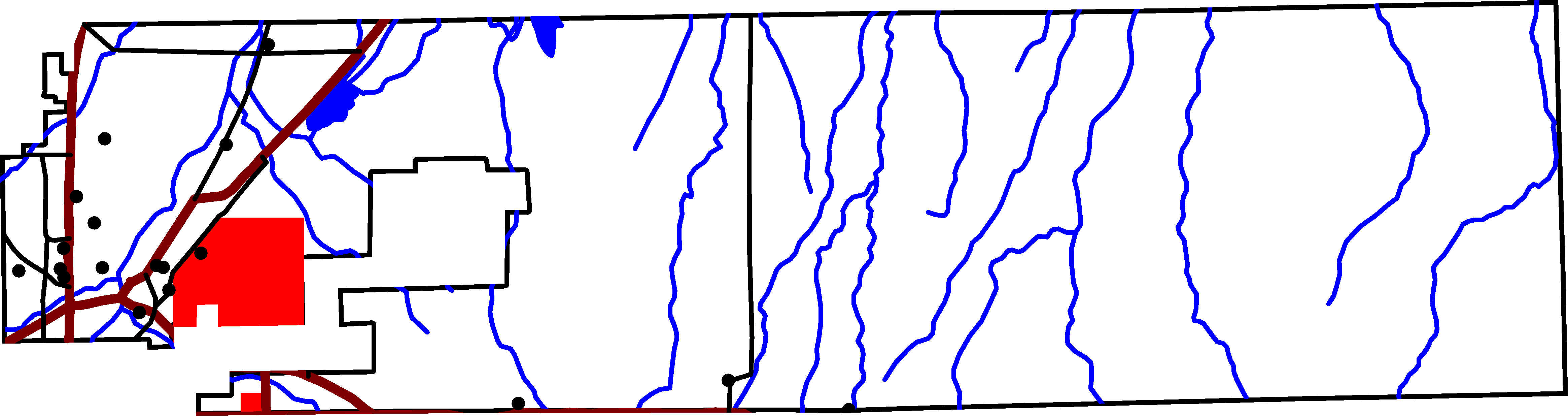
A map of Adams County, Colorado. The reddish lines are Interstate Highways: I-25 in the northwest corner, I-76 on the north border, and I-270 on the south border. The black lines are other roads. The north-south road in the middle of the county is Colorado State Highway 79. The north-south road intersecting I-76 is U.S. Highway 85. The east-west road going between I-25 and I-76 is Colorado State Highway 7.
The lakes are Barr Lake, to the west, adjacent to I-76, and Horse Creek Reservior, on the northern border.
The easternmost stream is Badger Creek. Bijou Creek is also drawn on the map.
The large red area is Rocky Mountain Arsenal National Refuge. The small red area is some other federal land, not yet identified.
David Benbennick made this map with data from nationalatlas.gov. Eventually I'll upload the Metapost script I used. In the mean time, see map.mp.
| I, the copyright holder of this work, release this work into the public domain. This applies worldwide. In some countries this may not be legally possible; if so: I grant anyone the right to use this work for any purpose, without any conditions, unless such conditions are required by law. |
File history
Click on a date/time to view the file as it appeared at that time.
| Date/Time | Thumbnail | Dimensions | User | Comment | |
|---|---|---|---|---|---|
| current | 17:45, 11 August 2005 | 4,659 × 1,235 (47 KB) | Dbenbenn (talk | contribs) | by me, PD |
You cannot overwrite this file.
File usage on Commons
The following page uses this file: