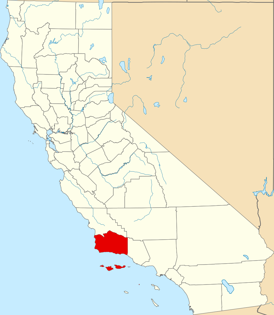
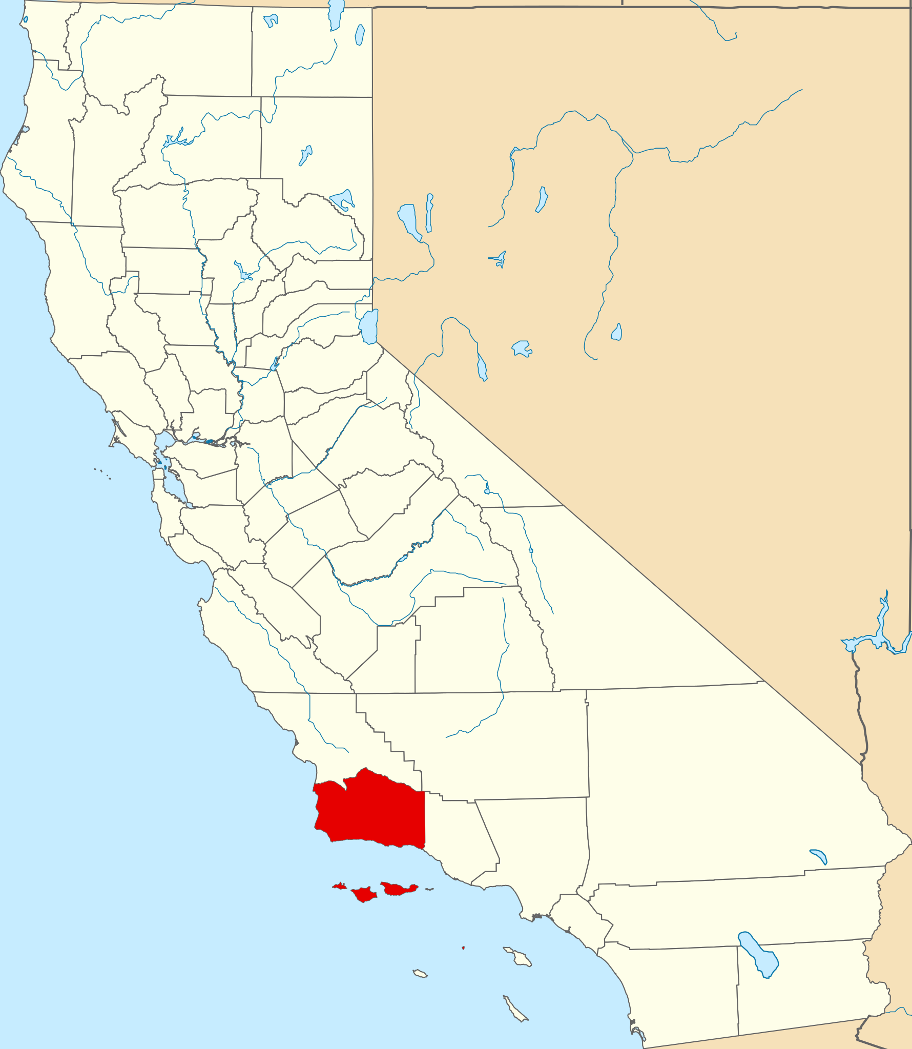
File:Map of California highlighting Santa Barbara County.svg
Jump to navigation
Jump to search

Size of this PNG preview of this SVG file: 521 × 599 pixels. Other resolutions: 209 × 240 pixels | 417 × 480 pixels | 667 × 768 pixels | 890 × 1,024 pixels | 1,780 × 2,048 pixels | 916 × 1,054 pixels.
Original file (SVG file, nominally 916 × 1,054 pixels, file size: 151 KB)
Captions
Captions
Add a one-line explanation of what this file represents
Summary
[edit]
| Description | |
| Date | |
| Source | nationalatlas.gov, specifically countyp020.tar.gz on the Raw Data Download page. The maps also use state outline data from statesp020.tar.gz. |
| Author | David Benbennick made this map. |
| Other versions | For more information, see Commons:United States county locator maps. |
| SVG development |
| I, the copyright holder of this work, release this work into the public domain. This applies worldwide. In some countries this may not be legally possible; if so: I grant anyone the right to use this work for any purpose, without any conditions, unless such conditions are required by law. |
File history
Click on a date/time to view the file as it appeared at that time.
| Date/Time | Thumbnail | Dimensions | User | Comment | |
|---|---|---|---|---|---|
| current | 23:03, 25 June 2024 | | 916 × 1,054 (151 KB) | Nux (talk | contribs) | uniform colors with good contrast |
| 21:39, 24 November 2016 |  | 1,022 × 1,171 (494 KB) | Spartan7W (talk | contribs) | Updated to higher quality map | |
| 10:27, 12 February 2006 |  | 9,164 × 10,536 (229 KB) | David Benbennick (talk | contribs) | {{subst:User:Dbenbenn/clm|county=Santa Barbara County|state=California}} |
You cannot overwrite this file.
File usage on Commons
The following 12 pages use this file:
- File:Honda Point Desaster de.JPG
- Category:Births in Santa Barbara County, California
- Category:Deaths in Santa Barbara County, California
- Category:Geography of Santa Barbara County, California
- Category:History of Santa Barbara County, California
- Category:Maps of Santa Barbara County, California
- Category:Nature of Santa Barbara County, California
- Category:People of Santa Barbara County, California
- Category:Rivers of Santa Barbara County, California
- Category:Roads in Santa Barbara County, California
- Category:Santa Barbara County, California
- Category:Wildfires in Santa Barbara County, California
File usage on other wikis
The following other wikis use this file:
- Usage on ang.wikipedia.org
- Usage on ar.wikipedia.org
- Usage on arz.wikipedia.org
- Usage on az.wikipedia.org
- Usage on ban.wikipedia.org
- Usage on be.wikipedia.org
- Usage on bg.wikipedia.org
- Usage on bpy.wikipedia.org
- Usage on ca.wikipedia.org
- Santa Barbara (Califòrnia)
- Buellton
- Carpinteria
- Guadalupe (Califòrnia)
- Isla Vista
- Lompoc
- Los Alamos (Califòrnia)
- Mission Canyon
- Mission Hills (Califòrnia)
- Montecito
- Orcutt
- Santa Maria (Califòrnia)
- Santa Ynez
- Solvang
- Summerland (Califòrnia)
- Toro Canyon
- Vandenberg Village
- Llista de comtats de Califòrnia
- Vandenberg Air Force Base
- Reserva Santa Ynez
- Plantilla:Comtat de Santa Barbara
- Comtat de Santa Barbara
- Usage on ceb.wikipedia.org
- Usage on ce.wikipedia.org
- Usage on cs.wikipedia.org
- Usage on cy.wikipedia.org
- Usage on da.wikipedia.org
- Usage on de.wikipedia.org
View more global usage of this file.