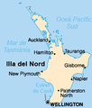
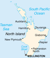
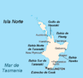
File:Map of North island.png
From Wikimedia Commons, the free media repository
Jump to navigation
Jump to search
Map_of_North_island.png (235 × 276 pixels, file size: 25 KB, MIME type: image/png)
File information
Structured data
Captions
Captions
Add a one-line explanation of what this file represents
| DescriptionMap of North island.png |
English: Map of North island, New Zealand Ελληνικά: Χάρτης του Βόρειου Νησιού της Νέας Ζηλανδίας |
| Date | |
| Source | Own work; transferred from el.wikipedia; transferred to Commons by User:MARKELLOS using CommonsHelper |
| Author | Αντιγόνη |
| Other versions |
|
Licensing
[edit]| Public domainPublic domainfalsefalse |
| |
This work has been released into the public domain by its author, Αντιγόνη, at the English Wikipedia project. This applies worldwide. In case this is not legally possible: |
Original upload log
[edit]The original description page was here. All following user names refer to el.wikipedia.
- 2006-02-17 07:24 Αντιγόνη 235×276× (26059 bytes)
File history
Click on a date/time to view the file as it appeared at that time.
| Date/Time | Thumbnail | Dimensions | User | Comment | |
|---|---|---|---|---|---|
| current | 19:45, 11 April 2010 |  | 235 × 276 (25 KB) | File Upload Bot (Magnus Manske) (talk | contribs) | {{BotMoveToCommons|el.wikipedia|year={{subst:CURRENTYEAR}}|month={{subst:CURRENTMONTHNAME}}|day={{subst:CURRENTDAY}}}} {{Information |Description={{el|Χάρτης του Βόρειου Νησιού της Νέας Ζηλανδίας}} |Source=Transferre |
You cannot overwrite this file.
File usage on Commons
The following 6 pages use this file:
File usage on other wikis
The following other wikis use this file:
- Usage on el.wikipedia.org
- Usage on el.wikivoyage.org
Hidden category:


