File:Map of Rhode Island highlighting Providence County.svg
Jump to navigation
Jump to search

Size of this PNG preview of this SVG file: 395 × 599 pixels. Other resolutions: 158 × 240 pixels | 317 × 480 pixels | 507 × 768 pixels | 676 × 1,024 pixels | 1,351 × 2,048 pixels | 755 × 1,144 pixels.
Original file (SVG file, nominally 755 × 1,144 pixels, file size: 6 KB)
Captions
Captions
Add a one-line explanation of what this file represents

|
File:Providence County in Rhode Island.svg is a vector version of this file. It should be used in place of this SVG file when not inferior.
File:Map of Rhode Island highlighting Providence County.svg → File:Providence County in Rhode Island.svg
For more information, see Help:SVG. |
 |
Summary
[edit]
| Description |
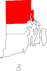
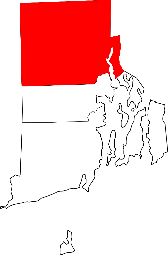
English: This is a locator map showing Providence County in Rhode Island. For more information, see Commons:United States county locator maps. |
| Date | |
| Source |
Own work: English: The maps use data from nationalatlas.gov, specifically countyp020.tar.gz on the Raw Data Download page. The maps also use state outline data from statesp020.tar.gz. The Florida maps use hydrogm020.tar.gz to display Lake Okeechobee. |
| Author | David Benbennick |
Licensing
[edit]
| I, the copyright holder of this work, release this work into the public domain. This applies worldwide. In some countries this may not be legally possible; if so: I grant anyone the right to use this work for any purpose, without any conditions, unless such conditions are required by law. |
File history
Click on a date/time to view the file as it appeared at that time.
| Date/Time | Thumbnail | Dimensions | User | Comment | |
|---|---|---|---|---|---|
| current | 22:19, 24 June 2024 | | 755 × 1,144 (6 KB) | Nux (talk | contribs) | fix rendering (remove clipping) |
| 16:23, 12 February 2006 |  | 6,416 × 9,720 (12 KB) | David Benbennick (talk | contribs) | {{subst:User:Dbenbenn/clm|county=Providence County|state=Rhode Island|type=county}} |
You cannot overwrite this file.
File usage on Commons
The following page uses this file:
File usage on other wikis
The following other wikis use this file:
- Usage on ar.wikipedia.org
- بروفيدنس (رود آيلاند)
- بوريلفيل (رود آيلاند)
- كمبرلاند (رود آيلاند)
- فوستر (رود آيلاند)
- غلوكستير (رود آيلاند)
- جونستون (رود آيلاند)
- لينكولن (رود آيلاند)
- نورث بروفيدانس (رود آيلاند)
- نورث سميثفيلد (رود آيلاند)
- سكيتوت (رود آيلاند)
- سميثفيلد (رود آيلاند)
- بوتكيت
- كرانستون
- ونسوكت (رود آيلاند)
- سنترال فولز
- إيست بروفيدانس
- باسكواغ (رود آيلاند)
- تشيباتشيت (رود آيلاند)
- سلايترسفيل (رود آيلاند)
- غرينفيل (رود آيلاند)
- فالي فالس (رود آيلاند)
- فورستديل (رود آيلاند)
- كامبرلاند هيل (رود آيلاند)
- هاريسفيل (رود آيلاند)
- فوستر سنتر (رود آيلاند)
- قائمة مقاطعات رود آيلاند
- قالب:مقاطعة بروفيدانس (رود آيلاند)
- Usage on bg.wikipedia.org
- Usage on bpy.wikipedia.org
- Usage on ca.wikipedia.org
- Providence (Rhode Island)
- Burrillville
- Central Falls
- Cranston
- Cumberland (Rhode Island)
- Cumberland Hill
- East Providence
- Foster (Rhode Island)
- Glocester
- Greenville (Rhode Island)
- Harrisville (Rhode Island)
- Johnston (Rhode Island)
- Lincoln (Rhode Island)
- North Providence
- North Smithfield
- Pascoag
- Pawtucket
- Scituate (Rhode Island)
- Smithfield (Rhode Island)
- Valley Falls (Rhode Island)
View more global usage of this file.