File:Map of USA.png
From Wikimedia Commons, the free media repository
Jump to navigation
Jump to search

Size of this preview: 800 × 525 pixels. Other resolutions: 320 × 210 pixels | 640 × 420 pixels | 904 × 593 pixels.
Original file (904 × 593 pixels, file size: 24 KB, MIME type: image/png)
File information
Structured data
Captions
Captions
Add a one-line explanation of what this file represents
Summary
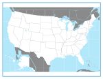
[edit]United States blank state outline map. This is the blank version of the map used for U.S. states and national park locations, etc., in Wikipedia. [1]
Licensing
[edit]
|
Permission is granted to copy, distribute and/or modify this document under the terms of the GNU Free Documentation License, Version 1.2 or any later version published by the Free Software Foundation; with no Invariant Sections, no Front-Cover Texts, and no Back-Cover Texts. A copy of the license is included in the section entitled GNU Free Documentation License.http://www.gnu.org/copyleft/fdl.htmlGFDLGNU Free Documentation Licensetruetrue |
| This file is licensed under the Creative Commons Attribution-Share Alike 3.0 Unported license. | ||
| ||
| This licensing tag was added to this file as part of the GFDL licensing update.http://creativecommons.org/licenses/by-sa/3.0/CC BY-SA 3.0Creative Commons Attribution-Share Alike 3.0truetrue |

|
File:StatesU.svg is a vector version of this file. It should be used in place of this PNG file when not inferior.
File:Map of USA.png → File:StatesU.svg
For more information, see Help:SVG.
|
File history
Click on a date/time to view the file as it appeared at that time.
| Date/Time | Thumbnail | Dimensions | User | Comment | |
|---|---|---|---|---|---|
| current | 17:41, 14 March 2012 |  | 904 × 593 (24 KB) | Smileguy91 (talk | contribs) | Reverted to version as of 03:32, 12 May 2006 |
| 16:07, 5 March 2008 |  | 904 × 593 (24 KB) | Briangotts (talk | contribs) | Reverted to version as of 00:22, 16 February 2008 | |
| 16:07, 5 March 2008 |  | 904 × 593 (52 KB) | Briangotts (talk | contribs) | {{Information |Description=Map of the w:United States, showing areas covered by each of the state compilation w:law reports published by w:Thomson West. :*Purple: w:North Eastern Reporter :*Orange: w:Atlantic Reporter :*Yellow: [[w:Nor | |
| 00:22, 16 February 2008 |  | 904 × 593 (24 KB) | Brianski (talk | contribs) | Clean up some artifacts, especially around black lines, and gray in the ocean. | |
| 03:32, 12 May 2006 |  | 904 × 593 (24 KB) | Roke~commonswiki (talk | contribs) | United States blank state outline map. This is the blank version of the map used for U.S. states and national park locations, etc., in Wikipedia. [http://en.wikipedia.org/wiki/Image:Map_of_USA.png] Category: Blank maps of the United States |
You cannot overwrite this file.
File usage on Commons
The following 2 pages use this file:
File usage on other wikis
The following other wikis use this file:
- Usage on bpy.wikipedia.org
- মডেল:তিলপারাষ্ট্র-লইনাসে
- কুইন্স কাউন্টি, নিউ ইয়র্ক
- আউটোগা কাউন্টি, আলাবামা
- চেরোকি কাউন্টি, আলাবামা
- গ্রীনলী কাউন্টি, অ্যারিজোনা
- লা পাজ কাউন্টি, অ্যারিজোনা
- মারিকোপা কাউন্টি, অ্যারিজোনা
- মোহাবে কাউন্টি, অ্যারিজোনা
- নাবাজো কাউন্টি, অ্যারিজোনা
- প্রিমা কাউন্টি, অ্যারিজোনা
- পিনাল কাউন্টি, অ্যারিজোনা
- সান্তা ক্রোজ কাউন্টি, অ্যারিজোনা
- ইয়াবাপাই কাউন্টি, অ্যারিজোনা
- য়ুমা কাউন্টি, অ্যারিজোনা
- চিলটন কাউন্টি, আলাবামা
- আরকান্সাস কাউন্টি, আরকান্সাস
- এশলি কাউন্টি, আরকান্সাস
- বক্সটের কাউন্টি, আরকান্সাস
- বেনটন কাউন্টি, আরকান্সাস
- বোনে কাউন্টি, আরকান্সাস
- ব্রাডলি কাউন্টি, আরকান্সাস
- কালহৌন কাউন্টি, আরকান্সাস
- কেরোল কাউন্টি, আরকান্সাস
- চিকোট কাউন্টি, আরকান্সাস
- ক্লার্ক কাউন্টি, আরকান্সাস
- চোকটাউ কাউন্টি, আলাবামা
- ক্লে কাউন্টি, আরকান্সাস
- ক্লেবোর্ন কাউন্টি, আরকান্সাস
- ক্লিবল্যন্ড কাউন্টি, আরকান্সাস
- কলম্বিয়া কাউন্টি, আরকান্সাস
- কনৱে কাউন্টি, আরকান্সাস
- ক্রেইগহেড কাউন্টি, আরকান্সাস
- ক্রফোর্ড কাউন্টি, আরকান্সাস
- ক্রিটেনডেন কাউন্টি, আরকান্সাস
- ক্রশ কাউন্টি, আরকান্সাস
- ডাল্লাস কাউন্টি, আরকান্সাস
- ক্লার্কে কাউন্টি, আলাবামা
- ডেসা কাউন্টি, আরকান্সাস
- ড্রিউ কাউন্টি, আরকান্সাস
- ফ্লাকনার কাউন্টি, আরকান্সাস
- ফ্রাঙ্কলিন কাউন্টি, আরকান্সাস
- ফুলটন কাউন্টি, আরকান্সাস
- গারল্যন্ড কাউন্টি, আরকান্সাস
- গ্রান্ট কাউন্টি, আরকান্সাস
- গ্রীন কাউন্টি, আরকান্সাস
- হেমস্টেড কাউন্টি, আরকান্সাস
- হট স্প্রিং কাউন্টি, আরকান্সাস
- ক্লে কাউন্টি, আলাবামা
- হাৱার্ড কাউন্টি, আরকান্সাস
- ইন্ডিপেনডেন্স কাউন্টি, আরকান্সাস
View more global usage of this file.
