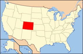
File:Map of USA CO.svg

Original file (SVG file, nominally 286 × 186 pixels, file size: 167 KB)
Captions
Captions
Clickable version
[edit]
| DescriptionMap of USA CO.svg | Map of USA with Colorado highlighted | ||
| Source |
Modified version of United States (Outline Map) 1998 from Perry-Castañeda Library Map Collection: United States Maps
|
||
| Author | Huebi | ||
| Other versions | image:Map of USA with state names.svg |
| This file is licensed under the Creative Commons Attribution-Share Alike 3.0 Unported license. Subject to disclaimers. | ||
| ||
| This licensing tag was added to this file as part of the GFDL licensing update.http://creativecommons.org/licenses/by-sa/3.0/CC BY-SA 3.0Creative Commons Attribution-Share Alike 3.0truetrue |

|
Permission is granted to copy, distribute and/or modify this document under the terms of the GNU Free Documentation License, Version 1.2 or any later version published by the Free Software Foundation; with no Invariant Sections, no Front-Cover Texts, and no Back-Cover Texts. A copy of the license is included in the section entitled GNU Free Documentation License. Subject to disclaimers.http://www.gnu.org/copyleft/fdl.htmlGFDLGNU Free Documentation Licensetruetrue |
- You are free:
- to share – to copy, distribute and transmit the work
- to remix – to adapt the work
- Under the following conditions:
- attribution – You must give appropriate credit, provide a link to the license, and indicate if changes were made. You may do so in any reasonable manner, but not in any way that suggests the licensor endorses you or your use.
- share alike – If you alter, transform, or build upon this work, you must distribute the resulting work under the same license as the original.
- You are free:
- to share – to copy, distribute and transmit the work
- to remix – to adapt the work
- Under the following conditions:
- attribution – You must give appropriate credit, provide a link to the license, and indicate if changes were made. You may do so in any reasonable manner, but not in any way that suggests the licensor endorses you or your use.
- share alike – If you remix, transform, or build upon the material, you must distribute your contributions under the same or compatible license as the original.
File history
Click on a date/time to view the file as it appeared at that time.
| Date/Time | Thumbnail | Dimensions | User | Comment | |
|---|---|---|---|---|---|
| current | 14:22, 27 May 2006 |  | 286 × 186 (167 KB) | Huebi~commonswiki (talk | contribs) | {{Information| |Description=Map of USA with Colorado highlighted |other_versions=image:Map of USA with state names.svg }} Category:Maps of the United States Category:Maps of Colorado Category:SVG maps {{GFDL-en}}{{cc-by-2.0}}{{cc-by-sa- |
You cannot overwrite this file.
File usage on Commons
The following 10 pages use this file:
- Locator maps for U.S. states
- File:Map of 2012 Aurora Shooting.svg
- File:Map of USA CO.svg
- File:Map of USA highlighting Colorado.png
- Category:Cities in Colorado
- Category:Locator maps of cities in Colorado
- Category:Locator maps of counties of Colorado
- Category:Maps of Catholic dioceses of Colorado
- Category:Maps of Colorado
- Category:Videos from Colorado
File usage on other wikis
The following other wikis use this file:
- Usage on af.wikipedia.org
- Usage on ang.wikipedia.org
- Usage on an.wikipedia.org
- Usage on arc.wikipedia.org
- Usage on arz.wikipedia.org
- Usage on ay.wikipedia.org
- Usage on azb.wikipedia.org
- Usage on az.wiktionary.org
- Usage on bar.wikipedia.org
- Usage on bat-smg.wikipedia.org
- Usage on ba.wikipedia.org
- Usage on bcl.wikipedia.org
- Usage on be-tarask.wikipedia.org
- Usage on bg.wikipedia.org
- Адамс (окръг, Колорадо)
- Аламоза (окръг)
- Арчулета
- Бака
- Бент (окръг)
- Гарфийлд (окръг, Колорадо)
- Гранд (окръг, Колорадо)
- Гънисън (окръг)
- Делта (окръг, Колорадо)
- Джаксън (окръг, Колорадо)
- Долорес (окръг)
- Елбърт (окръг, Колорадо)
- Игъл (окръг)
- Кайоуа (окръг, Колорадо)
- Кит Карсън (окръг)
- Краули (окръг)
- Къстър (окръг, Колорадо)
- Ла Плата (окръг)
- Лас Анимас (окръг)
- Линкълн (окръг, Колорадо)
- Минерал (окръг, Колорадо)
- Монтроуз (окръг)
- Морган (окръг, Колорадо)
- Мофат (окръг)
- Отеро (окръг, Колорадо)
- Питкин (окръг)
- Прауърс
- Пуебло (окръг)
- Раут
- Рио Бланко
- Рио Гранде (окръг)
- Сан Мигел (окръг, Колорадо)
- Сан Хуан (окръг, Колорадо)
View more global usage of this file.
Metadata
This file contains additional information such as Exif metadata which may have been added by the digital camera, scanner, or software program used to create or digitize it. If the file has been modified from its original state, some details such as the timestamp may not fully reflect those of the original file. The timestamp is only as accurate as the clock in the camera, and it may be completely wrong.
| Width | 286.00000 |
|---|---|
| Height | 186.00000 |