File:Map of fertile crescent-ru.svg
Jump to navigation
Jump to search

Size of this PNG preview of this SVG file: 488 × 600 pixels. Other resolutions: 195 × 240 pixels | 390 × 480 pixels | 625 × 768 pixels | 833 × 1,024 pixels | 1,666 × 2,048 pixels | 1,987 × 2,442 pixels.
Original file (SVG file, nominally 1,987 × 2,442 pixels, file size: 626 KB)
Captions
Captions
Add a one-line explanation of what this file represents
Summary
[edit]| Description |
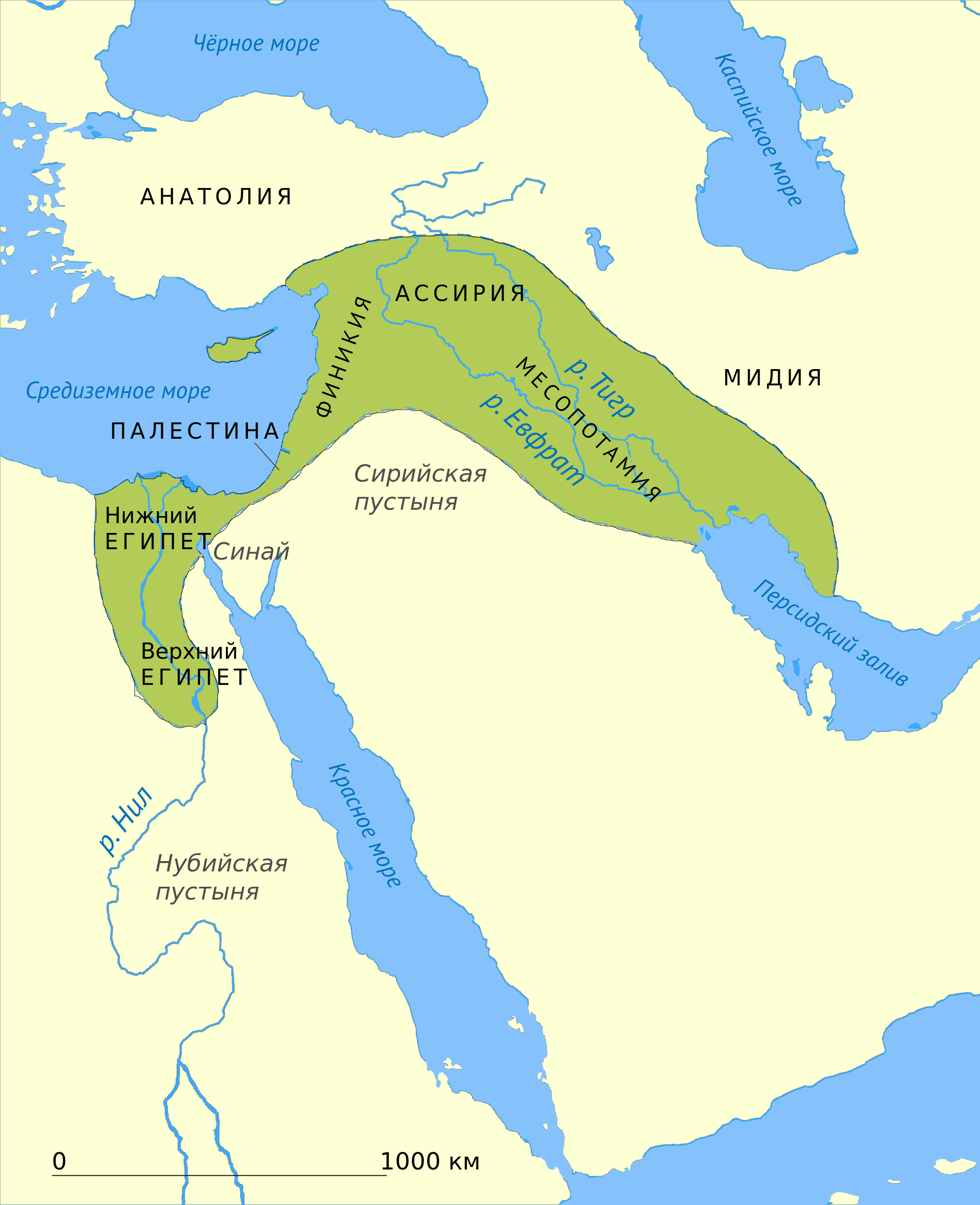
English: This map shows the location and extent of the Fertile Crescent, a region in the Middle East incorporating Ancient Egypt; the Levant; and Mesopotamia
Русский: Карта Плодородного полумесяца — условного региона на Ближнем Востоке, в котором в зимние месяцы наблюдается повышенное количество осадков |
| Date | |
| Source | Map of fertile cresent.svg |
| Author |
|
| Other versions |
[]
See also:
|
| SVG development | This map was created with Adobe Illustrator. |


Licensing
[edit]
I, the copyright holder of this work, hereby publish it under the following license:
| This file is made available under the Creative Commons CC0 1.0 Universal Public Domain Dedication. | |
| The person who associated a work with this deed has dedicated the work to the public domain by waiving all of their rights to the work worldwide under copyright law, including all related and neighboring rights, to the extent allowed by law. You can copy, modify, distribute and perform the work, even for commercial purposes, all without asking permission.
|
File history
Click on a date/time to view the file as it appeared at that time.
| Date/Time | Thumbnail | Dimensions | User | Comment | |
|---|---|---|---|---|---|
| current | 21:31, 7 December 2014 | | 1,987 × 2,442 (626 KB) | Maxrossomachin (talk | contribs) | fix2 |
| 21:25, 7 December 2014 |  | 1,987 × 2,442 (552 KB) | Maxrossomachin (talk | contribs) | fix | |
| 21:21, 7 December 2014 |  | 1,987 × 2,442 (543 KB) | Maxrossomachin (talk | contribs) | font-size up | |
| 21:05, 7 December 2014 |  | 1,987 × 2,442 (543 KB) | Maxrossomachin (talk | contribs) | {{Information |Description ={{en|1=Fertile Crescent}} {{ru|1=Плодородный полумесяц}} |Source ={{own}} |Author =Maxrossomachin |Date =2014-12-07 |Permission = |other_versions =... |
You cannot overwrite this file.
File usage on Commons
The following 10 pages use this file:
- File:Croissant fertile carte.png
- File:Fertile Crescent map rus.png
- File:Fruchtbarer Halbmond map deutsch.png
- File:Map of fertile crescent-af.svg
- File:Map of fertile crescent-ar.svg
- File:Map of fertile crescent-ca.svg
- File:Map of fertile crescent-ru.svg
- File:Map of fertile cresent-sr.svg
- File:Vruchtbare sikkel.svg
- Template:Other versions/Fertile Crescent map
File usage on other wikis
The following other wikis use this file:
- Usage on az.wikipedia.org
- Usage on ba.wikipedia.org
- Usage on hy.wikipedia.org
- Usage on ru.wikipedia.org
- Usage on uk.wikipedia.org